Pecos East Relief Route: US 285 north of Pecos to US 285 south of Pecos
Permian Promise
Project description
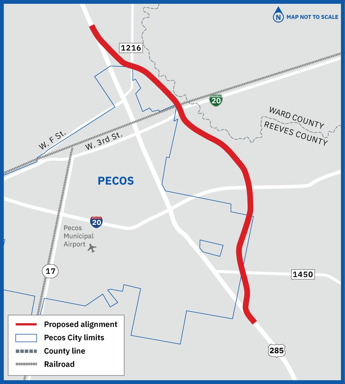
TxDOT is proposing to construct a relief route around the east side of the Town of Pecos City in Reeves County, Texas, from US 285 north of Pecos to US 285 south of Pecos. The relief route would help long-term mobility and connectivity and improve safety on US 285 for local and through traffic.
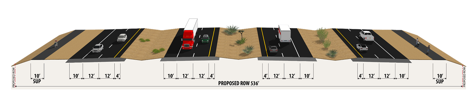
The proposed roadway would generally consist of a new four-lane divided highway, including two mainlanes and a one-way frontage road in each direction, separated by a grassy median. The project would also include new interchanges at major intersections and shared-use paths. The overall project length would be approximately 10 miles.
Public involvement
The purpose of public involvement is to share project information and updates, present proposed project information, and collect public input. TxDOT is committed to working closely with the public on this project. All input will be considered as TxDOT moves forward in developing a plan to enhance the safety of this corridor while preparing for future growth.
Public involvement
- Virtual public meeting – May 26, 2021
- Virtual public meeting with in-person option – June 4, 2024
- Virtual public hearing with in-person option – April 8, 2025