![](/content/dam/images/tourism/us-flag-waving-on-street-in-columbus-texas.png)
These maps show state-maintained roadways within Texas’s US congressional districts.
![Texas House of Representatives map](/content/dam/images/maps/texas-house-map.png)
Statewide map for each Texas House of Representative District.
![Texas Senate map](/content/dam/images/maps/texas-senate-map.png)
![](/content/dam/images/roads/traffic-on-a-roadside-exit.png)
![](/content/dam/images/roads/two-cars-fm-455-denton-county.png)
A convenient and reliable linear referencing method for locating features along a roadway.
![](/content/dam/images/roads/northbound-traffic-loop-1-austin-tx.png)
The departmental map serves as a visualization of all on-system routes (those that TxDOT maintains).
![District and county map](/content/dam/images/maps/district-county-maps.png)
![](/content/dam/images/tourism/austin-texas-skyline-with-river-in-foreground.png)
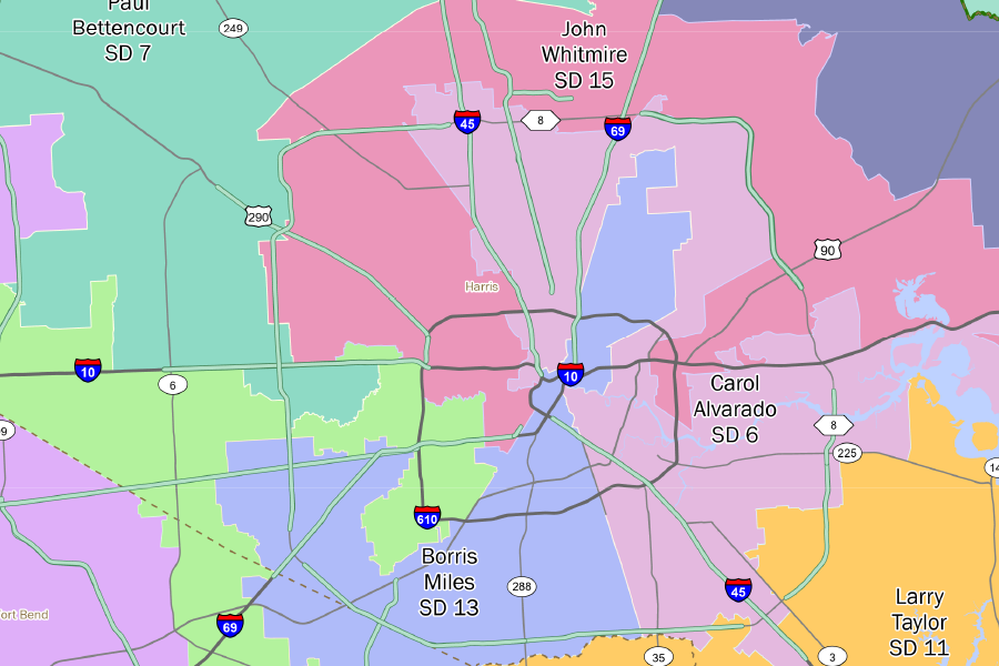
The state’s largest densely populated urban cores and their less densely populated surrounding areas.
![](/content/dam/images/people/maintenance/txdot-maintenance-road-worker-placing-cones-roadside.png)
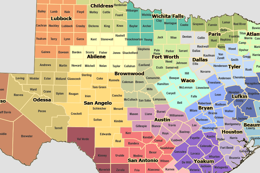
These maps show maintenance section routes by TxDOT district.
![Memorial Highways map](/content/dam/images/maps/memorial-highways.png)
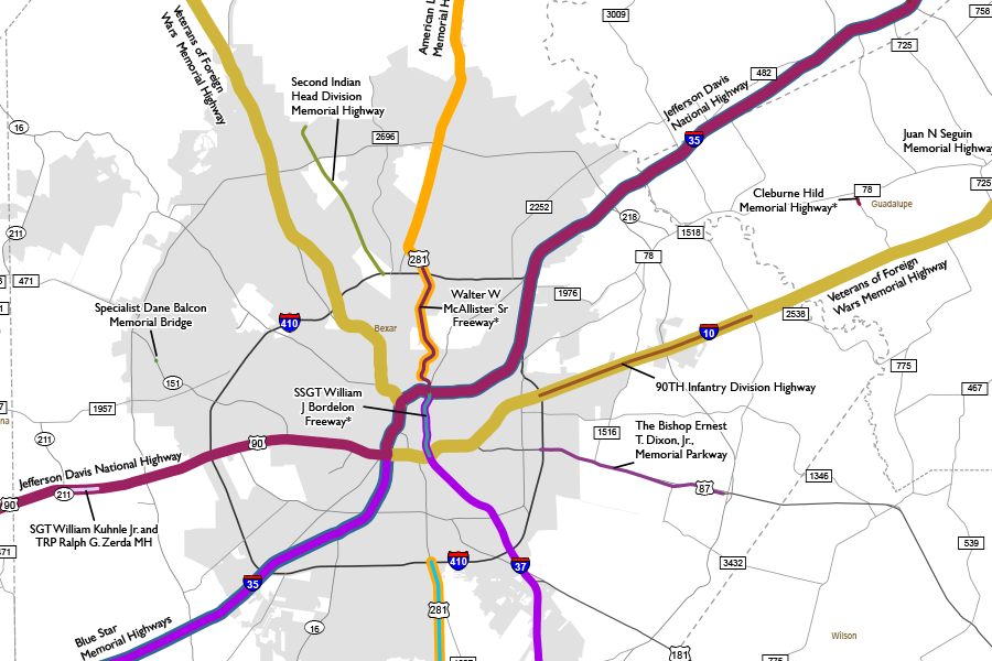
Memorial Highways pay tribute to notable people or groups and can be designated by the state or by local governments.
![Metropolitan Planning Organizations map](/content/dam/images/maps/mpo-map.png)
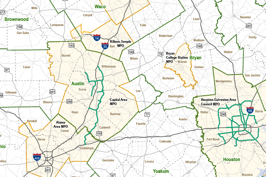
Metropolitan Planning Organization (MPO) is required for each urban area with a population of more than 50,000 people.
![Freight truck along highway](/content/dam/images/vehicles/freight-truck-along-highway.png)
City and county routing maps for vehicles transporting non-radioactive hazardous materials.
![](/content/dam/images/signs-signals/reference-marker-sign-on-side-of-state-highway.png)
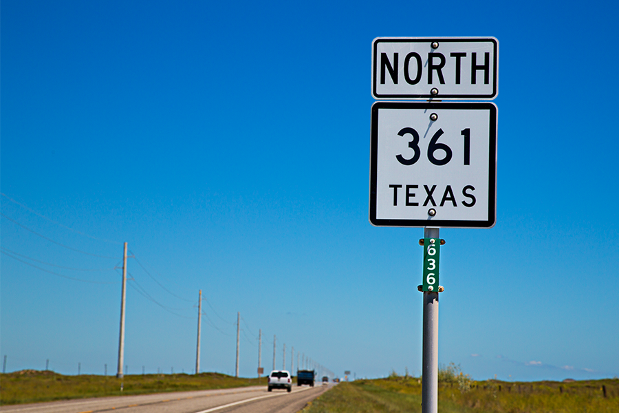
A small green placard displaying a three-digit number that’s placed at intervals along all state-designated routes in Texas.
![real property asset map](/content/dam/images/maps/real-property-asset-map.png)
View the real property asset map showing property, utilities, and commercial signs.
![](/content/dam/images/roads/state-highway-45-austin-tx.png)
The statewide planning map application contains the following TxDOT maps.
![Toll roads and HOV map (Houston)](/content/dam/images/maps/toll-roads-hov-map.png)
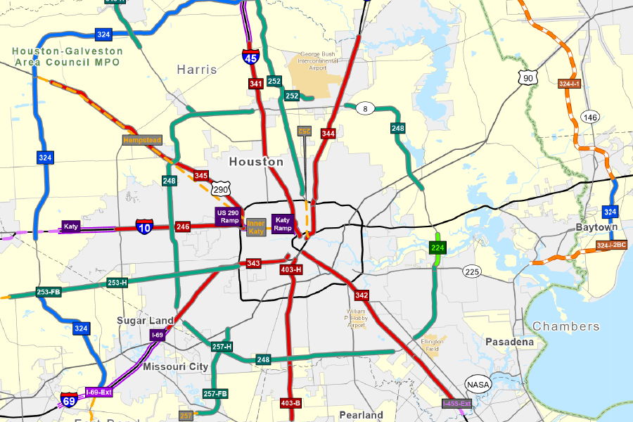
Map of toll roads and HOV lanes, including details such as toll names, IDs, operators, and mileage.