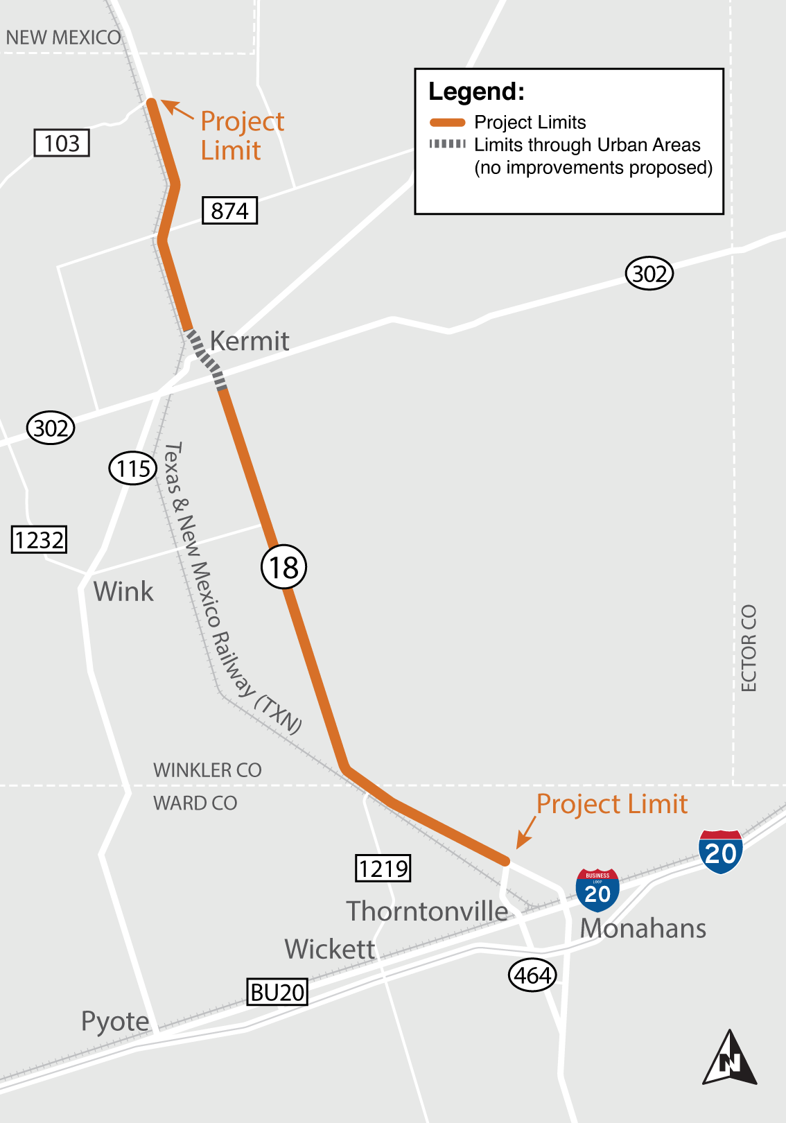
SH 18 North: from CR 103 to Loop 464 north of Monahans
Permian Promise
The SH 18 North project is designed to improve safety and enhance mobility along the SH 18 corridor from CR 103, just south of the New Mexico state line, to Loop 464, just north of Monahans. The capacity of the existing SH 18 roadway cannot meet the needs of current and proposed traffic volumes and loads associated with energy production activity in the Permian Basin. Existing roadway conditions are experiencing reduced safety due to outdated design standards and deteriorating pavement conditions resulting from heavy freight loads.
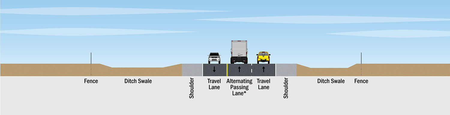
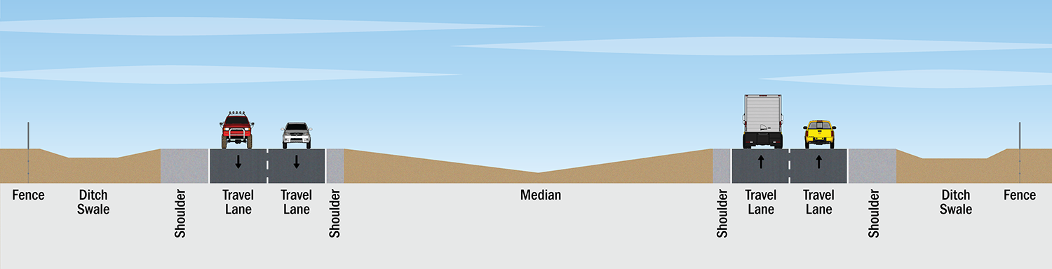
The proposed project would include the following upgrades to the existing roadway:
- Widening to a four-lane divided highway with two lanes in each direction
- A center median or barrier
- Turn lanes at various intersections throughout the entire length of the project
This project currently includes improvements for the rural sections only, outside of the cities of Kermit and Monahans.
TxDOT will consider items in the preliminary design and environmental evaluation of proposed roadway improvements including:
- Safety: From 2015-2019, there were 228 recorded crashes and 13 deaths from crashes, all of which occurred in rural areas outside of Kermit and Monahans. The most common crashes involved rear-end collisions (33 percent). 40 percent of total crashes in rural sections included fatalities or injuries and over 95 percent of costs associated with crashes occur in rural sections.
- Oil and Gas Activity: The corridor sees a significant amount of commercial vehicle traffic, much of this is associated with the energy sector. Truck traffic varies from 28-33 percent.
- Traffic: Traffic volumes along SH 18 North grew by 90 percent between 2015 and 2019 and are projected to grow by another 65 percent by 2044 with truck traffic ranging between 28-33 percent of the total daily traffic.
- Population Growth: Population grew in Winkler and Ward counties by 28.8 percent between 2010 and 2022.
Public involvement
The purpose of public involvement is to share project information and updates, present proposed project information, and collect public input. TxDOT is committed to working closely with the public on this project. All input will be considered as TxDOT moves forward in developing a plan to enhance the safety of this corridor while preparing for future growth.
- Virtual public meeting #1 – Aug. 18, 2021
- Virtual public meeting #2 – Sept. 13, 2022