Mitigation banks
Environmental programs
TxDOT has three mitigation banks that offer wetland and stream credits to offset impacts associated with on-system transportation projects. TxDOT is required to obtain a Section 404 permit from the U.S. Army Corps of Engineers (USACE) for any transportation project that discharges dredged or fill material into a water of the United States, including wetlands. If the USACE requires compensatory mitigation, TxDOT can withdraw mitigation credits from the appropriate mitigation bank if the project happens to be located within the bank’s service area.
Anderson Tract Mitigation Bank; established in 1994
TxDOT purchased 2,243 acres in Smith County to create the Anderson Tract Mitigation Bank. Project credits in this account may be used to compensate for adverse impacts to waters of the U.S. at a ratio of seven credits for each acre of high quality wetland or other water of the U.S. adversely impacted, five credits for each acre of medium quality wetland or other water of the U.S. adversely impacted and three credits for each acre of low quality wetland or other water of the U.S. adversely impacted. One credit unit was established for each acre of water of the U.S. that did not have significant human modifications (e.g., mineral recovery developments) that would negate the value of the area as mitigation land.
The geographic service area includes those portions of the Atlanta, Lufkin, Paris and Tyler Districts that are within the drainage basins of the Sabine, Sulphur, Cypress, Angelina and Neches rivers and are within the boundaries of the USACE Fort Worth District.
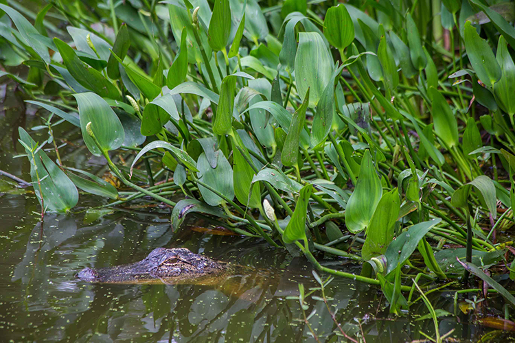
Blue Elbow Swamp; established in 1995
TxDOT purchased 3,343 acres in Orange County to create Blue Elbow Swamp. Project credits in this account may be used to compensate for adverse impacts to waters of the U.S. at a ratio of seven credits for each acre of high quality wetland or other water of the U.S. adversely impacted, five credits for each acre of medium quality wetland or other water of the U.S. adversely impacted and three credits for each acre of low quality wetland or other water of the U.S. adversely impacted. One credit unit was established for each acre of water of the U.S. that did not have significant human modifications (e.g., mineral recovery developments) that would negate the value of the area as mitigation land.
The geographic service area includes all portions of the Beaumont District that are within the drainage basins of the Sabine, Neches, Trinity and San Jacinto rivers and are within the boundaries of the USACE Galveston District.
Coastal Bottomlands Mitigation Bank; established in 1999
TxDOT purchased 3,552 acres in Brazoria County to create the Coastal Bottomlands Mitigation Bank. Credits were generated through preservation, restoration, enhancement and creation of wetlands. Project credits in this account may be used to compensate for adverse impacts to waters of the U.S. at a ratio of six credits for each acre of high quality wetland or other water of the U.S. adversely impacted, four credits for each acre of medium quality wetland or other water of the U.S. adversely impacted and two credits for each acre of low quality wetland or other water of the U.S. adversely impacted.
The geographic service area includes portions of the Houston and Yoakum Districts that are within all of Brazoria County, as well as those portions of Galveston, Ft. Bend, Austin, Colorado, Wharton, Matagorda and Harris counties that are within the drainage basins of the San Jacinto – Brazos Coastal Basin, Brazos Basin, Brazos – Colorado Coastal Basin, and Colorado Basin and within the boundaries of the USACE Galveston District.