Toll roads in Texas
Toll roads and managed lanes
Miles of open toll facilities
Miles of future toll facilities
Toll road operators statewide
Toll tag operators
Toll operators in Texas
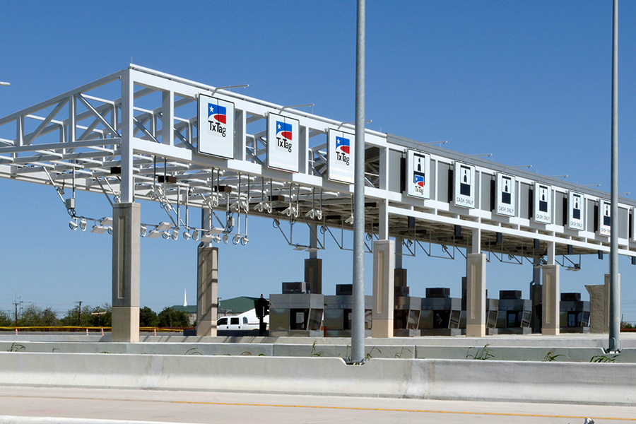
Texas has multiple toll operators across the state, each responsible for managing and maintaining their own toll roads.
These operators span from state agencies (Texas Department of Transportation), tolling authorities (Harris County Toll Road Authority and North Texas Tollway Authority), regional mobility authorities (Central Texas Regional Mobility Authority and North East Regional Mobility Authority), and public-private partnerships (3Ps) with TxDOT (LBJ Infrastructure Group, NTE Mobility Partners, and NTE Mobility Partners Segments 3). Although each entity operates under its own business rules, billing practices, and toll rates, all share a common goal: improving mobility across the state for the millions driving on Texas roads daily.
Some operators issue their own toll tags, all of which are interoperable on toll roads in Texas, Oklahoma, Kansas, Colorado and most of Florida. As long as a tag is active and funded, drivers can use toll roads, receive discounted tolls rates, and avoid additional fees and fines.
Learn more about the different Texas toll operators below by visiting each region's page.
| Operator name | Region | Toll roads | Billing agency |
| Texas Department of Transportation (TxDOT) | Austin, Houston, Dallas-Fort Worth | Austin - Loop 1, SH 45N, SH 45SE, SH 130 (Segments 1-4) Houston - SH 99 Grand Parkway System (Segment E, F-1, F-2, G, H, I-1 & I-2); SH 249 Project (Segment 1); SH 288 Managed Lanes Project Dallas-Fort Worth - I-30 TEXpress lanes; I-35E TEXpress lanes; SH 114 TEXpress lanes; SH 183 TEXpress lanes; Loop 12 TEXpress lanes; I-635E (LBJ East) TEXpress lanes |
Harris County Toll Road Authority (HCTRA) |
| Central Texas Regional Mobility Authority (CTRMA) | Austin | 183A Toll; 290 Toll; MoPac Express Lanes; 71 Toll Lane; 45SW Toll; 183 Toll; 183 Express Lanes | CTRMA |
| SH 130 Concession Company (SH 130CC) | Austin | SH 130 (Segments 5 & 6) | Harris County Toll Road Authority (HCTRA) |
| Harris County Toll Road Authority (HCTRA) | Houston | Hardy Toll Road; SH 225 Direct Connector; Ship Channel Bridge; Westpark Tollway; Katy Managed Lanes; Sam Houston Tollway Northeast; Tomball Tollway; Hardy Downtown Connector, Lynchburg Ferry; The Washburn Tunnel | Harris County Toll Road Authority (HCTRA) |
| Brazoria County Toll Road Authority (BCTRA) | Houston | BC Expressway (SH 288 managed lanes located within Brazoria County) | Harris County Toll Road Authority (HCTRA) |
| Fort Bend County Toll Road Authority (FBCTRA) | Houston | SH 99 Grand Parkway (Segment D); Westpark Tollway; Fort Bend Parkway | Harris County Toll Road Authority (HCTRA) |
| Montgomery County Toll Road Authority (MCTRA) | Houston | SH 249 (from Spring Creek to Pinehurst) | Harris County Toll Road Authority (HCTRA) |
| LBJ Infrastructure Group (LBJIG) | Dallas-Fort Worth | LBJ TEXpress lanes | North Texas Tollway Authority (NTTA) |
| North Texas Tollway Authority (NTTA) | Dallas-Fort Worth | 360 Tollway; Addison Airport Toll Tunnel (AATT); Chisholm Trail Parkway (CTP); Dallas North Tollway (DNT); Lewisville Lake Toll Bridge (LLTB); Mountain Creek Lake Bridge (MCLB); President George Bush Turnpike (PGBT); Sam Rayburn Tollway (SRT) | NTTA |
| North East Texas Regional Mobility Authority (NETRMA) | Dallas-Fort Worth | Toll 49 (Tyler) | North Texas Tollway Authority (NTTA) |
| NTE Mobility Partners | Dallas-Fort Worth | North Tarrant Express (NTE) TEXpress lanes | North Texas Tollway Authority (NTTA) |
| NTE Mobility Partners Segments 3 | Dallas-Fort Worth | NTE 35W TEXpress lanes | North Texas Tollway Authority (NTTA) |
| Cameron County Regional Mobility Authority (CCRMA) | Rio Grande Valley | SH 550 | CCRMA |
TxDOT currently oversees approximately 263 centerline miles of toll roads, including managed lanes, in the Austin (Central Texas Turnpike System), Houston (SH 99 Grand Parkway System, SH 249 Project, and SH 288 Managed Lanes Project), and Dallas-Fort Worth regions.
For current driving conditions on TxDOT toll roads, visit DriveTexas.
Regional Mobility Authorities (RMAs) also own and operate toll roads in Texas. Learn more about RMAs by visiting https://www.txdot.gov/about/partnerships/regional-mobility-authorities.html.

Learn more about Austin-area toll roads and operators, including TxDOT, Central Texas Regional Mobility Authority (CTRMA), and SH 130 Concession Company (SH 130CC).

Learn more about Dallas-Fort Worth (DFW) area toll roads and operators, including TxDOT, TEXpress lanes, North Texas Tollway Authority (NTTA), and North East Texas Regional Mobility Authority (NETRMA).

Learn more about Houston-area toll roads and operators, including TxDOT, Harris County Toll Road Authority (HCTRA), Brazoria County Toll Road Authority (BCTRA), Fort Bend County Toll Road Authority (FBCTRA) and Montgomery County Toll Road Authority (MCTRA).

Learn more about toll roads and operators in the Rio Grande Valley (RGV), including Cameron County Regional Mobility Authority (CCRMA).
Interoperability
With interoperability, drivers can enjoy the convenience of toll roads when traveling out of state without worrying about having to buy another toll tag or getting a fine for using a toll road without paying.
Learn more about interoperability