Illustrated maps
Map guidelines
These guidelines are for illustrated maps created in applications like Adobe Illustrator. These standards ensure that maps are visually cohesive, accessible, and aligned with TxDOT’s brand identity. Illustrated maps are often used for presentations, reports, signage, and public-facing materials.
By following these illustrated map guidelines, TxDOT ensures that all visual materials are consistent, professional, and aligned with the agency’s branding. These standards support effective communication and reinforce trust in TxDOT’s visual outputs.
Best practices
Simplify Visuals
Remove unnecessary geographic features that do not support the map’s purpose.
Muted Backgrounds
Use soft, neutral tones for background elements to avoid distracting from the main content.
Label Hierarchy
Use font size, weight, and color to establish a clear hierarchy. Label only essential features.
Consistent Margins
Maintain at least 0.25 inch or 10% of the map size as margin space for visual balance.
Use Authoritative Data
Base map content on verified TxDOT datasets, even if stylized.
Design and layout
Header and footer
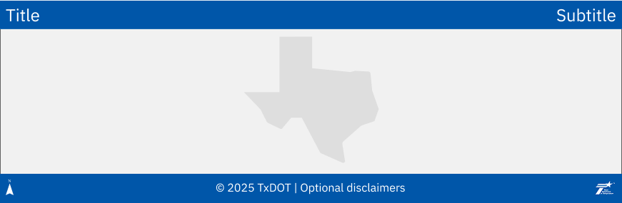
- Use a solid TxDOT Primary Blue (Blue 50) bar for headers and footers
- No outlines or borders on the bars
- IBM Plex Sans
- When IBM Plex Sans is unavailable, use Verdana. Verdana is native to Windows and MacOS.
- TxDOT White font color
- Text should be centered vertically, and evenly spaced
- Header: Title on the left, subtitle (e.g., year, district) on the right
- Footer: Include copyright, TxDOT logo, and optional disclaimers
- North arrow
- Include for regional or local maps
- Omit for statewide maps unless necessary for orientation
- No fixed dimensions for header and footer bars — use cartographic judgment to size them proportionally for visual balance
Primary Blue (Blue 50)
HEX: #0056a9
RGB: 0 / 86 / 169
White
HEX: #FFFFFF
RGB: 255 / 255 / 255
TxDOT vertical white logo

IBM Plex Sans Regular
IBM Plex Sans
*Alternatively, use Verdana
For additional guidance on TxDOT’s official color palette, refer to the Color Guidelines in the Digital Design System.
Accessing the logo
- Employees can access the TxDOT logo from the organization's intranet.
- Vendors should request the logo from their TxDOT point of contact.
Draft and confidentiality
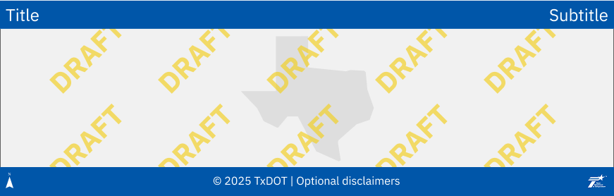
- Use a yellow “DRAFT” watermark for unpublished maps
- For sensitive, confidential, or regulated data maps, display “FOUO” (For Official Use Only) in red
- TxDOT Warning (Yellow 50) font color
- Text: “DRAFT”
Warning (Yellow 50)
HEX: #F2CE1B
RGB: 242 / 206 / 27
Legend
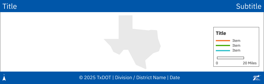
- Avoid using the word “Legend” as a title
- 1 pt, neutral gray border (matches map frame)
- TxDOT White background
- Place in open, uncluttered areas (e.g., Gulf of Mexico)
- Include scale bar, disclaimers, or notes as needed
- Scale bar
- Ensure it does not overlap key map elements
- Use whole number increments (e.g., 1 mile, 5 miles)
- Label units after the bar
- TxDOT Gray 100 outline and font color
Neutral gray (Gray 60)
HEX: #616161
RGB: 97 / 97 / 97
White
HEX: #FFFFFF
RGB: 255 / 255 / 255
Gray 100
HEX: #1A1A1A
RGB: 26 / 26 / 26
Map insets
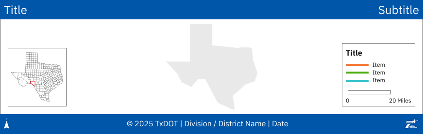
- 1 pt, neutral gray border (matches map frame)
- TxDOT White background
- TxDOT Gray 100 font color
- Maintain consistent spacing between insets
- Locator maps
- No surrounding states
- Use neutral gray county or district boundary for context
- Area of interest outline in TxDOT Red 50
- No scale bar, north arrow or title
Neutral gray (Gray 60)
HEX: #616161
RGB: 97 / 97 / 97
White
HEX: #FFFFFF
RGB: 255 / 255 / 255
Gray 100
HEX: #1A1A1A
RGB: 26 / 26 / 26
Red 50
HEX: #D90D0D
RGB: 217 / 13 / 13
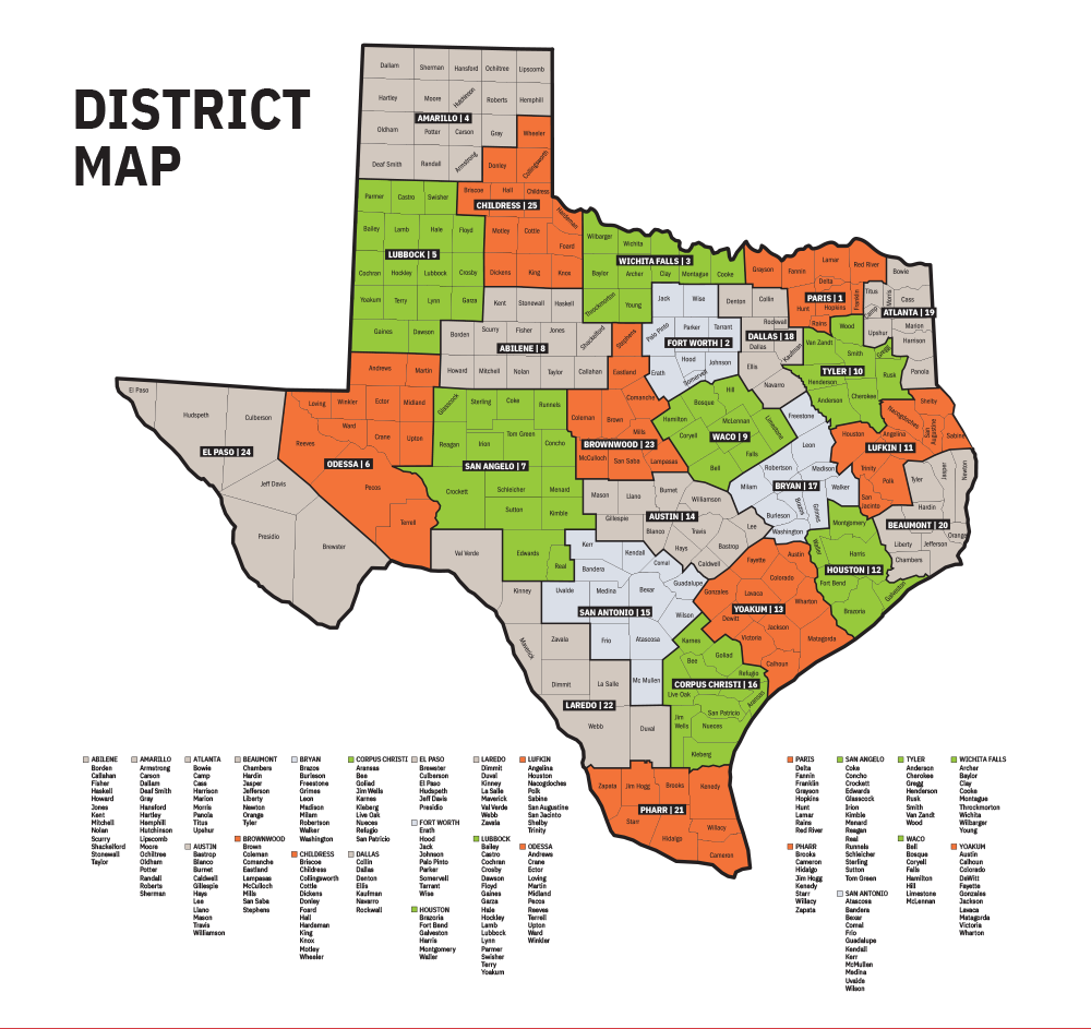
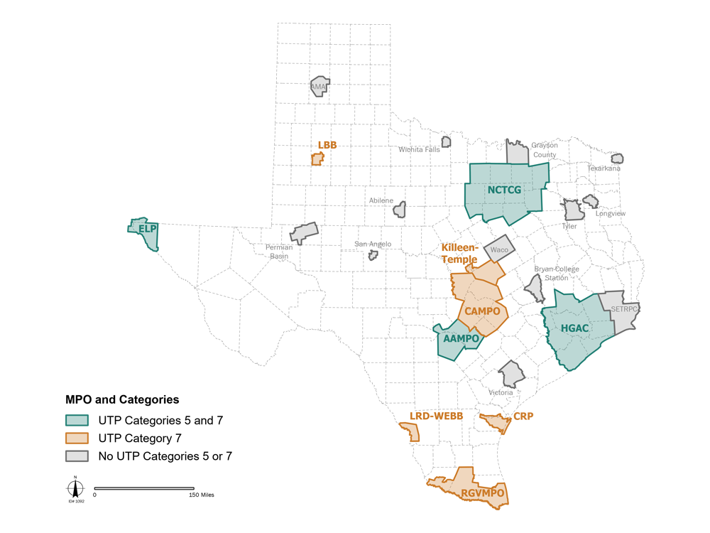
Symbology for map features and layers
- When symbolizing map layers that are the focus of the map - as opposed to background/basemap features - strive to use aesthetically pleasing, modern-looking color palettes. For simple features and/or simple maps without a lot of complexity, try some of TxDOT's data visualization colors.
Metadata (digital files)
While illustrated maps are static, include metadata in accompanying in digital files:
- Title and description
- Data sources
- Date of creation
- Version or revision history