Using AI and machine learning to assess pavement markings
The Yoakum District implemented an artificial intelligence and machine vision-based approach to assessing pavement marking conditions across a large roadway network. By leveraging roadway image data and automated image analysis techniques, the system can identify and classify deteriorating lane markings more efficiently than traditional methods. This innovation enhances roadway safety by improving detection speed and coverage. It provides a scalable solution for monitoring pavement markings across extensive networks.
Challenge
Maintaining clearly visible lane markings across Texas’ nearly 90,000-mile roadway network is highly labor-intensive and inefficient using traditional manual surveys. Limited inspection capacity reduces coverage and frequency, allowing deteriorating markings to go unnoticed, delaying maintenance, and increasing safety risks. Additionally, reliance on time-consuming manual processes constrains the ability to quickly identify deficiencies and ensure consistent, system-wide monitoring.
Solution
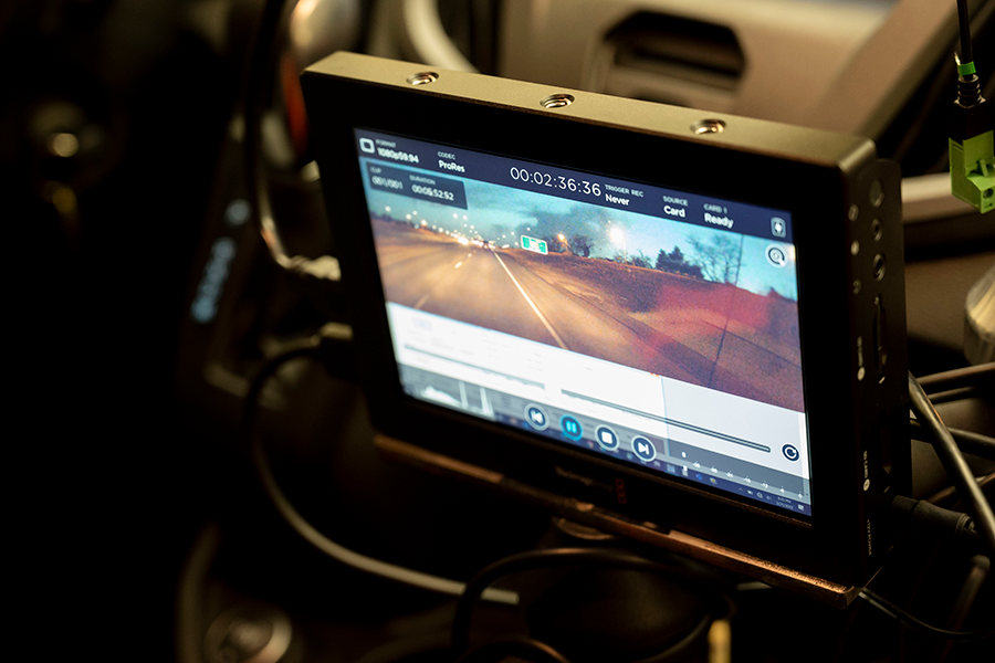
The Yoakum District developed a solution using artificial intelligence (AI) and machine vision to analyze roadway images. The system uses AI to detect lane marking locations and machine vision to identify deterioration in lane markings. Image data is sourced from existing PathWeb archives and supplemental camera footage collected from vehicles equipped with GoPro devices. This approach automates detection and evaluation, enabling faster, more consistent, and scalable monitoring across a large network.
Benefits
- Faster identification of deteriorating lane markings
- Expanded monitoring coverage across the roadway network
- Improved roadway safety through more timely maintenance
- Cost efficiency and reduced reliance on manual inspections
- Better consistency and accuracy in lane marking condition assessments
Additional key information

- AI-based detection of lane markings from roadway images
- Machine vision analysis to evaluate marking deterioration
- Integration with existing image databases such as PathWeb
- Use of vehicle-mounted cameras for supplemental data collection
- Identified appropriate image sources for data collection
- Evaluated existing machine vision and AI frameworks
- Selected and tested methods for detecting and assessing lane markings
- Developed and validated a proof-of-concept system for daytime use
- Integrated insights into maintenance operations with support from Texas A&M Transportation Institute and TxDOT teams

- Expandable statewide for large-scale pavement marking monitoring
- Adaptable to other asset condition assessments using image-based AI
- Supports broader use of automated inspection technologies in transportation maintenance
Alignment with TxDOT strategic goals
Resources
Contact
Do you have questions or need additional information about this innovation project?