Traffic sign identification and location extraction from roadway images
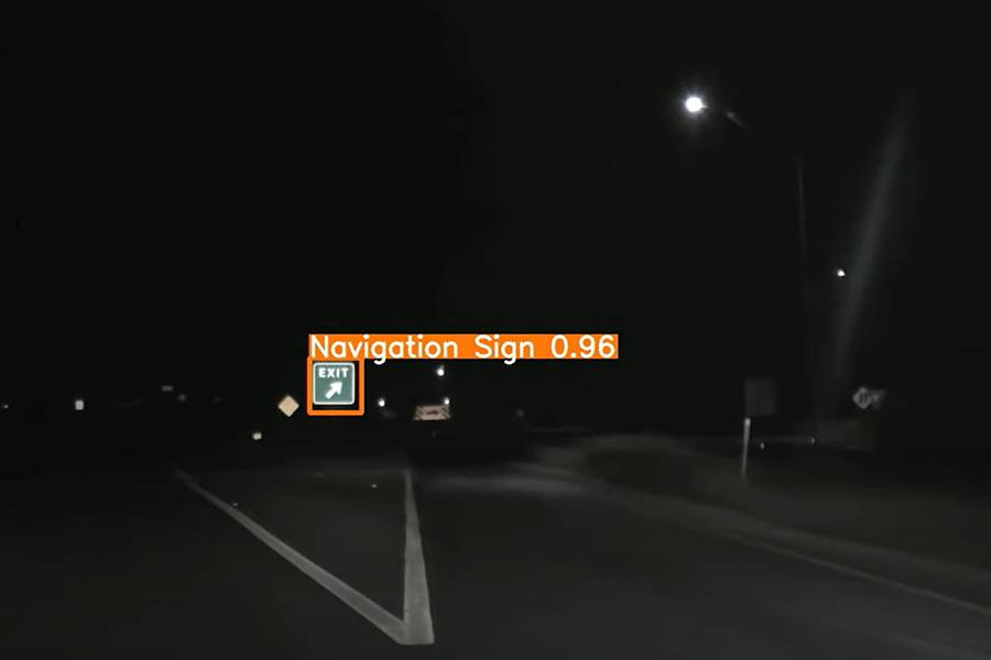
The San Angelo District implemented an innovative approach to automatically identify and locate traffic signs using roadway image data and artificial intelligence. By leveraging existing video resources and machine learning techniques, the district can generate a comprehensive and accurate sign inventory. This approach improves efficiency, reduces manual effort, and enhances the accuracy of sign inspection and maintenance activities. The innovation supports better asset management and provides a scalable solution for statewide use.
Challenge
The district relied on a manual, nighttime inspection process where crews visually identified and recorded traffic sign conditions while traveling along roadways. This process made it difficult to anticipate upcoming signs and accurately document their locations in real time. As a result, data collection was time-consuming, labor-intensive, and less consistent, creating challenges for maintaining an accurate and reliable sign inventory.
Solution
The district developed a system that uses roadway image data and artificial intelligence to identify traffic signs and extract their locations. By utilizing existing PathWeb video and image data, machine learning models are trained to detect and classify signs. The system captures images and coordinates of each sign and compiles the information into a structured database, creating a digital sign inventory that supports inspection and maintenance activities.
Benefits
- Improves accuracy and consistency of traffic sign inventories
- Reduces time and labor required for manual data collection
- Enhances efficiency of inspection and maintenance processes
- Provides easily accessible and well-organized asset data
- Supports better planning and decision-making for roadway safety
- Leverages artificial intelligence to identify traffic signs
Additional key information

- Automated traffic sign detection using AI and machine learning
- Extraction of image data and geolocation for each identified sign
- Creation of a centralized digital sign inventory
- Integration with existing inspection and maintenance tools
- Roadway image and video data from PathWeb platform
- Annotated image data used for training machine learning models

- Selected and prepared machine learning models for sign detection
- Collected and labeled training data from roadway images
- Tested models using new image inputs to evaluate performance
- Developed a database to store sign images and location information

- Can be expanded across additional districts statewide
- Adaptable for other asset identification and inventory applications
- Supports broader use of AI in transportation asset management
Alignment with TxDOT strategic goals


Resources
Contact
Do you have questions or need additional information about this innovation project?