I-35 Texas Corridor Study: A Path to 2050
Study overview
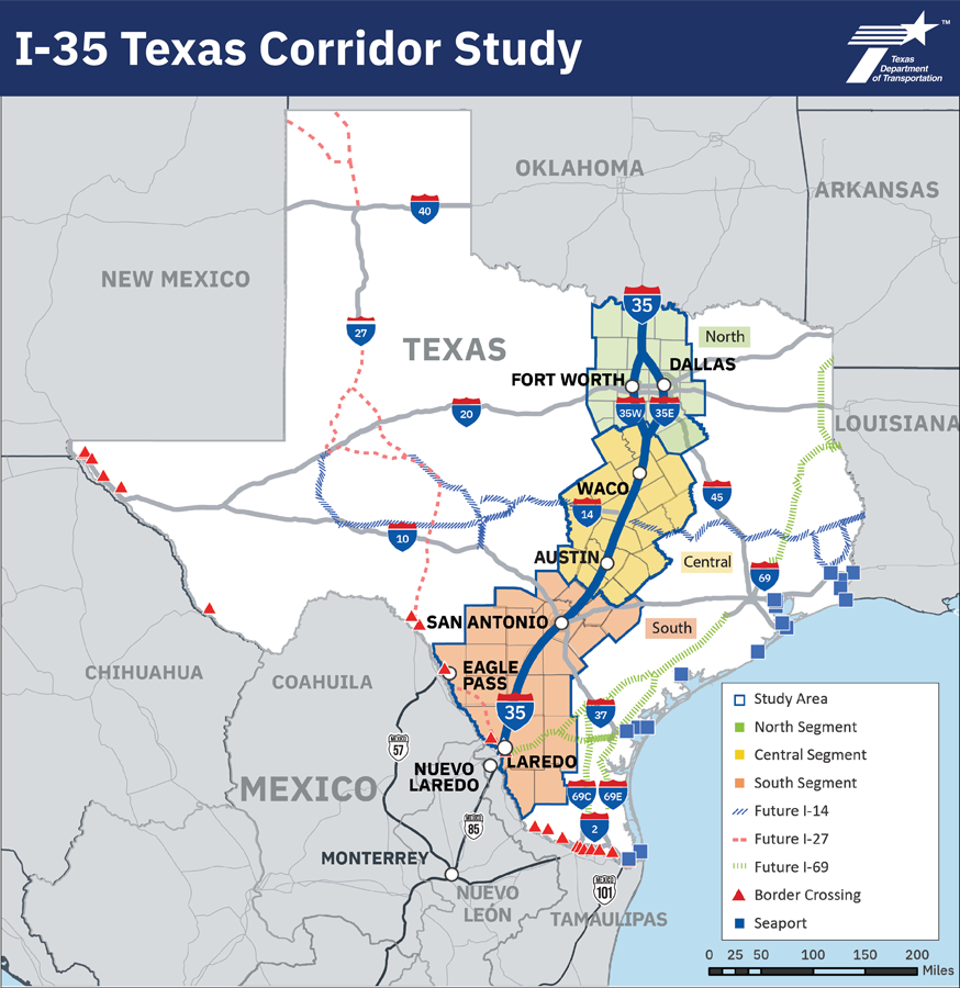
TxDOT works to deliver a safe, reliable and integrated transportation system. The Interstate 35 (I-35) Texas Corridor Study was initiated by the TxDOT - Transportation Planning and Programming (TPP) Division as a long term, comprehensive analysis of the I-35 Texas Corridor from an intermodal and multimodal approach. The Main Street of Texas, I-35 supports Texas’ growing population, employment, economy and quality of life, with nearly half of Texas’ population living and working along the corridor. The study includes the entire I-35 Texas Corridor from the Oklahoma State line to the Mexico international border for approximately 590 miles. I-35 stretches across Texas with approximately four to 10 main lanes in addition to frontage roads in the urban and metropolitan areas with discontinuous frontage roads in the rural areas.
I-35 is one of the most significant corridors within Texas and is critical to maintaining a regional, state-wide, national and international transportation system that is safe, efficient and responsive to growth.
Building upon current investments, the I-35 Texas Corridor Study will identify existing gaps and evolving multimodal transportation needs and opportunities. Through data-informed analysis and collaborative stakeholder engagement, the study will develop prioritized solutions including projects, policies, programs or regional planning studies that address challenges, intermodal coordination and emerging technologies across urban, rural and border areas for the next 25 years.
I-35 Texas Corridor Study area map
Key considerations
The study will consider the following key elements to identify and prioritize proposed improvements along the corridor:
- Safety
- Asset preservation
- Multimodal passenger and freight
- Intermodal (rail/air)
- Truck parking
- Mobility and congestion
- Alternative routes and resiliency
- Connectivity
- Operations and emerging technologies
- Economic competitiveness
Study approach
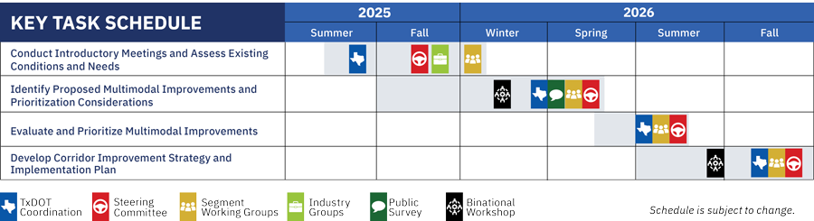
TxDOT will conduct technical analyses and engage local elected officials, regional organizations, state and federal agencies, industry and business representatives, advocacy groups, members of the public and other stakeholders throughout the study process from Spring 2025 to Fall 2026. The study will be conducted in phases with four rounds of stakeholder engagement meetings. The phases will evaluate and assess existing conditions and needs, develop strategies and a prioritization framework, identify and prioritize future improvements and develop an implementation plan, as shown in the schedule.
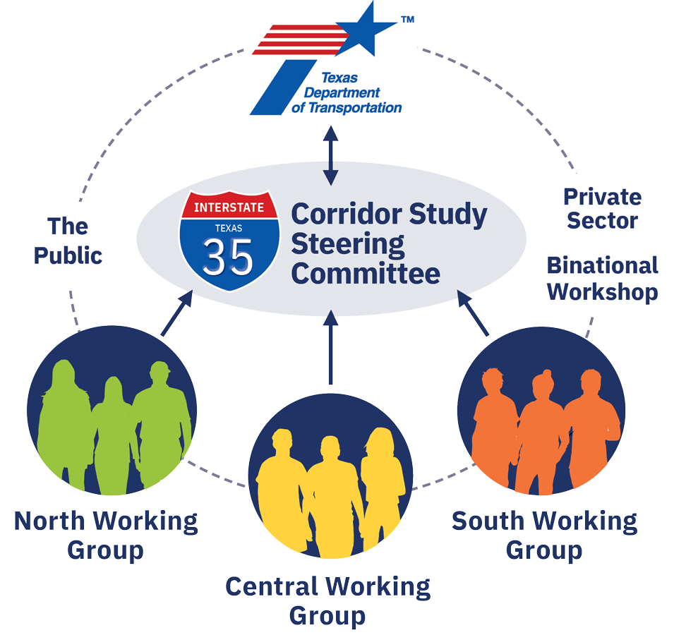
Stakeholder and public engagement
Input collected from public and private stakeholders throughout the study will be important
to help TxDOT identify transportation needs and prioritize improvements to safety, connectivity and mobility along the I-35 corridor.
Key stakeholders include:
- TxDOT district and division representatives.
- A steering committee.
- Three segment working groups.
- North – Oklahoma State line to the Johnson and Ellis/Hill County line.
- Central – Johnson and Ellis/Hill County line to Hays/Comal County line.
- South – Hays/Comal County line to the Mexico international border.
- Binational Workshops.
- Local, state and federal agencies.
- Local elected officials.
- Industry groups - the energy sector industry, trucking, freight, rail, military groups and economic development organizations.
- Ports of entry, inland ports and seaports.
- Advocacy groups.
- Members of the public.
The public will have the opportunity to provide input through a survey conducted during the
development of the study.
| Title |
| Fact sheet |
| Hoja informativa |
| Title | |
| Steering Committee - First Meeting Summary | Nov. 18, 2025 |
| South Working Group - First Meeting Summary | Jan. 7, 2026 |
| Central Working Group - First Meeting Summary | Jan. 9, 2026 |
| North Working Group - First Meeting Summary | Jan. 20, 2026 |