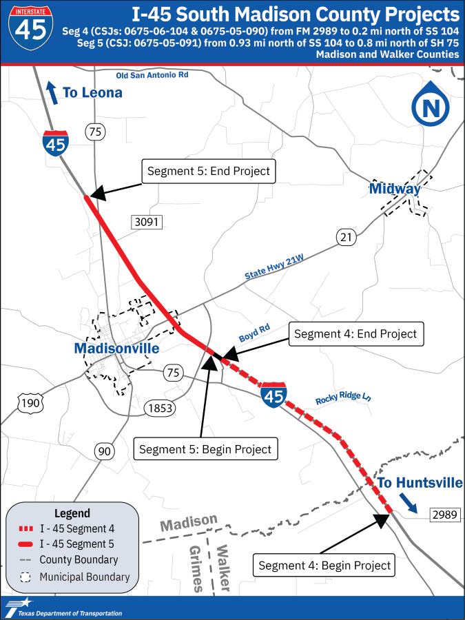
I-45 South Madison County Projects (Segments 4 and 5)
Segment 4 and Segment 5
Purpose
The I-45 South Madison County Projects includes Segments 4 and 5 and part of the larger I-45 Corridor Program, which has been created to enhance safety and improve mobility along 90.4 miles of I-45 through Walker, Madison, Leon, and Freestone counties. It serves as the main connection between Dallas and Houston. I-45 is also a major freight corridor and hurricane evacuation route.
The I-45 South Madison County Projects (Segments 4 and 5) proposes to update the roadway to current design standards, increase its capacity to accommodate future traffic volumes, and improve access for local travelers.
Proposed improvements
- Adding one mainlane in each direction.
- Updating the roadway to current interstate design standards
- Converting existing two-way frontage roads north of US 190/SH 21 to one-way frontage roads
- Providing a new two-way frontage road between FM 2989 and Spur 67
- Replacing bridges and increasing vertical clearance to 19-feet.
- Improving traffic flow at interchanges, including the use of innovative intersections
- Providing shared-use paths (wide sidewalks) for pedestrian and bicycle use, where appropriate
Get involved
Public participation is encouraged throughout the design process, and this website will be updated as opportunities are available. Public input is a highly valued and important part of creating improvements to address transportation needs. TxDOT is committed to working closely with the community to ensure that interested citizens can comment, voice concerns, and ask questions. Please contact the project team with any questions or comments by using the contact information found in the “Contact Us” box to the right.