RM 620 Projects
RM Road 620 runs 23.2 miles from SH 71 in Bee Cave, Travis County to I-35 in Round Rock, Williamson County. The road has major intersections with SH 71, RM 2222, US 183, FM 734, SH 45 North, and I-35.
RM 620 provides primary access to the southern Lake Travis area of Travis County and the southernmost tip of Williamson County. Through most of its length, RM 620 functions as both a local thoroughfare and commuter highway. In many cases, it is the sole access to subdivisions, businesses and schools. It is also the primary access route to Lake Travis area recreation amenities.
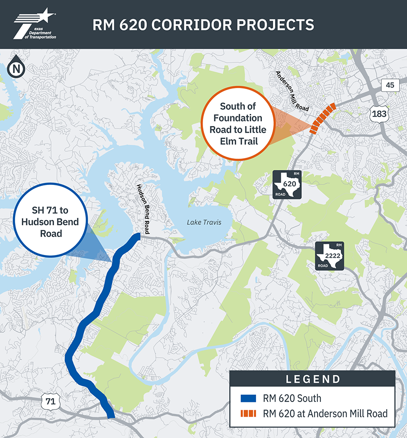
Planned improvement projects
Previous feasibility studies
Active construction projects
RM 620 at Mansfield Dam Bridge, October 2026
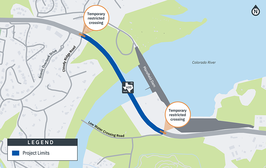
TxDOT is performing critical bridge maintenance work on RM 620 at Mansfield Dam Bridge. Once complete, these improvements will provide a smoother ride, enhance safety, and help extend the life of the roadway and bridge. Northbound and southbound RM 620 between Cloudy Ridge Road and Low Water Crossing Road, there will be ongoing lane closures and restricted crossings at driveways, while crews repair bridge expansion joints, upgrade bridge railings, and resurface the roadway. The project is anticipated to complete mid-2027.