TxDOT performs 'once-in-a-lifetime survey' in ancient cave
July 30, 2025
By Laura Butterbrodt
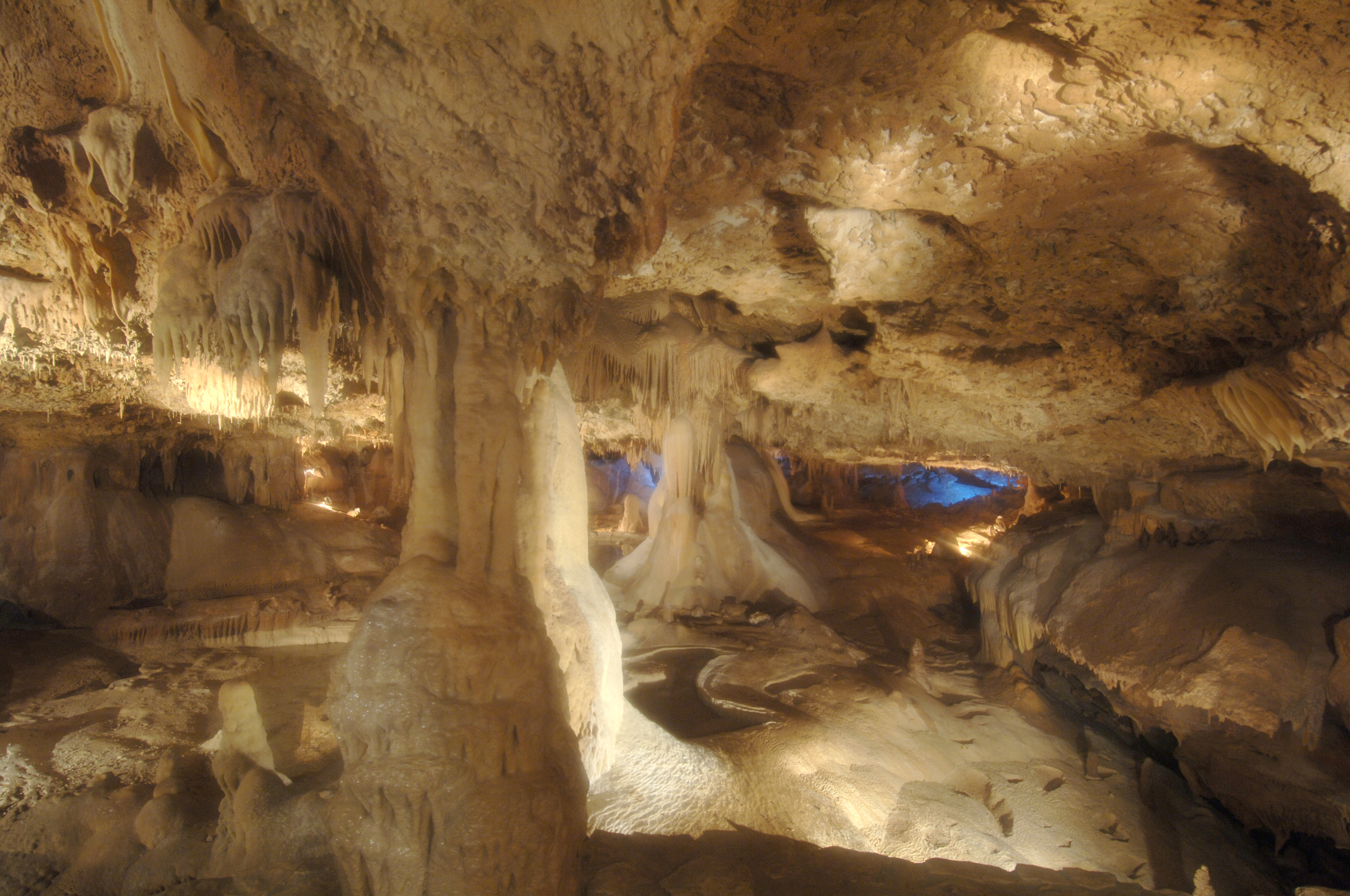
AUSTIN – Most TxDOT survey work includes establishing property boundaries, making maps and other above-ground tasks to prepare an area for design and construction. But last winter, a TxDOT survey team got to work underground in the Inner Space Cavern near Georgetown to create a detailed 3D model of the cavern.
Gina Loftis-Franklin, a land surveyor with the TxDOT Austin District and project lead for the Inner Space Cavern survey, said the project will establish the exact coordinates of the cavern to help plan future transportation projects along the I-35 corridor.
“We don’t do this very often,” Loftis-Franklin said. “This is kind of a once-in-a-lifetime survey for us, because we mainly are surveying on the surface for boundaries and land for the roadways. Here, we actually get to traverse underground to survey and still maintain good coordinates.”
The undertaking called for a team of land surveyors, environmentalists, engineers and technologists across multiple TxDOT departments to work together.
Knowing the exact location and size of the cavern’s passages will help Inner Space Cavern be protected in any future construction projects.
A previous TxDOT project actually led to the cave’s discovery in 1963. TxDOT was drilling core samples to build a bridge on I-35 and hit the cave several times, said Adrian Martinez, assistant section director for Digital Delivery.

“When they did hit it, they realized how big it was and eventually we sent cavers into it to map it and explore it,” Martinez said. “It ended up being more than 5.5 miles of passages.”
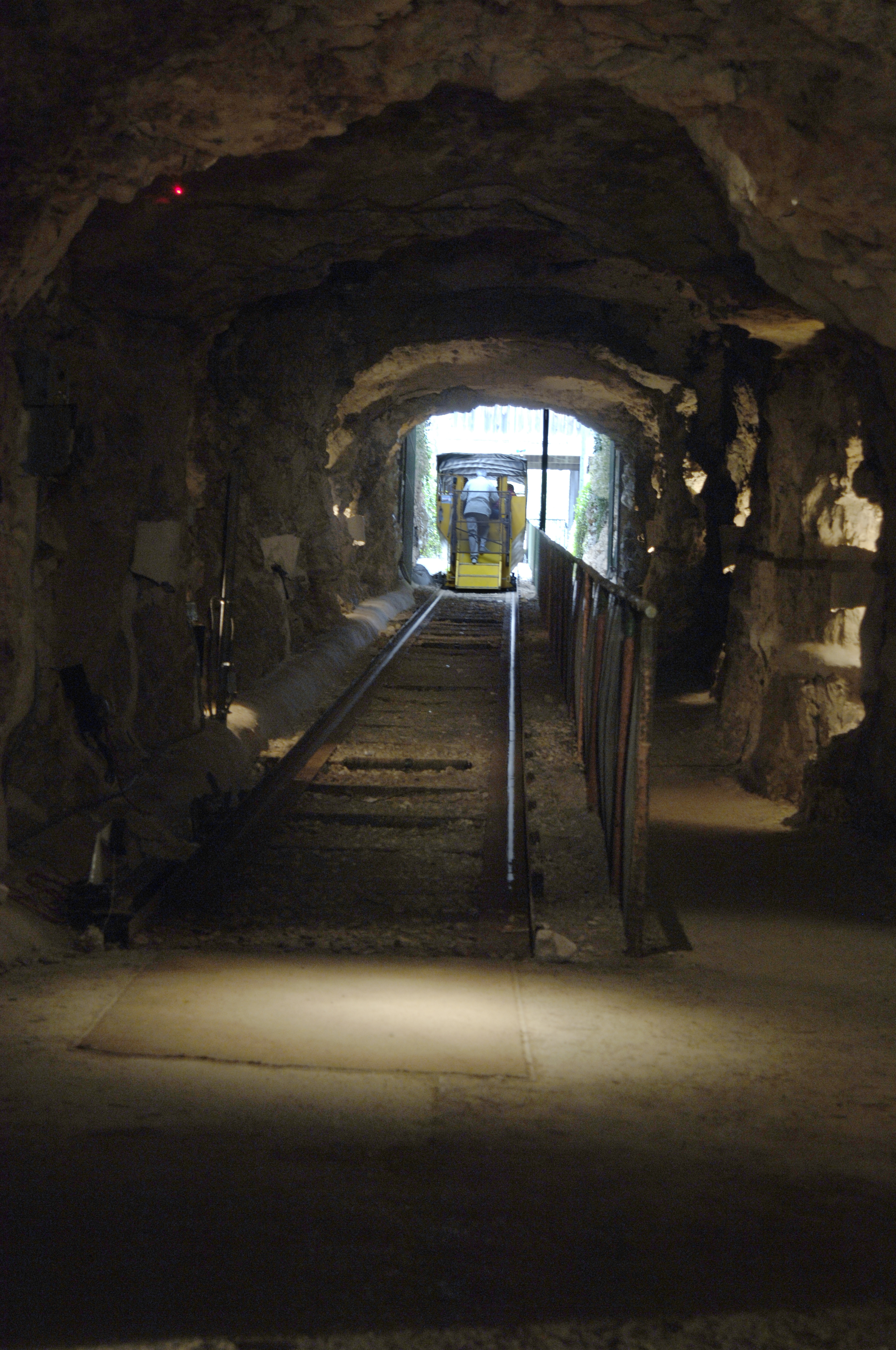
Inner Space Cavern opened to the public in 1966 and continues to offer tours and spelunking to the public in more than a mile of cave passages. TxDOT limited their recent survey work to three days a week on-site to allow public access tours to continue uninterrupted.
Loftis-Franklin said the survey crews were in the tunnels for so long, they would sometimes forget about the beauty around them until a tour of school kids would come through and remind them of the wonders of the cavern.
The team spent 18 days over a four-month period for onsite survey and scanning. Despite the survey taking place during the winter months, they were plenty warm in the cavern, which stays about 72 degrees and very humid year-round. Because of the humidity, some survey instruments had to acclimatize to the underground environment to recalibrate before they could be used effectively.
TxDOT land surveyors set up the cave’s known coordinates, developed a mapping system and performed precision scans of the cavern throughout the project.
“This required months of work from a land surveyor, a surveyor-in-training and a survey intern,” said James Johnson, TxDOT Transportation Programs Support director. “It was a unique training opportunity for our two junior staff members who learned how to develop a mapping system for a challenging worksite.”
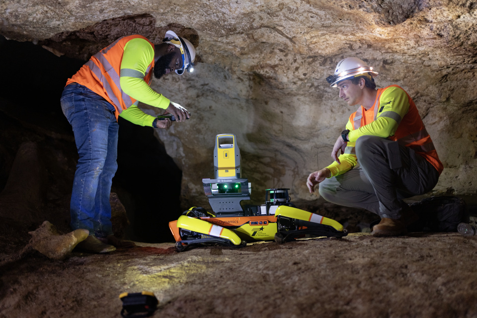
TxDOT also took scans with a dog-shaped robot named Dot. Dot could be equipped with inspection and survey equipment including a LiDAR scanner, and helped capture scans in parts of the cavern that were difficult to reach.
Information technology specialists helped with data collection and engineering services with computer-aided drawing and survey, construction and mapping support.
The scans taken in the cavern created a digital twin of the cave’s passages, complete with ceiling heights and the lengths and widths of the tunnels. The underground map was paired with its above-ground coordinates to pinpoint the exact location of the cavern underneath.
"Developing precise coordinates requires diligent application of technology and technique to ensure accurate data collection,” said Ronny Lackey, Surveying Section Director. “This is more difficult when you don't have access to global positioning systems or long sightlines in the caverns. Gina 's mentorship of employees will give them the experience needed to perform projects like this in the future.”
When TxDOT completes the data extraction and mapping, the 3D model and its newly mapped coordinates will ensure the natural wonder of Inner Space Cavern stays protected for future generations to explore.