TxDOT map leads you to Texas BBQ and stargazing spots
Nov. 26, 2025
By Ryan LaFontaine
AUSTIN — For centuries, maps have been a vital tool for human survival.
Early cultures used them to hunt for food. But lucky for us, today when hunger strikes, we can rely on TxDOT’s Statewide Planning Map to find the best barbecue joint near us.
Two decades after its debut, TxDOT’s Statewide Planning Map—now a daily tool for planners, engineers, and partners across Texas—is celebrating its 20th anniversary with new data layers, fresh basemaps, and a nod to the innovation that sparked its creation.
Michael Chamberlain, TxDOT’s director of data management, built the first version of the planning map himself in 2005 after recognizing how transformative web-based mapping would become.
Google Maps had launched just a year earlier, and no modern mapping frameworks existed at the time, so Chamberlain taught himself JavaScript and HTML and hand-coded TxDOT’s own web map.
“The first version was brutally simple,” he said. “None of the mapping frameworks available today existed back then so I wrote my own—after reading and re-reading a dozen books on the topic.”
Early features included basemaps for highways, railroads, traffic data and imagery—tools that quickly became a shared workspace for staff and planning partners. What began as a straightforward viewer rapidly grew into an all-purpose planning platform.
“Over the years it evolved into more than a simple map viewer,” Chamberlain said. “We added overlays, dynamic data, more basemaps, and the ability to share everything you create using URLs.”
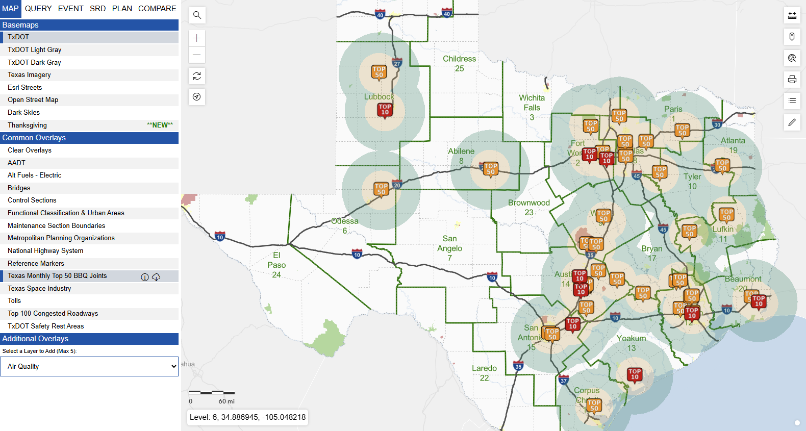
In recent years, the Statewide Planning Map has evolved into a full-featured analytical tool used by TxDOT engineers to plan, design, build and maintain the state’s highway system. But the map offers many additional features that don’t require an engineering degree, including the best places to view the night sky, see wildflowers, live traffic, current and future project locations and more.
As part of the 20-year celebration, TxDOT is rolling out unique new overlays and themed basemaps through 2026. Recent additions include a “BBQ layer” featuring Texas Monthly’s Top 50 barbecue joints and a new Thanksgiving theme.
Chamberlain said the team has many more creative additions planned for 2026.
“I am proud of what it has become, and I want to thank everyone who contributed to its success over the years,” he said. “As part of our celebration for ‘20 Years of Planning Map,’ we are creating unique overlays, basemaps and content through the end of the year and 2026.”