US 290 Texas Corridor Study
Study overview
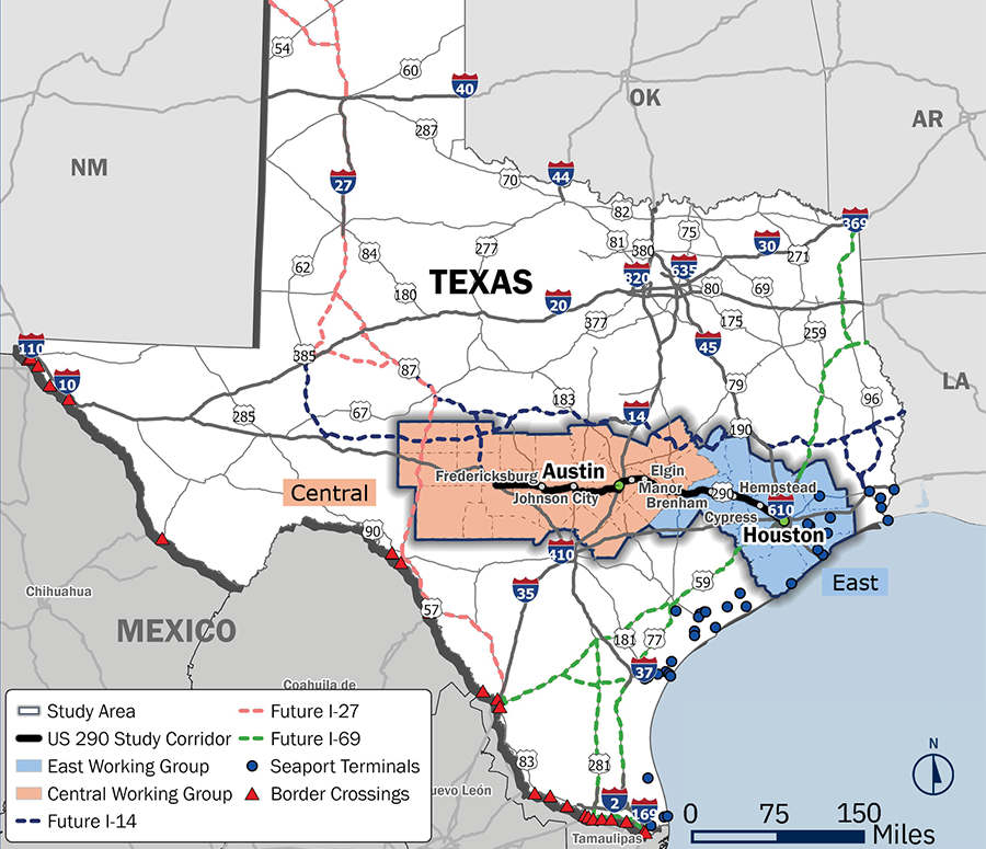
TxDOT is conducting a study of the US 290 Texas corridor from I-10 West in the Hill Country area to I-610 in Houston. This vital east-west, end-to-end corridor connects some of the State’s busiest ports to inland destinations, links urban and rural areas, connects Metro cities (Austin-Houston), and provides access to tourist destinations that fuel regional economies. This study aims to address current and future mobility challenges, incorporate opportunities for all users and transportation modes, and benefit urban and rural development.
Key considerations
The study will consider the following key elements to identify and prioritize proposed improvements along the corridor:
- Safety
- Intermodal (Rail/Air)
- Connectivity/Continuity of Frontage Roads
- Mobility and Congestion
- Truck Parking
- Innovation, Operations, and Emerging Technologies
- Asset Preservation
- Alternative Routes and Resilience
- Multimodal Passenger and Freight
Study approach
The US 290 Texas Corridor Study is designed to comprehensively assess the corridor by first reviewing existing conditions to identify current needs and gaps, while actively engaging a broad range of corridor stakeholders to ensure diverse perspectives are incorporated. The study includes an economic analysis to better understand impacts and opportunities, followed by identifying and prioritizing potential improvements. It culminates in the development of an implementation plan and final report, supported by preliminary cost estimates for each recommended improvement to guide future decision-making and investment.
Stakeholder and public engagement
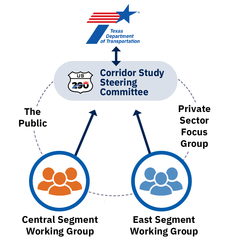
This study will be guided through a corridor-wide Steering Committee with input from the Segment Working Groups, TxDOT Districts and Divisions, the public, and the private sector.
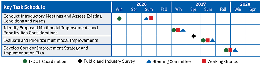
The Steering Committee is comprised of representatives from local governments, regional entities, and other key stakeholders across the corridor, for the US 290 Texas Corridor Study to guide and oversee the study and ensure its successful completion. This committee sets priorities and makes high-level decisions to keep the study aligned with its objectives. The Committee will meet at four key milestones throughout the study.
TxDOT has also established two Segment Working Groups, Central and East. Each group represents a distinct geographic segment as shown on the corridor study map and brings together key stakeholders, including County Judges, mayors, metropolitan planning organizations, regional planning organizations, chambers of commerce, public transportation agencies, freight stakeholders, private sector representatives, and advocacy organizations. The groups will meet at four key milestones to discuss segment-specific needs, challenges, and recommendations.
The importance of US 290
- US 290 traverses widely different contexts from Houston, through rural southeast Texas, to Austin, and beyond to the rolling Hill Country.
- The corridor links seaports to the I-35 corridor, facilitating trade and distribution.
- US 290 serves as an important route to access tourist destinations, historic sites, and universities that generate seasonal traffic increases.
- US 290 serves as a critical Hurricane Evacuation Route for the Houston region.
Key stakeholders include
US 290 Texas Corridor study materials
Study materials and meeting summaries will be posted here as they become available.