TxDOT map blooms with new feature
April 15, 2026
By Staff
AUSTIN — A new “wildflower” layer added to TxDOT's Statewide Planning Map is designed to bring both data and discovery to users across the state.
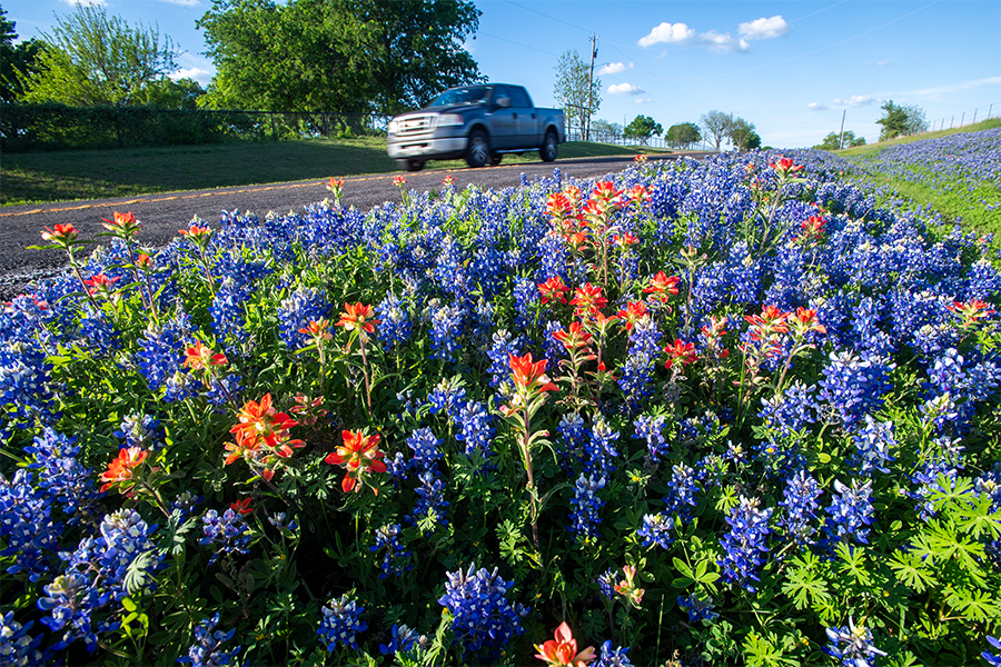
Drivers can pinpoint the exact area to plan where they can not only park to see the flowers, but get the best pictures. The Texas Department of Transportation (TxDOT) recommends drivers park away from traffic and not on top of flowers.
Elaine Wendt, TxDOT GIS analyst who worked on the new layer, said the wildflower map includes four types of Texas wildflowers: Prairie Verbena, Texas Paintbrush, Indian Blanket and Bluebonnets.
Additional research helped identify wildflower festivals scheduled throughout Texas in 2026.
“These festival locations were incorporated into the map as interactive points with pop-ups that include event details and links to photos,” said Leslie Ralston, TxDOT GIS analyst. “Each festival is represented with its own icon on the map.”
To create the wildflower layer, developers wanted to balance technical precision with statewide usability. To help gather the vast amounts of data, the team turned to iNaturalist, a global database of user-submitted and verified species observations.
“Using that data, we were able to map wildflower sightings across Texas dating back more than a decade,” said Tom Neville, a TxDOT GIS analyst, who helped develop the new layer. “The dataset was eventually refined, and a heat map was created to show concentrations of wildflower activity across the state.”
The map is one of TxDOT’s most widely used digital tools and is designed to bring both data and discovery to users across the state.
Now celebrating its 20th anniversary, the Statewide Planning Map has grown far beyond its original purpose. What began as a planning resource has evolved into a robust, interactive platform used daily by engineers, planners and partners to design, build and maintain Texas’ vast transportation system.
At the same time, it has become increasingly accessible to the public, offering layers that highlight everything from live traffic conditions to stargazing spots and scenic destinations.
The newly added wildflower layer is part of a broader rollout of themed overlays and basemaps planned through 2026 to commemorate the anniversary.
Recent additions have included a barbecue-themed layer featuring top-ranked Texas smokehouses and a seasonal Thanksgiving map, underscoring the agency’s effort to blend functionality with cultural and recreational interest.
The team has some additional layers in the works, including some new summer themes they hope to roll out in the coming months.
As TxDOT continues to expand the Statewide Planning Map, the addition of the wildflower layer reflects a broader goal: making transportation data not only useful, but engaging—offering Texans new ways to experience the roads that connect them.