Driver beware you're in for a scare
Oct. 13, 2026
By Julien Devereux
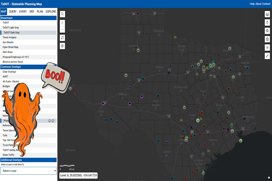
A Statewide Planning Map is Texans’ go-to online source to keep up with transportation projects around the state. But now, just in time for Halloween, you can also consult it for spooky tales.
The map’s new “Phantom Layer” features haunted hotels, mysterious cryptid sightings, urban legends, eerie cemeteries, UFO sightings and other stories that might give you shivers as you drive around our beautiful state.
This year is the Statewide Planning Map’s twentieth anniversary, and to celebrate, the Texas Department of Transportation (TxDOT) is adding a special layer every month. Elaine Wendt, a GIS analyst in TxDOT Data Management’s Roadway Inventory Branch, created the map.
"I chose the month of October this year and wanted to explore historic regional folklore and haunted sites throughout our state,” Wendt said.
Danny Smith, Catherine Hodde-Pierce and Alejandra Zermeño of TxDOT’s Transportation Planning and Programming Division also assisted after working on a similar project. They drew inspiration from the October basemap that Leslie Ralston and Tom Neville created in 2025.
The Phantom Layer is now your unofficial guide to Texas’s most mysterious tourist attractions. Some examples include:
- Ghost town in Big Lake
- Haunted hotel in Mineral Wells
- Legendary Hairy Man in Round Rock
- An alleged UFO landing site on South Padre Island
- Cemetery in Aurora where a UFO is said to have crashed in April 1897
- A spot on Old Greenhouse Road in Katy where mists are said to form in the shape of a woman who died in a car crash
- The haunted Worley Hospital in Pampa, where an episode of the TV show “Ghost Hunters” was filmed and a “tortured soul” allegedly captured on a thermal camera
Each entry includes information about the location, what visitors might expect if they visit and a small blurb about the history of the site.
TxDOT also sent out a survey to its employees to gather the spooky stories and urban legends for the map. Wendt researched online articles, blogs, radio shows and books to find more stories.
“It was a fun and fascinating research project!” Wendt said. “Many of the entries on this map are well known stories, while others were brand new to me. Once we generated this list, and compiled all the details, I plotted each site’s location onto the map.”
TxDOT published the new haunted layer called "Phantom" on Oct. 5 and it will remain on the Statewide Planning Map, along with a spooky splash screen, for the entire month of October. After Halloween, the layer will remain available as an option on the map.
As more stories are reported from the employee survey, they will be added to the map. Although the public can’t yet send in stories, TxDOT hopes to expand opportunities for public involvement for the 2027 version of the map.