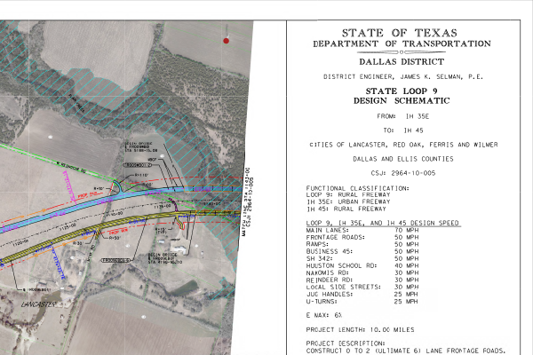
The proposed Loop 9, Segment C project begins at I-45 and ends at I-20. The need for the Loop 9 project is to address population growth, regional transportation demand, system linkages, and intermodal connections in the study area and Dallas – Fort Worth (DFW) Region.
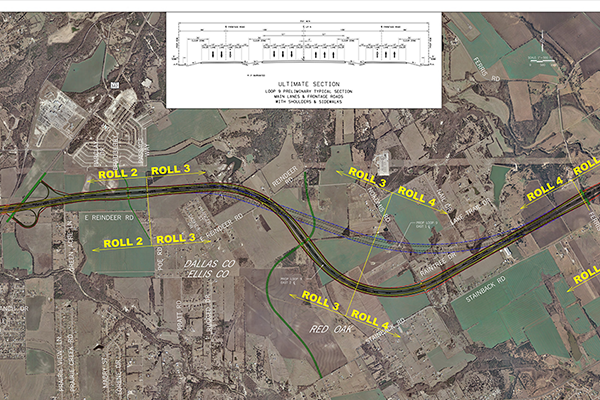
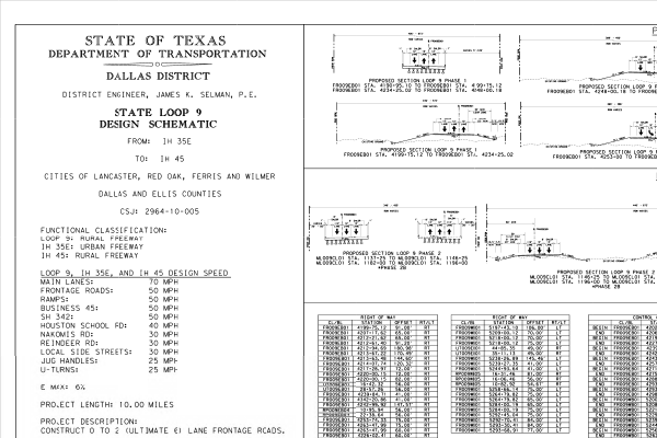
The proposed project would be constructed as two three-lane frontage roads with a median (200 to 364 feet wide) reserved for the future ultimate access-controlled facility. The typical ROW for the project would vary from approximately 384 to 548 feet in width. The proposed project would consist of three 12-foot lanes with 8-foot inside shoulders and 8-foot outside shoulders. The width between the frontage roads and the ROW would be 40 feet at a minimum to allow room for drainage ditches. The median would remain unutilized until construction of the future ultimate facility at a later date.
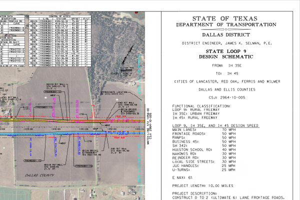
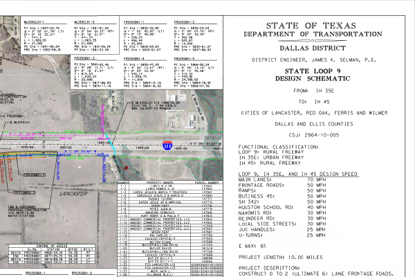
The total area needed for the proposed new location project (existing ROW plus proposed ROW and easements) is approximately 754.72 acres. The total proposed ROW is 568.93 acres. Because the project crosses numerous other transportation facilities, it would utilize 182.44 acres of existing ROW. Temporary construction easements would not be required. Permanent drainage easements, totaling 3.35 acres, would be required in several locations.
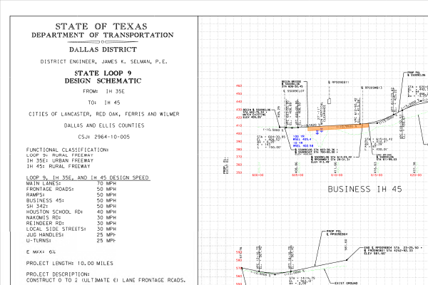
The proposed new location frontage roads would include intersections at major cross roads along the proposed route to include I-35E, Houston School Road, State Highway (SH) 342 (South Dallas Avenue/North Central Boulevard), existing and future Reindeer Road, existing and future Nokomis Road, Ferris Road, Business I-45 (North Central Street), and I-45. Interchange connections to existing I-35E and I-45 would include ramping and frontage road modifications. The proposed project would also include the construction of grade separations at I-35E and the BNSF Railway.
During the planning, specifications, and estimates (PS&E) process, it was determined that an additional 27.7 acres of new ROW must be acquired for construction of the I-35E Interchange. The proposed ROW located along the west side of I-35E from north of Travis Street to south of Parakeet Drive would be needed to accommodate the proposed interchange improvements of ramps, bridge structures, and frontage roads within the project area. Total project length of the I-35E Interchange at Loop 9 is approximately 0.5 mile in length.
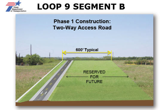
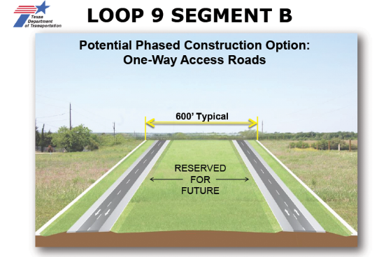
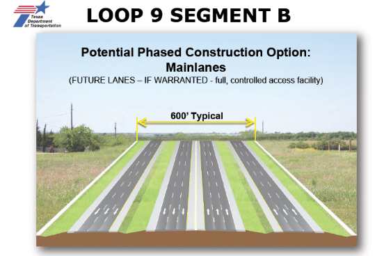
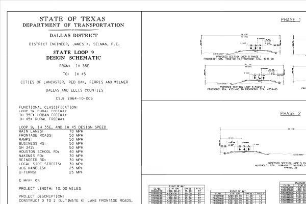
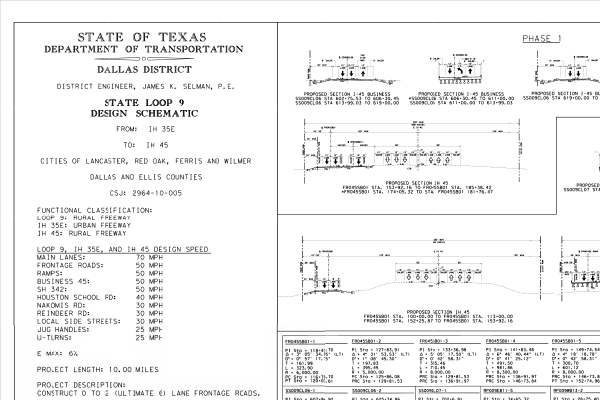
The proposed Loop9 Segment B project would likely be constructed in four phases based on traffic needs and project funding.
- Phase 1 - Construct a single two-lane, two-way frontage road, and acquire the proposed ROW to accommodate the frontage roads and the future ultimate access-controlled mainlane facility.
- Phase 2 - Construction of the second two-lane frontage road and the conversion of the two-way frontage road built in Phase 1 to a one-way operation.
- Phase 3 - Construction of a third frontage road lane in each direction and include the construction of grade separations at specific high-volume intersections.
- Phase 4 - Construction of the ultimate access-controlled mainlane facility in both directions.
Frequently asked questions
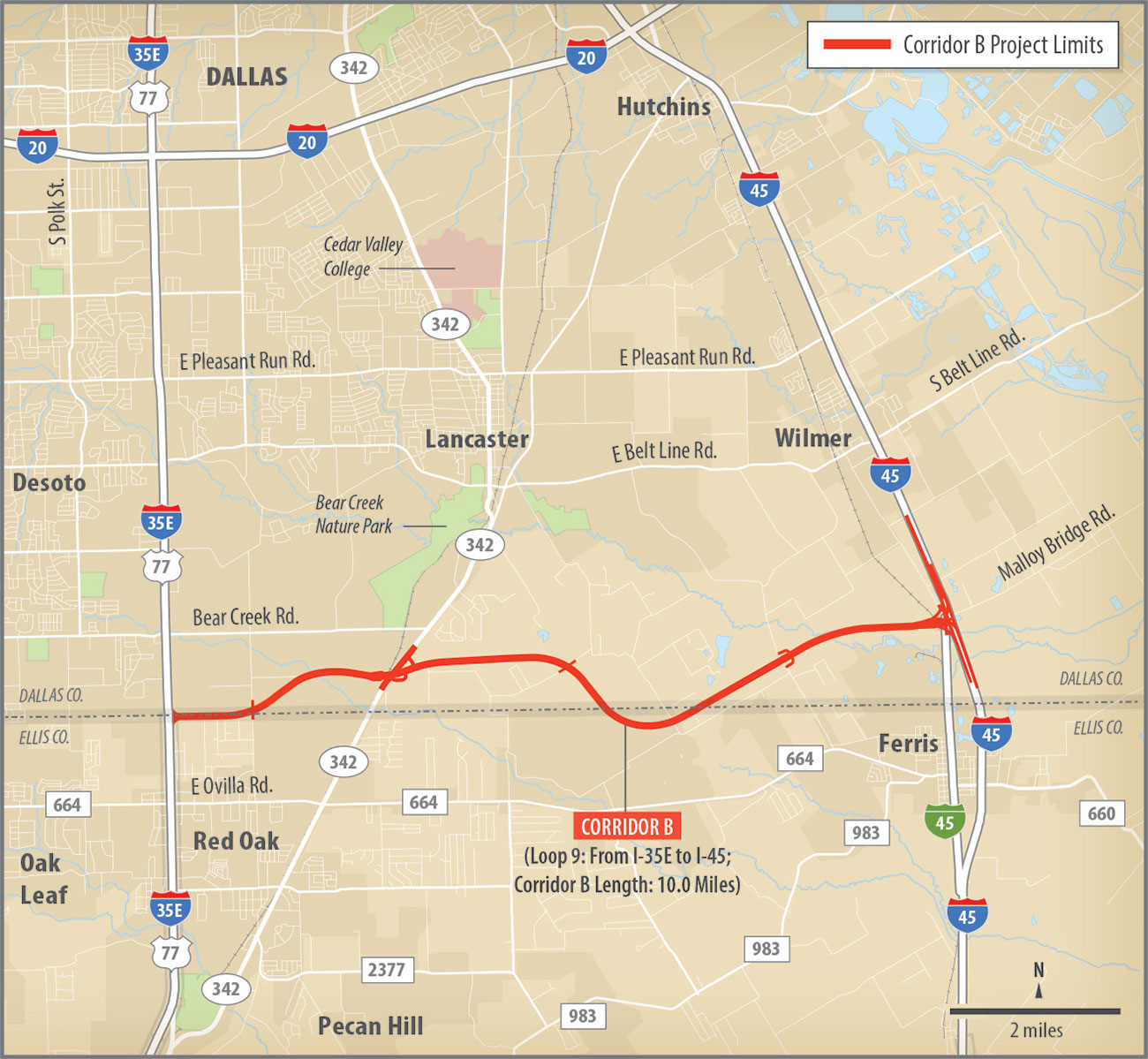
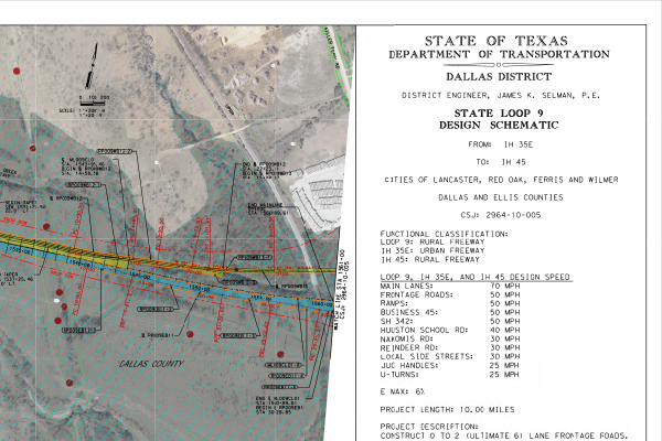
A 10-mile, six-lane new location frontage road system between I-35E and I-45 through Dallas and Ellis counties, Texas. The proposed ROW would include a median that would accommodate the future construction of an ultimate access-controlled mainlane facility. Construction of the ultimate access-controlled mainlane facility would be based on projected traffic and funding and would require additional environmental analysis prior to construction.
The proposed Loop9 Segment B project would likely be constructed in four phases based on traffic needs and project funding.
- Phase 1 - Construct a single two-lane, two-way frontage road, and acquire the proposed ROW to accommodate the frontage roads and the future ultimate access-controlled mainlane facility.
- Phase 2 - Construction of the second two-lane frontage road and the conversion of the two-way frontage road built in Phase 1 to a one-way operation.
- Phase 3 - Construction of a third frontage road lane in each direction and include the construction of grade separations at specific high-volume intersections.
- Phase 4 - Construction of the ultimate access-controlled mainlane facility in both directions.
568.93 acres of proposed ROW, including 3.35 acres of permanent drainage easements.
The proposed project would potentially displace 25 residences, 7 commercial structures, and 68 other structures.
Consistent with U.S. Department of Transportation policy, as mandated by the Surface Transportation and Uniform Relocation Assistance Act of 1987, TxDOT provides relocation resources to all displaced persons without discrimination. All property owners from whom property is needed are entitled to receive just compensation for their land and property. Just compensation is based upon the fair market value of the property. The TxDOT also provides, through its Relocation Assistance Program, payment and services to aid in movement to a new location.
Loop 9, Segment B would provide an 8-foot outside shoulder along the frontage roads for bicycle accommodations. Frontage roads located in the urbanized area of I-35E would consist of one 14- foot-wide outside shared-use lane (for bicycle accommodation) and a 6-foot sidewalk for pedestrian accommodation.
Phase 1 is expected to be let for construction in March of 2022, require approximately three years to construct, and then open to traffic in 2025.
The estimated total cost for the project is $297 million. Construction of Phase 2 and Phase 3 will be determined based on projected traffic and funding availability (as warranted). At that time, cost estimates will be developed based on the current market values.
Loop 9, Segment B was environmentally cleared on Nov. 16, 2017.
The project was modeled using FHWA's approved Traffic Noise Model. Results of the model showed impacts at 3 of the 20 modeled receivers. It was determined that traffic noise barriers would not be feasible and reasonable for the 3 impacted receivers and therefore are not proposed for incorporation into the project.
Contact information
Approved environmental and technical reports
Use the links below to access Loop 9, Segment B reports. Due to the large file sizes, each link connects to a separate part of the document in order to reduce downloading time.
- Final Approved Environmental Assessment Sept. 2017
- EA FONSI
- Re-Eval Checklist
- Community Impacts Assessment Technical Report
- Waters of the U.S. Delineation Report
- Surface Water Analysis
- Hazardous Materials Initial Site Assessment (ISA)
- Biological Resources Technical Report
- Biological Evaluation Assessment
- Biological Evaluation Assessment Supporting Documents
- Tier 1 Site Assessment
Maps and documents
Public involvement
Meetings
Lancaster Elementary School 1109 West Main Street Lancaster, TX 75146
- Legal Notice: English (PDF: 0.23Mb)
- Venue Location Map (PDF: 0.29Mb)
- Summary Report (PDF: 0.18Mb)
- Comment Form (PDF: 0.08Mb)
- Project Fact Sheet (PDF: 0.07Mb)
- Information Boards (PDF: 0.76Mb)
- Constraints Map (PDF: 8.9Mb)
- Ultimate Schematic (PDF: 12.8Mb)
- Exhibits: Map 1 (PDF: 6.5Mb) | Map 2 (PDF: 6.2Mb) | Map 3 (PDF: 6Mb) | Map 4 (PDF: 6.2Mb) | Map 5 (PDF: 6.4Mb) | Map 6 (PDF: 8.8Mb) | Map 7 (PDF: 8.9Mb)
Hearings
Ferris High School 1025 East 8th Street Ferris, TX 75125
- Legal Notices: English (PDF: 0.12Mb) | Spanish (PDF: 0.25Mb)
- Venue Location Map (PDF: 1.18Mb)
- Project Schematic 1 (PDF: 7.18Mb)
- Project Schematic 2 (PDF: 8.11Mb)
- Project Schematic 3 (PDF: 7.56Mb)
- Project Schematic 4 (PDF: 7.24Mb)
- Project Schematic 5 (PDF: 7.79Mb)
- Project Schematic 6 (PDF: 8.87Mb)
- Project Schematic 7 (PDF: 8.56Mb)
- Project Schematic 8 (PDF: 1.97Mb)
- Draft Environmental Assessment (PDF: 79.05Mb)
- Public Hearing Presentation (PDF: 0.51Mb)
- Documentation of Public Hearing (PDF: 7.12Mb)