36A North
Environmental studies
The environmental review, consultation and other actions required by applicable Federal environmental laws for this project are being, or have been, carried-out by TxDOT pursuant to 23 U.S.C. 327 and a Memorandum of Understanding (MOU) dated Dec. 9, 2019, and executed by the Federal Highway Administration (FHWA) and TxDOT.
The National Environmental Policy Act (NEPA) requires agencies to assess the environmental effects of their proposed actions prior to making decisions. FHWA, as a federal agency, has developed regulations and guidance for preparation of environmental documentation under NEPA. TxDOT, which assumes the responsibility for environmental review and clearance under the previously mentioned MOU with FHWA, has developed state guidance which largely mirrors and supplements the federal process. Development of an Environmental Impact Statement (EIS) for projects, such as the 36A North segments of independent utiltiy (SIU), in which potentially significant environmental or community impacts may occur, is appropriate.
Natural environment
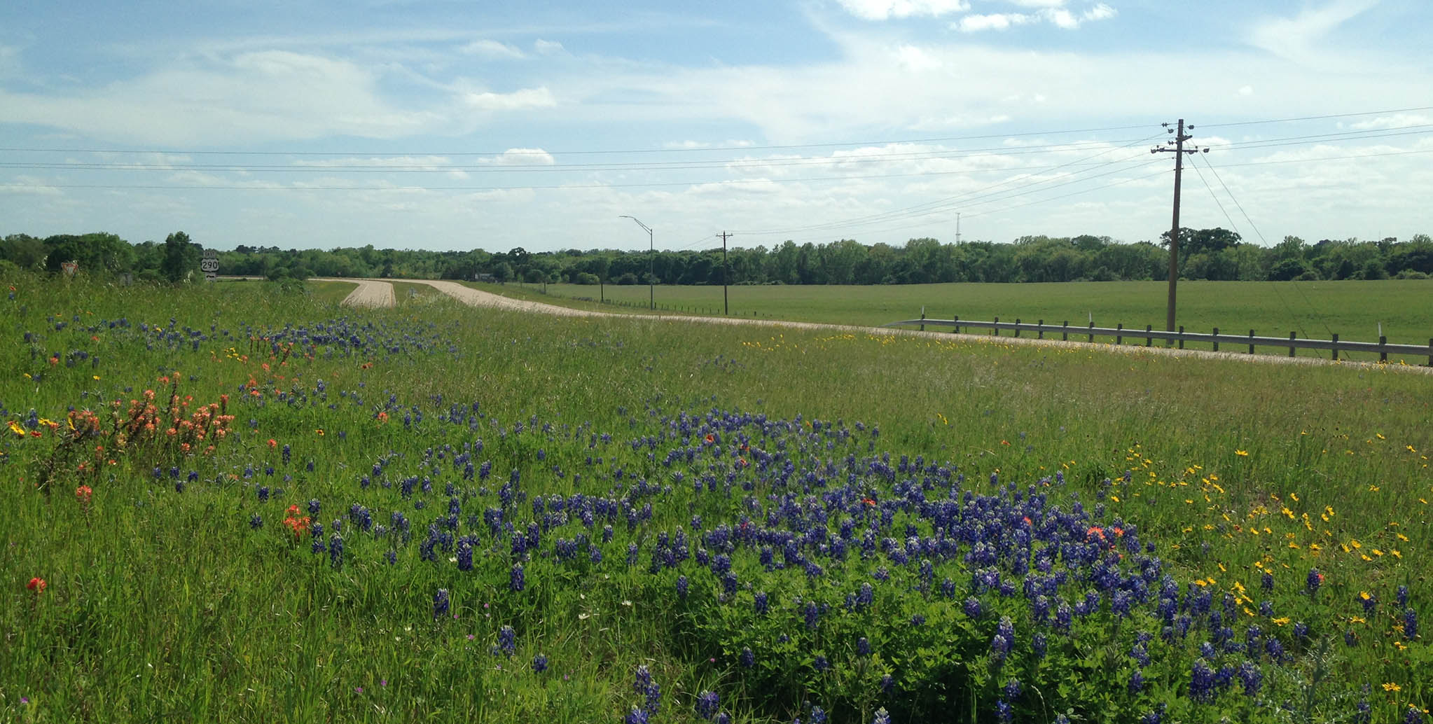
- Land use
- Farmlands
- Protected lands
- Water resources (including Clean Water Act Section 404, Clean Water Act Section 401, Executive Order 11990 Wetlands, Rivers and Harbors Act, Clean Water Act Section 303 (d), Clean Water Act Section 402, Floodplains, Wild and Scenic Rivers, Coastal Barrier resources, Coastal Zone Management and Drinking Water Systems)
- Biological resources (including Texas Parks and Wildlife Coordination, Impacts to Vegetation, Executive Order 13112 on Invasive Species, Executive Memorandum on Environmentally and Economically Beneficial Landscaping, Impacts to Wildlife, Migratory Bird Protections, Fish and Wildlife Coordination Act, Bald and Golden Eagle Protection Act of 2007, Magnuson-Stevens Fishery Conservation Management Act, Marine Mammal Protection Act, and Threatened, Endangered and Candidate Species)
Social environment
- Right of way/Displacements
- Utility relocations
- Bicycle and pedestrian facilities
- Community impacts
- Visual/Aesthetic impacts
- Cultural resources (including archaeology and historic properties)
- Air quality
- Hazardous materials
- Traffic noise
- Induced growth
- Cumulative impacts
- Construction phase impacts
- Greenhouse gas and climate change (including statewide on-road greenhouse gas (GHG), mitigation measures and TxDOT and a changing climate)
A cooperating agency means any federal agency other than a lead agency which has jurisdiction by law or special expertise with respect to any environmental impact involved in a proposal (or a reasonable alternative). Cooperating agencies have a higher degree of authority, responsibility, and involvement in the environmental review process. A distinguishing feature of a cooperating agency is that the CEQ regulations permit a cooperating agency to “assume on request of the lead agency responsibility for developing information and preparing environmental analyses including portions of the environmental impact statement concerning which the cooperating agency has special expertise.” An additional distinction is that “a cooperating agency may adopt without recirculating the environmental impact statement of a lead agency when, after an independent review of the statement, the cooperating agency concludes that its comments and suggestions have been satisfied.”
TxDOT collaborates with various federal, state and local agencies including Tribal Nations, Federal Highway Administration, US Army Corps of Engineers, US Coast Guard, US Department of Agriculture, US Department of Housing and Urban Development, US Department of the Interior, US Environmental Protection Agency (EPA), US Fish and Wildlife Service, Public Utility Commission of Texas, Railroad Commission of Texas, Texas Commission on Environmental Quality, Texas Department of Agriculture, Texas Department of Houston and Community Affairs, Texas General Land Office, Texas Historical Commission, Texas Parks and Wildlife Department, Texas State Soil and Water Conservation Board, Gulf Coast Rail District, Houston-Galveston Area Council, Port Freeport, County Historical Commissions, County Drainage Districts, County Subsidence Districts, County Toll Road Authorities, various cities, towns and villages.
| Federal | State | Local |
Federal Highway Administration, US Army Corps of Engineers, US Coast Guard, US Department of Agriculture, US Department of Housing and Urban Development, US Department of the Interior, US Environmental Protection Agency (EPA), US Fish and Wildlife Service, |
Texas Comission on Environmental Quality Service Public Utility Commission of Texas, Railroad Commission of Texas, Texas Commission on Environmental Quality, Texas Department of Agriculture, Texas Department of Houston and Community Affairs, Texas General Land Office, Texas Historical Commission, Texas Parks and Wildlife Department, Texas State Soil and Water Conservation Board, |
Gulf Coast Rail District, Houston-Galveston Area Council, Port Freeport, County Historical Commissions, County Drainage Districts, County Subsidence Districts, County Toll Road Authorities, various cities, towns and villages. |
The EIS will also provide a discussion of public involvement activities. This section of the EIS will summarize the public involvement activities conducted for the project, and an explanation of any changes to the project that may have occurred as a result of comments received during the public involvement activities. There are some circumstances that require specific public involvement activities and notifications, such as hearings required under Transportation Code 203.021, for projects that bypass a municipality or county; Texas Parks and Wildlife Code Chapter 26, for projects requiring the taking of public land designated and used as a park, recreation area, wildlife refuge, historic or scientific area; or projects adding bicycle lanes under specific circumstances, as per 43 TAC 25.55. In addition, noise workshops in areas for which noise abatement measures are considered reasonable and feasible will be scheduled. These special circumstances will be evaluated as the environmental studies for the project progress.
The EIS will explain that a combined notice of availability of the draft EIS/notice of public hearing was provided prior to preparation of the final EIS. The EIS will describe where Public Meeting/Public Hearing documentation may be found for review, typically online and at the District Office. Post clearance public involvement, such as notices of impending construction, which would be provided to adjacent property owners, affected local governments, and public officials will be outlined. As an EIS is anticipated for this project, the requirements for a notice of availability of the final EIS will be described, along with an explanation that the record of decision (ROD) will not be signed until 30 days after issuance of the notice of availability. Please see the 36A North Project Get Involved page for more information regarding public involvement activities anticipated for this project.
Every EIS is required to analyze a No Action Alternative, in addition to the range of alternatives presented for the study. The No Action Alternative identifies the expected environmental impacts in the future if existing conditions were left as is with no action taken by TxDOT. Analysis of the No Action Alternative is used to establish a baseline upon which to compare the proposed “Action” alternatives.
Evaluated resources and context
The EIS is required to identify and compare the acreage and location of any right-of-way or easements that would be needed for each reasonable alternative. The EIS must also identify and compare residences, businesses, other facilities or developments that would be potentially displaced, either partially or completely, for each reasonable alternative.
TxDOT provides relocation resources to all displaced persons without discrimination in a manner
consistent with U.S. Department of Transportation (DOT) policy as mandated by the Uniform Relocation Assistance and Real Property Acquisition Policies Act of 1970, as amended in the Surface Transportation and Uniform Relocation Assistance Act of 1987 (the Uniform Act).
Impacts on land use for each reasonable alternative must be described and compared in the EIS. Existing land use in the study area must be characterized (e.g., residential, commercial, industrial, vacant etc.), including the reasonably foreseeable environmental trends and planned actions in the area. The EIS will explain whether and how such use is expected to change because of each reasonable alternative (e.g., conversion from existing land use to highway ROW). Explanations will include acreages of conversion for each reasonable alternative and each land use type.
The Farmland Protection Policy Act (FPPA) is meant to minimize the impact Federal programs have on permanent farmland conversions to nonagricultural uses. Farmland includes prime farmland, unique farmland and land of statewide or local importance. TxDOT will meet regulatory requirements to prepare the project specific, NEPA documentation compliant with the FPPA of 1981. The Natural Resources Conservation Service’s (NRCS), a U.S. Department of Agriculture (USDA) agency, policies govern compliance with the FPPA.
Utilities consist of publicly, privately, or cooperatively owned utilities that provide telephone, telegraph, communications, electric, gas, heating, water, railroad, storm sewer, sanitary sewer or pipeline services. The TxDOT-Utility Cooperative Management Process (“The Process”) is a partnership between TxDOT, Local Public Agencies (LPAs), when applicable, and the utility industry. “The Process” provides for cooperation and shared accountability to achieve integration of required utility accommodation with transportation improvement projects. Proactive management of “The Process” accomplishes efficient utility accommodation and minimizes project delays. A flowchart of “The Process” can be found here: TxDOT Utility Cooperative Management Process
Bicycle and pedestrian facilities
NEPA requires federal agencies to consider the effects of major federal undertakings on the quality of the human environment. Impacts to communities are one example of the types of impacts studied to determine a project’s potential effects. Community impacts can be, but are not limited to, displacements, effects to access and travel patterns, disruption to community cohesion, effects on environmental justice and effects to limited English proficiency populations. An assessment of community impacts is a vital component in the EIS process. As such, TxDOT will complete a Community Impact Assessment (CIA). Regulations that drive TxDOT policy and procedures related to CIAs are NEPA, Title VI of the Civil Rights Act of 1964, Executive Order (EO) 12898 Federal Actions to Address Environmental Justice in Minority Populations and Low-Income Populations and EO 13166 Improving Access to Services for Persons with Limited English Proficiency.
Once impacts to the community as a whole are determined, the CIA process then focuses on how the project could impact traditionally underserved communities. TxDOT compares how project impacts are distributed and aims to ensure that negative impacts are not disproportionately borne by minorities and/or low-income populations as directed in EO 12898 and Title VI of the Civil Rights Act of 1964. If it is determined that negative impacts are more concentrated in minority and/or low-income communities, then TxDOT will reexamine project design and explore mitigation options to reduce the disparity to the extent possible.
Finally, the CIA aims to ensure that all members of the community have the opportunity to participate in the NEPA process regardless of what language they speak. Guided by EO 13166, TxDOT uses American Community Survey data, information gathered during visits to the community and other local sources of reliable data to determine what languages are prevalent in the community, other than English. If determined necessary, project materials may be translated and made available to the public or interpreters may be made available at public meetings. The public can also request translated materials at any time. The goal of this process is to ensure that no one be denied the opportunity to provide their feedback and express their concerns about the project whether or not they are fluent in English.
For more information, visit: TxDOT Community Impacts Assessment Toolkit
Visual/Aesthetic impacts
Archeology and cemeteries
Archaeological sites and cemeteries may include – but are not limited to – prehistoric camps and villages; prehistoric and historic cemeteries; isolate burials; shipwrecks; and historic farmsteads. TxDOT will follow the process steps necessary to comply with the National Historic Preservation Act (NHPA), the Antiquities Code of Texas (ACT), and the Health and Safety Code. These laws require consideration of potential project effects on archaeological sites and cemeteries both known and unknown. The process includes background research and field surveys. All the activities will be coordinated with the State Historic Preservation Office to ensure that the appropriate review and concurrences are met. Additionally, TxDOT recognizes the inherent interest that Native American tribes have in the state’s natural and cultural resources. As such, TxDOT, on behalf of the FHWA, consults with tribes on transportation planning and projects to identify and determine any potential effect the project will have on places of cultural significance to the tribes, including archeological sites and cemeteries. The publications listed below are good resources for learning about the process and how to participate:
- Historic Preservation Toolkit
- Citizen guide to the NEPA
- TxDOT Environmental Compliance Toolkit link
- Archeological Sites and Cemeteries Toolkit
Historic properties
TxDOT works to identify historic properties in compliance with federal and state laws. TxDOT will conduct the process steps necessary to conduct a review of non-archeological historic properties in compliance with Section 106 of the National Historic Preservation Act (NHPA) and the Antiquities Code of Texas (ACT). While the general review process is required under these directives, most of the resource identification and consultation is conducted in accordance with TxDOT’s programmatic agreement (PA) and Memorandum of Understanding (MOU) with the Texas Historical Commission that streamline project review and approval conducted under Section 106 and the ACT Results of this process must be integrated into the NEPA documentation for the project.
TxDOT appreciates your help in identifying historic (at least 45 years old) properties important to you and your communities that may be in the project area. The links below provide more information on TxDOT's historic preservation efforts, including examples of historic properties, and how you can help make us aware of potentially historic resources..
Parkland resources are protected under various regulations, such as Section 4(f) of the U.S.
TxDOT will ensure compliance with Section 4(f) of the U.S. DOT Act, Federal Highway Administration (FHWA) regulations, policies and guidance explained in t he 2012 FHWA Section 4(f) Policy Paper. Ultimate decision-making responsibility and approval of Section 4(f) compliance ties with the USDOT agency with jurisdiction over the project. If any discrepancy arises between the 2012 FHWA Policy Paper and the Section 4(f) regulation, the regulation takes precedence. If any discrepancy arises between the FHWA guidance and TxDOT guidance, the FHWA guidance takes precedence. TxDOT will determine if Section 6(f) LWCF Act protected properties are present in the project area will complete the necessary documentation and compliance activities. Ultimate decision-making responsibility and approval of Section 6(f) compliance lies with the National Park Service (NPS). TxDOT will take all steps to comply with PWC Chapter 26.[CW1]
Section 4(f) of the Department of Transportation Act of 1966
Section 6(f) of the Land and Water Conservation Fund Act
Chapter 26 of the Texas Parks and Wildlife Code
Water resources is an umbrella term referring to surface water, groundwater, wetlands, coastal resources, floodplains or waters of the U.S. (WOUS) including lakes, rivers, streams and their adjacent wetlands. TxDOT will meet its obligation to document compliance with legal requirements concerning the management of water resources for federal and state laws and regulations that apply to water resources in Texas.
- Clean Water Act Section 404
- Clean Water Act Section 401
- Executive Order 11990 Wetlands
- Rivers and Harbors Act
- Clean Water Act Section 303(d)
- Clean Water Act Section 402
- Floodplains
- Wild and Scenic Rivers
- Coastal Barrier Resources
- Coastal Zone Management
- Edwards Aquifer
- International Boundary and Water Commission
- Drinking Water Systems
Biological resources includes the following considerations: Terrestrial and aquatic plant and animal species; Game and non-game species; Special status species (state or federally listed threatened or endangered species, marine mammals, or species of concern, such as species proposed for listing or migratory birds); Environmentally sensitive or critical habitats. Biological resources are valued for their intrinsic, aesthetic, economic, and recreational qualities and include fish, wildlife, plants, and their respective habitats. Typical categories of biological resources include:
Biological Resources, along with community impacts, have some of the greatest potential for disturbance by transportation projects. For this reason, biological resource studies will be conducted by reviewing online resources as well as field surveys to identify and document resources within the project area. Furthermore, TxDOT will coordinate with the appropriate agencies, such as the Texas Parks and Wildlife Department and the U.S. Fish and Wildlife Service to identify biological resources that may be impacted by the project. These measures are meant to ensure avoidance, minimization and mitigation of impacts to such resources.
Impacts to Wildlife and Habitat: The EIS must discuss and compare the potential for impacts to wildlife and habitat for each reasonable alternative identified. Explain any mitigation proposed for the preferred alternative with respect to impacts to wildlife or habitat. This includes any voluntary conservation measures or other commitments related to impacts to wildlife or habitat.
Executive Order 13112 on Invasive Species: The EIS must address Invasive Species through its Roadside Vegetation Management Manual and Landscape and Aesthetics Design Manual.
Executive Memorandum on Environmentally and Economically Beneficial Landscaping: The EIS must address Environmentally and Economically Beneficial Landscaping through its Roadside Vegetation Management Manual and Landscape and Aesthetics Design Manual.
Migratory Bird Protections: The EIS must comply with applicable provisions of the Migratory Bird Treaty Act (MBTA) and Texas Parks and Wildlife Code Title 5, Subtitle B, Chapter 64, Birds. It is TxDOT’s policy to avoid removal and destruction of active bird nests except through federal or state approved options. In addition, it is TxDOT’s policy to, where appropriate and practicable: use measures to prevent or discourage birds from building nests on man-made structures within portions of the project area planned for construction, and schedule construction activities outside the typical nesting season.
Fish and Wildlife Coordination Act: If the preferred alternative is anticipated to require an individual permit issued by the US Army Corps of Engineers, then compliance with the Fish and Wildlife Coordination Act will be accomplished through the individual permit application process.
Bald and Golden Eagle Protection Act of 2007: Studies will be conducted to determine if the preferred alternative is within 660 feet of an active or inactive Bald or Golden Eagle nest, and if there are, then determine whether construction activities will occur during nesting season. The project will adhere to the National Bald Eagle Management Guidelines of 2007, and if necessary, coordinate with the US Fish and Wildlife Service to obtain a Non-Purposeful Take Permit. The project must also identify any voluntary conservation measures or other commitments resulting from this coordination.
Magnuson-Stevens Fishery Conservation Management Act: If the project is located within essential fish habitat, then the project must explain whether the project may have an adverse effect on essential fish habitat. If there is no adverse effect, then the EIS must explain the basis for that determination and must explain that no consultation with the NMFS under the Magnuson-Stevens Fishery Conservation Management Act is required. If the project is located within essential fish habitat, and the project may have an adverse effect on essential fish habitat, then the EIS must explain that consultation with the National Marine Fisheries Service is required, and must explain the status of that consultation. The EIS must also identify any voluntary conservation measures or other commitments resulting from NMFS coordination.
Marine Mammal Protection Act:
Threatened, Endangered, and Candidate Species: The EIS must explain that an analysis of the preferred alternative’s potential impacts on state and federally listed threatened, endangered, and candidate species was performed, and must reference the Species Analysis Form and Species Analysis Spreadsheet that was prepared for the preferred alternative. For federally listed species, identify any species for which it was determined that the preferred alternative may affect the species (or for a state-funded project, any species for which it was determined that the preferred alternative would cause a take of the species). Explain that for all other federal listed species that may occur in the project area, it was determined that the preferred alternative will have no effect on them (or for a state-funded project, no take). For a federally funded project, if it was determined that the preferred alternative may affect one or more federally listed species, explain that Section 7 consultation is required and the status of such consultation. The EIS must also identify any voluntary conservation measures or other commitments resulting from section 7 coordination. For state-listed species, identify any species for which it was determined that the preferred alternative may impact the species. Explain that for all other state-listed species that may occur in the project area, it was determined that the preferred alternative will have no impact on them.
Texas Parks and Wildlife Coordination: The EIS must explain that this project is being coordinated with Texas Parks and Wildlife Division (TPWD) and reference the written coordination exchanges. The EIS must also indicate which TPWD-recommended Best Management Practices will be applied to the project, and any voluntary conservation measures or other commitments resulting from TPWD coordination.
To learn more, visit: TxDOT Natural Resources Compliance Toolkit
The two major groups of transportation-related pollutants are the Environmental Protection Agency (EPA) criteria pollutants (including ozone, carbon monoxide and particulate matter) as well as the Mobile Source Air Toxics (MSAT). Monitoring data for both of these groups of pollutants in the Houston area indicate trends of improving air quality over the last several decades. This improvement in air quality is largely due to the significantly cleaner vehicles and fuels which, along with associated fleet turnover, have greatly outpaced the emissions from the increasing population and number of vehicles on the road in the Houston area over the same time period. Future pollutant trends modeling by the Texas Commission of Environmental Quality (TCEQ) for criteria pollutants and by the FHWA for MSAT have projected these improvements to continue into the future, even assuming increasing population and VMT.
The Houston area, including many of the counties associated with the 36A project, are in nonattainment for the National Ambient Air Quality Standards (NAAQS) for ozone. As mentioned above, however, ozone in Houston has been improving over time. In order to assure the area will continue this trend, the Clean Air Act (CAA) mandates that transportation plans, programs and projects must conform to Texas’ State Implementation Plan (SIP), the air quality plan for the state. This project must receive a project level conformity determination from FHWA prior to the environmental decision.
The Houston-Galveston Area Council (H-GAC) has a congestion management process (CMP) in place to ensure their roadway network achieve congestion improvements. The project will also have to address congestion solutions in accordance with H-GAC’s CMP.
NEPA regulations require FHWA projects to be evaluated for both carbon monoxide (CO) and MSAT. Under current FHWA guidance in Texas, projects with low traffic volumes (under 146,000 vehicles per day) are unlikely to have the possibility of producing either a CO or MSAT impact. The 36A project is projected to have traffic volumes under this threshold and, therefore, is not expected to rise to a level where a potential quantitative impact analysis is required.
During construction there is the potential for dust (particulate matter) and for MSAT (diesel particulate matter) emissions from construction equipment. To address these concerns, TxDOT requires construction contractors to perform dust suppression in accordance with its construction specifications; and recommends contractors upgrade their construction equipment with cleaner engines using programs such as the Texas Emission Reduction Program (TERP). Construction contractors are also required to follow all applicable federal and state regulations during construction of the project. The environmental document will identify and specify these construction mitigation opportunities.
Carbon Monoxide Traffic Air Quality Analysis (CO TAQA)
Mobile Source Air Toxics (MSAT)
Congestion Management Process (CMP)[CW1]
Learn more about the TxDOT Air quality Compliance toolkit
Hazardous materials concerns and constraints will be identified and evaluated in the development of the EIS. Examples of hazardous material sites and issues commonly encountered on transportation projects include the following: industrial sites, petroleum storage tank sites, oil and gas well sites, landfills, pipelines, structures with asbestos containing materials, structures with lead containing materials, contaminated soil and groundwater associated with any of the above listed concerns. Hazardous materials may be encountered on practically all transportation projects. The following general guidelines will be followed with regard to identification and assessment of potentially hazardous materials in the development of the EIS.
Assess hazardous material concerns/constraints in the early planning stage of project development.
Consider hazardous material concerns in alignment selection.
Determine additional investigations, considerations and/or coordination required for subsequent stages of project development because of the known or possible presence of hazardous materials.
Coordinate assessment and/or investigation findings, decisions, considerations and commitments with affected parties, entities, internal functional areas and agencies. Document the hazardous materials assessment, alignment selection decisions regarding hazardous materials and preliminary commitments due to the known or possible presence of hazardous materials.
For more information, visit: TxDOT Hazardous Materials Compliance toolkit
Traffic noise is one of the most concerning community impacts to the general public. Traffic noise mainly stems from the tires, engines and mufflers of vehicles. Decibels (dB) are the typical sound measurement, but not all sound can be heard by the human ear and traffic noise is never constant. As a result, sound measurements are adjusted, referred to as A-weighting (dBA), and single values are used to represent the average or equivalent sound level (Leq). Noise impacts occur when predicted noise levels are one dBA below, equal to or above the threshold for a specific activity area. To mitigate and/or minimize traffic noise, the most used mitigation measure is the construction of noise barriers built between the noise source and the impacted area.
In the 1972 Federal-aid Roadway Act, Congress require the FHWA to develop a noise standard for new Federal-aid roadway projects. While providing national criteria and requirements for all roadway agencies, the FHWA Noise Standard at 23 Code of Federal Regulation (CFR) Part 772 gives roadway agencies flexibility that reflects state-specific attitudes and objectives in approaching the problem of roadway traffic and construction noise. TxDOT’s 2019 Traffic Noise Policy was developed in accordance with 23 CFR 772. TxDOT will follow the requirements of this policy for how roadway traffic noise impacts are defined, how noise abatement is evaluated, how noise abatement decisions are made and how the analysis is documented.
Induced growth impacts can be described as changes in land use that are attributed to the project. In many cases, improvements to the roadway coupled with ongoing population growth, city plans and other factors can lead to new residential, commercial or other developments OR redevelopment of existing properties. TxDOT uses a six-step process to determine if the project would make the area attractive for development and also aims to determine where exactly those changes could occur. This analysis can be found in the Induced Growth Technical Report. A summary will also be included in the Induced Growth section of the EIS.
Learn more through the TxDOT Environmental Toolkit
Cumulative impacts can be thought of as the total past, present and reasonably foreseeable impacts on a resource. It would be impossible to know the exact calculations of past and reasonably foreseeable impacts. In order to make the most reasonable and logical estimation of those impacts TxDOT uses a five-step approach which uses information from historic aerial photos, local knowledge, planning documents and other reliable sources of data. By piecing together what is known about past, present and future actions a reasonable assessment of the overall outcome for the resource can be made. While TxDOT is not responsible for all past and future impacts to a given resource, it is our responsibility to determine what part our projects play in the overall health of the resource we impact.
The requirement to assess cumulative impacts of proposed projects is established in the TxDOT environmental review rules (43 TAC Chapter 2). Detailed information on Cumulative Impacts in general and TxDOT’s specific approach to this analysis can be found in the Cumulative Impacts Guidelines in the Indirect and Cumulative Environmental Compliance Toolkit.
A summary of the analysis will be included in the Cumulative Impacts section of the EIS, the complete analysis can be found in the Cumulative Impacts Technical Report. It is important to note that not all resources are analyzed for cumulative impacts. Only resources that are considered to be substantially
impacted by the project and/or resources that are in poor and declining health are included in cumulative impacts analysis.
Learn more about the TxDOT Environmental Toolkit
Relationship between short-term uses of man’s environment and the maintenance and enhancement of long-term productivity
Irreversible or irretrievable commitments of resources
Possible conflicts between the proposed action and the objectives of Federal, regional, State, and local land use plans, policies and controls for the area concerned
Energy requirements and conservation potential of various alternatives and mitigation measures
Natural or depletable resources requirements and conservation potential of various alternatives and mitigation measures
Urban quality, historic and cultural resources, and the design of the build environment, including the reuse and conservation potential of various alternatives and mitigation measures.
Statewide On-road GHG
Mitigation Measures
TxDOT and a Changing Climate