36A
Project overview
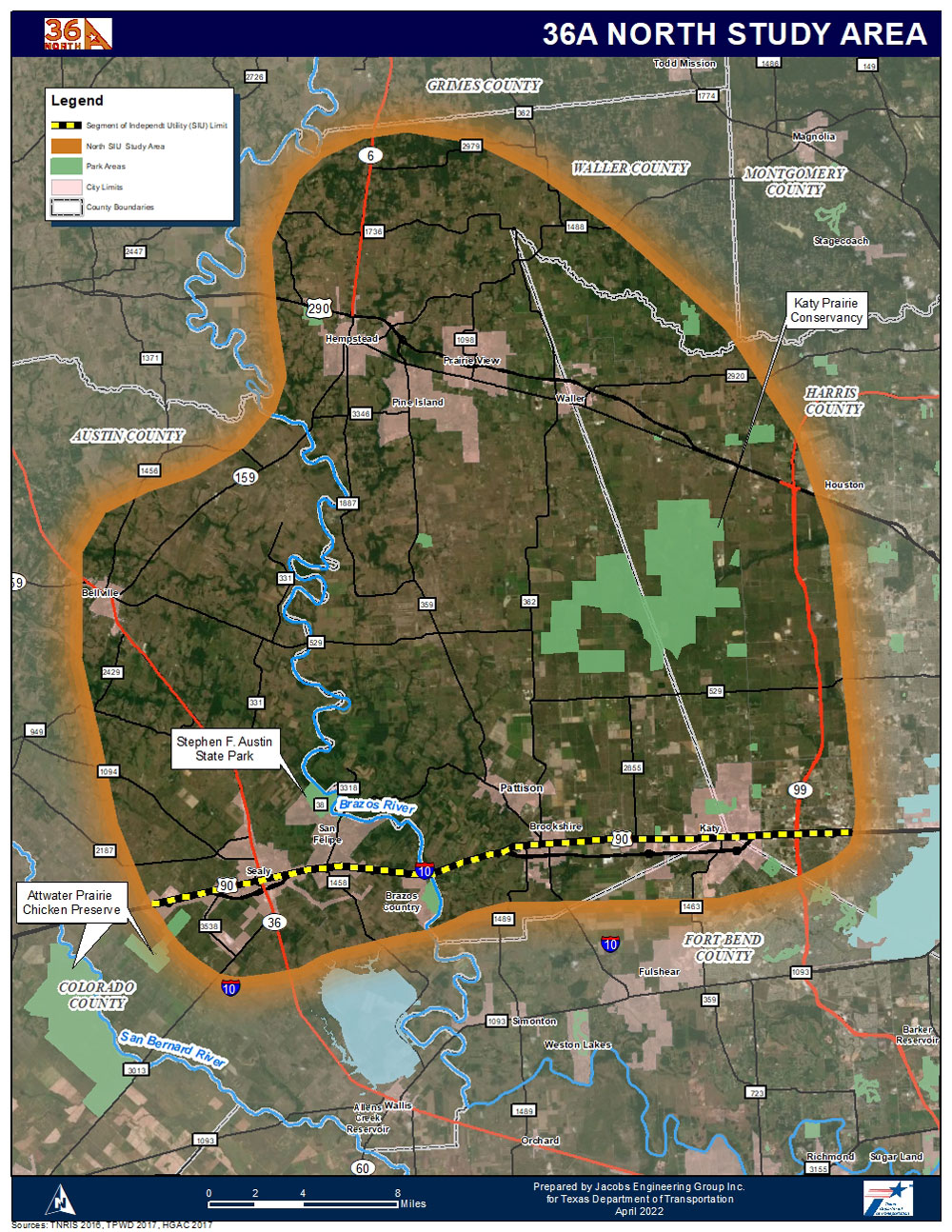
The proposed northern SIU would extend northward from the I-10/US 90 corridor to US 290/SH 6 north of the city of Hempstead, and ranges from approximately 30 to 40 miles (36A North Study Area Map). This area is less developed than the southern segment. Additionally, this segment has more areas of environmental concern including prairie lands, protected and managed by the Katy Prairie Conservancy, the headwaters of Cypress Creek, and more diverse demographics and different parcel size/land ownership characteristics. This project will address anticipated mobility/congestion issues based on projected growth, improve north/south freight movement, improve north/south system linkage/ connectivity and improve safety and increase hurricane evacuation route capacity within the study area and region.
If you want to know more about the project split add (SIUs), visit 36A Project History