About Loop 360
Loop 360
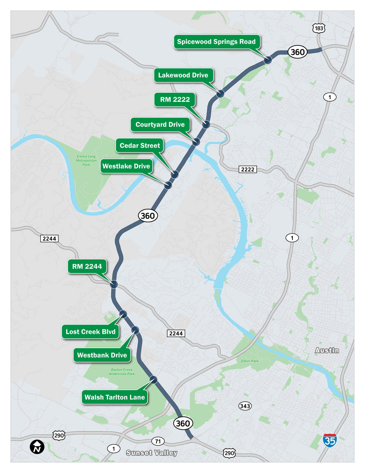
Loop 360 is a major north/south transportation corridor for the Capital Area region, acting as a thoroughfare and commuter route for residents in west Austin as well as those passing through. The 14-mile corridor runs from US 183 on the north end to US 290/SH 71 on the south end.
In addition to serving residents and commuters, Loop 360 also provides access to businesses located along the route, as well as bicyclists, photographers, geologists, hikers, and visitors to Lake Austin. The natural beauty and unique Hill Country environmental features along Loop 360 draw regional, national and even international visitors to the area. The Pennybacker Bridge located at the roadway’s crossing of the Colorado River serves as an iconic symbol of central Texas.
Loop 360 has severe traffic congestion, causing both mobility and safety concerns. We can expect traffic congestion to worsen as our population grows. More than two million people live in the Austin area today, and that number is expected to double by 2040.
Program approach and purpose
In 2018, the Texas Department of Transportation, in partnership with the City of Austin, began the next phase of work on Loop 360 to maximize safety and mobility in the corridor.
The program will upgrade multiple intersections along the roadway. Check out the Projects page for more information about the individual projects.
TxDOT recognizes the importance of involving stakeholders in the efforts to improve mobility and safety. We want to hear about community needs, concerns and ideas for the future of Loop 360. Throughout the duration of the program, TxDOT will solicit comments from all potentially impacted parties, including commuters, adjacent property owners, businesses, environmentalists, bicyclists and neighborhood associations. TxDOT will consider potential aesthetic and environmental impacts, bicycles/pedestrians and other issues identified through stakeholder input.
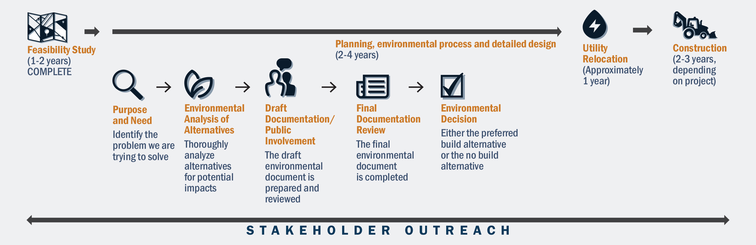
Project process
The Loop 360 projects will be conducted using a multi-step process that engages stakeholders on an ongoing basis:
Agencies and their roles in the environmental process
Many agencies participate in the development of a project at local, state and federal levels. This chart identifies the agencies participating in the Loop 360 projects and explains how each contributes.
| Who they are | What they do |
|---|---|
| TxDOT Austin District | Lead agency
|
| City of Austin | 2016 Mobility Bond Implementation agency
|
| TxDOT Environmental Division | Decision making agency
|
U.S. Army Corps of Engineers U.S. Environmental Protection Agency U.S. Fish and Wildlife Service Texas Historical District |
Cooperating agencies
|
Texas Parks and Wildlife Department Texas Commission on Environmental Quality Travis County Capital Metropolitan Transportation Authority
Invited: |
Participating agencies
|
Note: Capital Area Metropolitan Planning Organization prepares the Long-Range Transportation Plan that identifies potential projects and allocates state and federal funding for both environmental studies and construction projects.