History
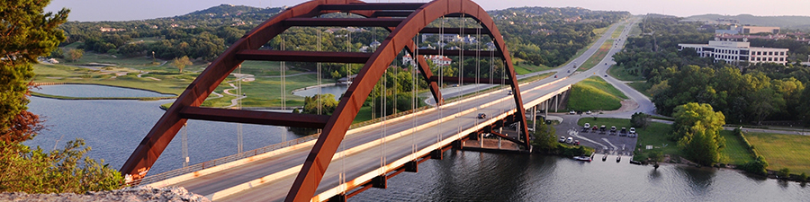
In 1962, Loop 360 was envisioned as a “west loop” connecting US 290/ SH 71 on the southwest side of Austin to Braker Lane on the north end of Austin. The loop was to be completed by taking Braker Lane east to Springdale Road and heading south on US 183 back to SH 71. It has been categorized as both a highway and a major arterial route. The initial section from US 290/SH 71 to RM 2244 was opened in 1970, with the remainder of the road finally opening with the completion of the iconic Pennybacker Bridge in December 1982. The end result was described as a four-lane lowered median arterial with at-grade signalized intersections.
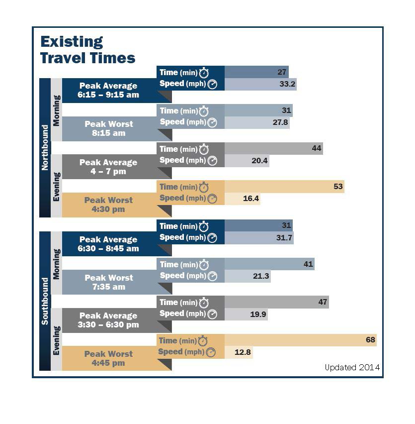
In the last few years, increased traffic congestion has led to a growing demand to do something. The 2014 Loop 360 feasibility study embodied a four-step process incorporating a wide range of public engagement strategies to help identify and evaluate potential short- and long-term transportation solutions for the corridor.
The current Loop 360 Program takes into account the recommendations from the feasibility study by upgrading multiple intersections along the corridor.
Feasibility study
In 2014, TxDOT initiated a feasibility study to address the ongoing transportation issues along and across Loop 360. Lessons learned from previous efforts led to a different approach to actively engage the public throughout the planning process. The study did not represent a continuation of previous efforts, but a new community-driven effort to identify and address problems in both the short and long term.
The Loop 360 Feasibility Study team worked closely with stakeholder groups and individuals throughout the community. The outreach effort cast a wide net, including those who live or own property along the corridor or have a specific interest in it, as well as those who simply use the corridor to travel to and from their destinations.
Stakeholder outreach and engagement strategies included working groups, small group meetings, an online public survey, electronic newsletters, informational kiosks, postcards, newspaper advertisements, social media posts, fact sheets, a website offering updated study information and opportunities to comment, and personal phone calls and emails.
Stakeholders were identified based on their participation in past study efforts, demonstrated interest in unique corridor issues, and/or their location within six distinct sections of the corridor defined by major intersections or geographic features. These stakeholders included adjacent property owners, leaders of neighborhood and civic organizations, school administrators, emergency response staff, and business owners along the corridor, as well as representatives from local bicycle and environmental organizations. Additional stakeholders were identified and engaged as study information was distributed through newspaper advertisements, electronic notifications, online participation opportunities such as an online survey, and word of mouth.
The input gathered through these efforts was incorporated into each phase of the study, including the identification of problems and potential solutions, as well as the evaluation, refinement and presentation of solutions.
Learn more about the 2014 feasibility study: