Lady Bird Lake Segment (Holly Street to SH 71/Ben White Boulevard)
I-35 Capital Express Central Project
Connect with us
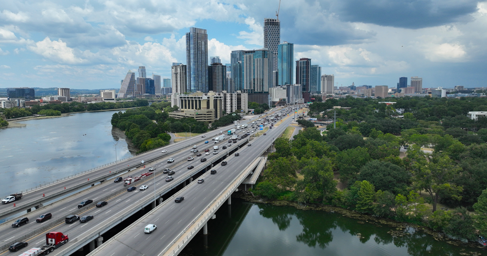
Segment overview
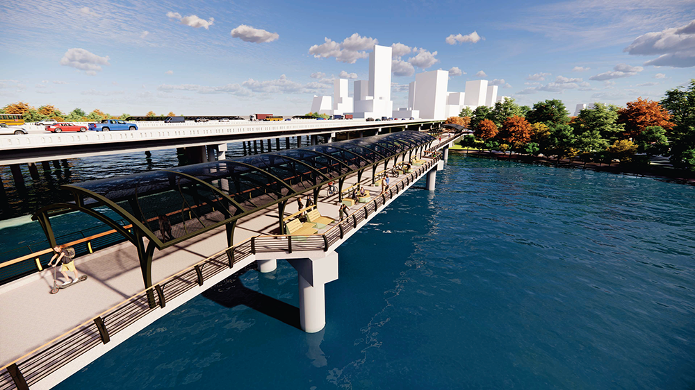
The project will add two high-occupancy-vehicle managed lanes in both directions, reconstruct Lady Bird Lake bridge and build a single-point urban interchange at Riverside Drive. It will enhance safety and connectivity with a pedestrian-only bridge at Woodland Avenue, bike and pedestrian paths along the corridor and will accommodate future City light rail.
Major impacts/activity
- Eastbound Riverside Drive reduced to one lane between the southbound I-35 frontage road and Travis Heights Boulevard through mid-2026.
- Kenwood Avenue at Riverside Drive will be closed through mid-2026.
- East Avenue under the I-35 Lady Bird Lake bridge will be closed through mid-2026.
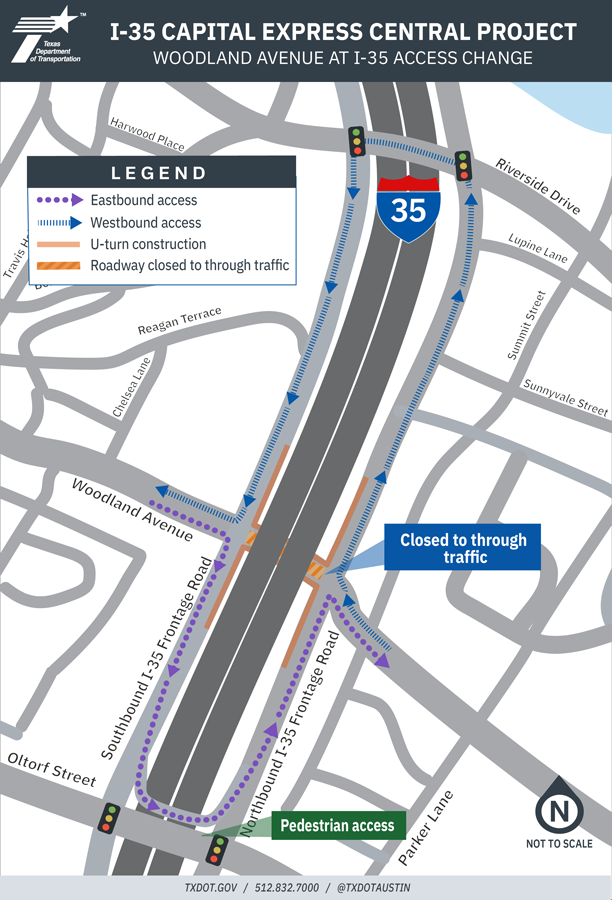
- Traffic on the southbound I-35 frontage road just north of Riverside Drive will shift long-term. Drivers on the southbound I-35 frontage road will use the Riverside Drive bypass lane to continue south on the frontage road. A new temporary signal will open on the southbound I-35 frontage road to allow drivers to access eastbound and westbound Riverside Drive. Elements of this traffic pattern will remain in place through 2029, with work on Riverside Drive expected to shift next year.
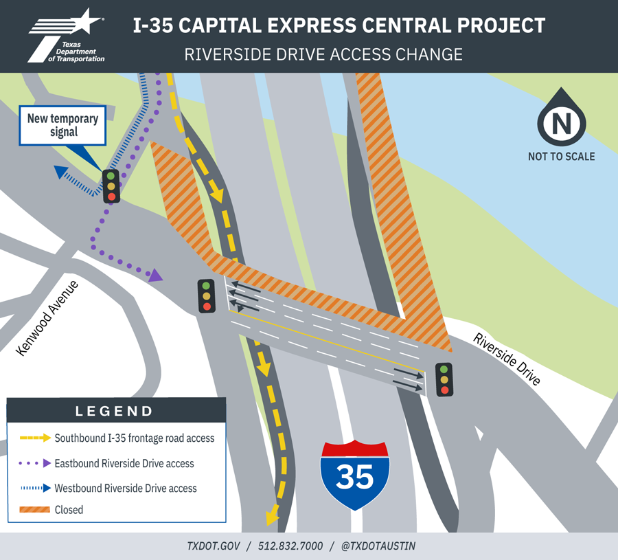
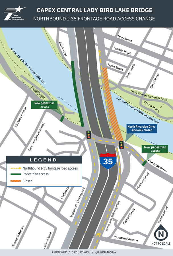
- Access to the northbound I-35 frontage road just north of Riverside Drive will be closed through 2029. Drivers on the northbound I-35 frontage road will use the Riverside Drive bypass lane to continue north on the frontage road. Drivers on Riverside Drive will use the southbound I-35 frontage road to U-turn at Woodland Avenue and take the Riverside Drive bypass lane to access the northbound I-35 frontage road. Pedestrians will use the existing west pedestrian sidewalk on the southbound I-35 frontage road bridge to cross the Colorado River. In addition, temporary pedestrian signals have been installed on Riverside Drive at Manlove Street (east of I-35) and Edgecliff Terrace (west of I-35) to cross Riverside Drive.
- Woodland Avenue under I-35 is permanently closed. See map below for detours.
Trails and waterway impacts
- Continuous closures of trails and waterway near the Lady Bird Lake bridge are limited to three times per year, each lasting no more than one week. Intermittent closures for construction activities will occur as needed in addition to nightly closures in line with curfew.
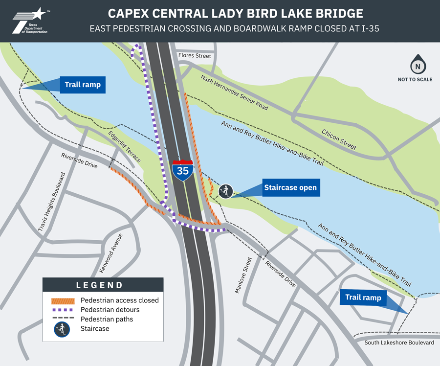
- The existing east pedestrian path at Lady Bird Lake and northern sidewalk on Riverside Drive will be closed through 2029.
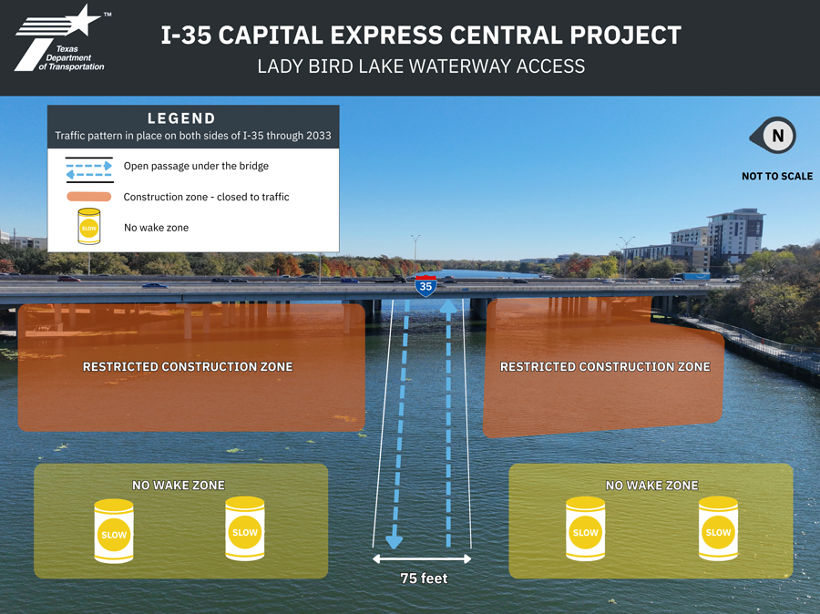
- Waterway access under the I-35 bridge limited to a 75-foot-wide passage away from work zones through 2033.
- Long-term trail detour along the north shore of Lady Bird Lake west of I-35 through 2033.
- The Holiday Inn boat ramp on the north shore of Lady Bird Lake, west of I-35, will be limited to emergency vehicles only through 2033.
- Parking lot under the I-35 Lady Bird Lake bridge will be closed through 2033.The Holiday Inn boat ramp on the north shore of Lady Bird Lake, west of I-35, will be limited to emergency vehicles only through 2033.

Schedule
- Construction start: early 2025
- Anticipated construction completion: 2033, weather permitting
Contractor
- Balfour Beatty Construction