Project location
Skip to main content
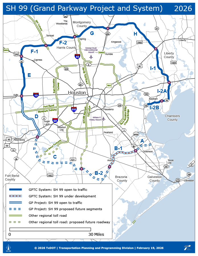
Project location

This main map has cities, counties, toll facilities, and other TxDOT roadways.  This map highlights State Highway 99 (Grand Parkway Project and System). Legend
Consists of six key features: 
A solid dark blue line, as GPTC System: SH 99 open to traffic from Fort Bend and Harris County line eastward to SH 146.
A red dashed line on top of a white on blue line, as GPTC System: SH 99 under development from SH 96 westward to south of Alvin, TX at the intersection of SH 35 and FM 2403.
A white on dark blue dashed line, as GP Project: SH 99 proposed future segments. From the intersection of SH 35 and FM 2403 westward to I-69.
A white on dark blue line, as GP Project: SH 99 open to traffic from I-69 and FM 2759 northward to and the Fort Bend and Harris County line.
A white on spruce green line, as Other regional toll road.
A dashed whit on spruce green line, as Other regional toll road: proposed future roadway.