Section 4: Shared-Use Path Level of Service Calculator Guidance
The SUPLOS calculator can be found at this link:
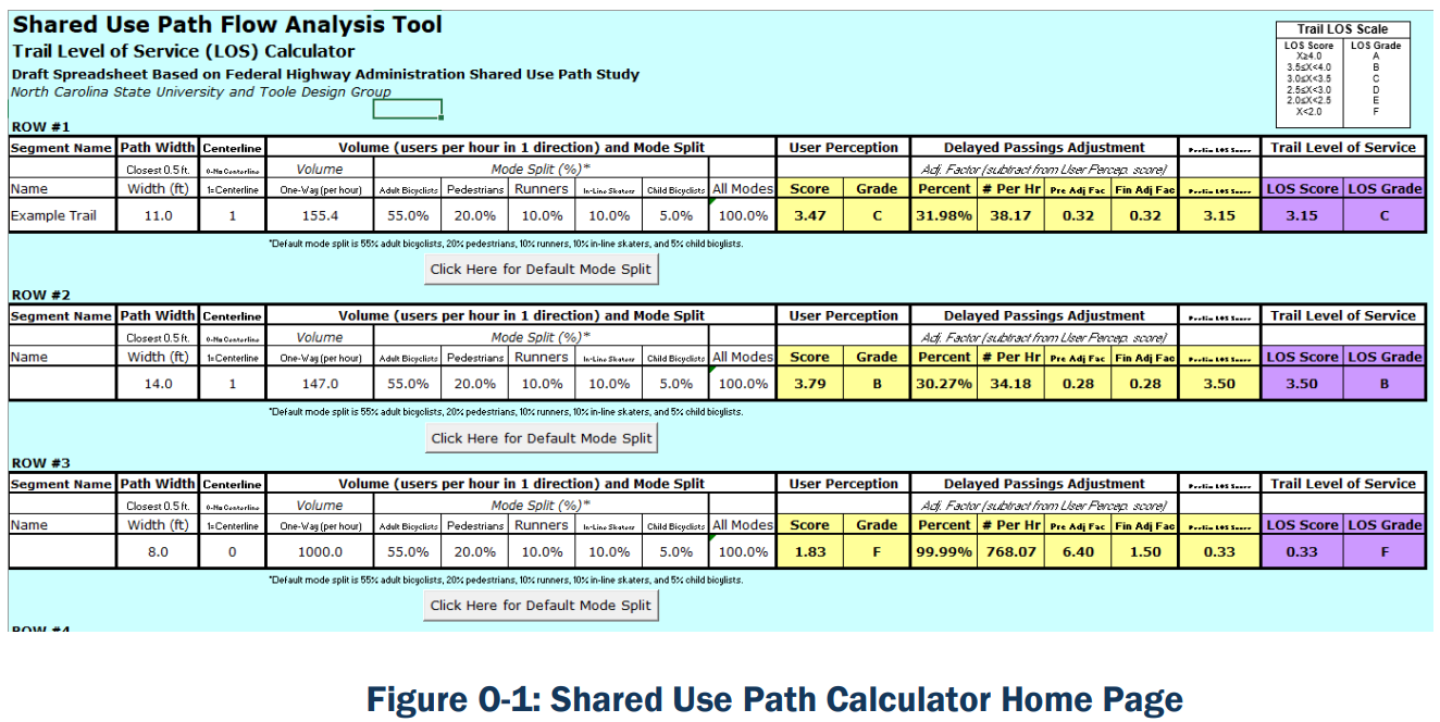
An image of the home page of the SUPLOS calculator can be seen in .
The Federal Highway Administration has created a thorough guide on using the SUPLOS calculator. The guide can be found at this link:
The guidance includes the following content:
- Introduction
- How to Use This Guide
- For What Types of Shared-Use Paths Is This Study Applicable?
- Chapter Summaries
- Other Reports and Products Generated by This Study
- An Overview of the Research
- Problem Statement
- Purpose
- Approach
- Findings
- LOS For Shared-Use Paths
- What is LOS?
- The Shared-Use Path LOS Model
- Interpreting Shared-Use Path LOS Grades
- LOS Scores for 15 Study Trails
- Applying the Model to Your Trail
- Link Analysis
- Data Requirement
- Assumptions and Defaults
- Shared-Use Path LOS Look-Up Tables
- Link Analysis
- Data Requirement
- Assumptions and Defaults
- Shared-Use Path LOS Look-Up Tables
- Instructions for Using the Shared-Use Path LOS Calculator
- Introduction
- Step-by-Step Instructions
- Implications of This Research for Trail Design
- Trail Width
- Centerline Striping
- Multilane Striping
- Multiple Treadways
- Trailway Operations and Management
- Example Applications: Fictional Case Studies
- Case Study 1: Testing Design Options for the Stone Creek Trail Upgrade
- Case Study 2: Testing Design Options for the De Soto River Waterfront Trail
- Appendix A. Study Trail Profiles
- Appendix B. Factors Used in the LOS Model
- Appendix C. LOS Look-Up Tables
- References