1.2.6 Geographic (Spatial) Limits
The geographic (spatial) limits include the project improvement locations (project area) and the area impacted by the project improvement (study area). Spatial limits for operation and safety are typically the same. For spatial limits, it is recommended to attach a map to the
Scoping Form
. For an example
of the spatial limit map, see .Below are sample prompts that may provide guidance:
- Spatial Limits:What is the overall project location? What intersections, interchanges, segments, or other facilities are to be included in the analysis? Is this an Interstate Access Justification Report (IAJR) that requires upstream and downstream interchanges to be included? For freeways, is it recommended that the main lanes and frontage roads be considered?
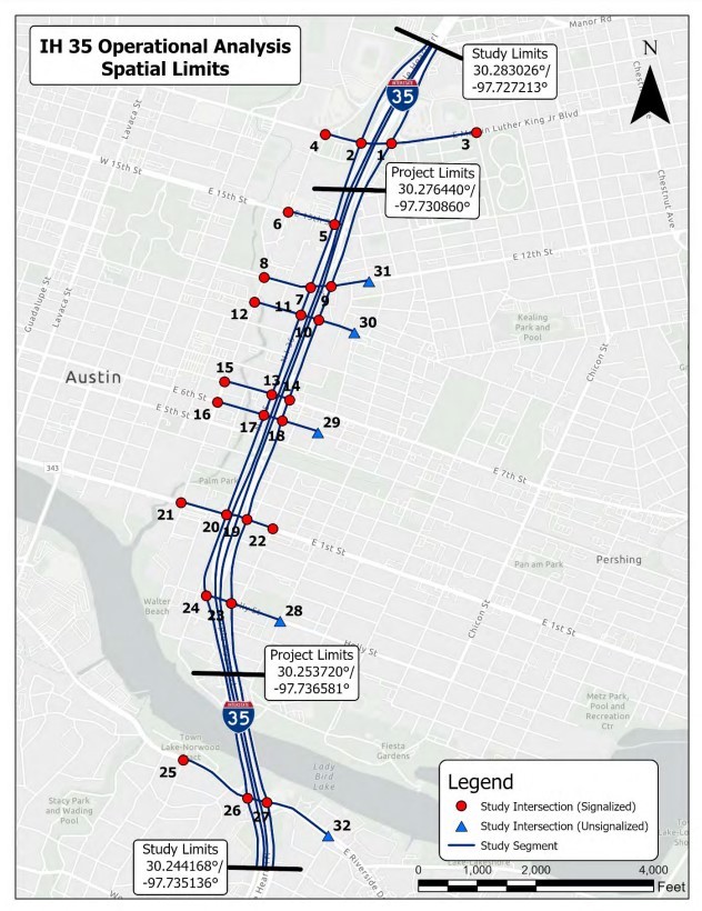
Figure 1-1: Spatial Limits Map Example