2.2.3 Route Studies
Route studies are typically conducted to evaluate two or more geometric alternatives associated with a specific project location. The purpose of a route study is to identify a specific build option(s) for further detailed schematic design and/or environmental impact analysis.
Many times a route study is associated with some type of “relief route” around cities/towns that is forecasted to experience adverse traffic congestion, has outdated roadway design criteria or has other circumstances where a route study is desired.
illustrates an example of a route study map.
Route options typically include the construction of roadways on new alignment or along the existing highway where substantial improvements would:
- Increase capacity, such as new main lanes and/or frontage roads;
- Enhance mobility, such as limiting access and grade separations such as overpasses and interchanges; and
- Improve safety.
Route options can include moving traffic around new developments or design elements to accommodate bicyclists, pedestrians, public transportation and railroads.
Route studies do not include high-occupancy vehicle (HOV) lanes, toll lanes, tolled facilities or managed lanes as route options.
Refer to TxDOT’s
Transportation Planning and Programming Manual
for additional discussion on route studies.TxDOT’s Open Data Portal is the agency’s platform for exploring and downloading GIS datasets. The portal allows users to view datasets on a map, filter data using queries, and download data in various formats.
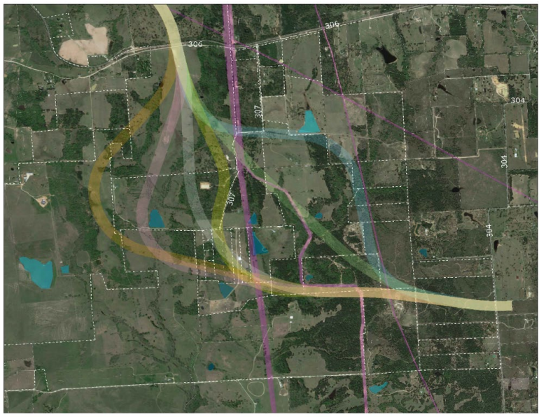
Figure 2-4: Example Route Study Map
|
|
|
|
|