2.2.2 Corridor Studies
The purpose of a corridor study is to assess existing and forecasted conditions along the highway corridor and develop a plan to implement various projects along the corridor, which are prioritized and phased based on need. Corridor studies are typically conducted along an elongated area that may span multiple counties, cities/towns, TxDOT Districts, and/or neighboring states (see
for an example corridor study map).
The study should include short (0-4 years), middle (5-10 years) and long term (10+ years) recommendations. From the implementation plan, the District(s) can then begin the process of planning and programming these projects into their respective project portfolios for further study and funding. However, there is no guarantee that any of the potential projects identified would be funded or implemented in the timeframes recommended in the corridor study.
Corridor planning is an early opportunity to establish a framework for integrating specific thoroughfare projects into the overall objectives for a local area and to bring public and private stakeholders together to discuss the transportation project(s). This helps to expedite the project development process by identifying and addressing key issues, opportunities, and community objectives before the design and engineering process begins.
The corridor planning process should have the following outcomes:
- Determine the relationships and needs for both mobility and land use along the corridor and in the subareas;
- Allow non-MPO communities to discuss multimodal transportation issues that may benefit their residents;
- Determine how decisions for individual thoroughfare segments affect the corridor and the transportation network as a whole;
- Establish objectives, operational concepts, context-based functions, performance measures and thresholds, land uses, access control and functional classification potential changes for an entire network or corridor, which can be applied to individual thoroughfare segments in project development;
- Allow for policy, social and public discussion of debate on issues that impact a broader area than an individual thoroughfare segment; and
- Identify additional related studies that may provide information for planning a project and assessing the relationship between a specific transportation project and neighboring community projects. Types of related studies include feasibility study, route study, toll road study, market study and value capture study. Obtaining and reviewing these studies can give a broader perspective of network and corridor needs.
Corridor studies can be initiated by Districts or TPP.
Urban and rural corridors have unique design characteristics. For planning purposes, rural corridors are outside urbanized areas and may be basic, developed, or suburban. Rural corridors may be defined by scenic purpose, connection between urban areas or by accommodating surface freight transport. Refer to the Statewide Planning Map referenced below for information on corridor context classification and functional classification.
Refer to TxDOT’s
Transportation Planning and Programming Manual
for additional discussion on corridor studies.The Statewide Planning Map displays data in support of planning operations at TxDOT. Base map options include TxDOT, Texas Imagery Service, TxDOT Light Gray, TxDOT Dark Gray, Esri Streets, Open Street Map. Overlay options are indicated as table of contents.
2.2.2.1 Resiliency Planning
As a part of corridor planning and strategic projects, planning for public security must be considered. TxDOT initiated the Statewide Resiliency Plan (SRP) to strengthen the resilience of the State’s multimodal transportation system to a range of potential hazards.
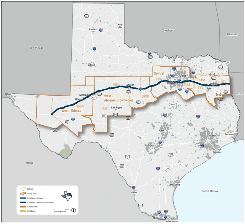
Figure 2-3: Example I-20 Corridor Planning Map
Every year, the State’s transportation system is at risk to extreme weather events, such as riverine and coastal flooding, extreme heat, extreme cold, Intelligent Transportation System (ITS) security threats and other human-made hazards such as dam and levee failures. These hazards can damage transportation infrastructure and disrupt operations, with cascading impacts for public safety and health, freight and supply chains and the Texas economy. Texas is also a significant national and international supplier of energy products with refineries and distribution infrastructure near the Texas transportation network.
Findings and recommendations of the SRP serve as a resource to TxDOT Divisions and Districts for incorporating transportation resilience into statewide, regional and local transportation planning and project development. A science-based approach, informed by stakeholder input, generates strategies and solutions that can anticipate current and future hazards for decades to come.