1.4 Ecoregions
The landscape design aesthetic of TxDOT facilities and roadways should be in keeping with the character of the individual TxDOT District, as well as the more specific individual character of each District’s Ecoregion and plant hardiness zones.
1.4.1 Texas Parks and Wildlife Texas Ecoregions
Texas is divided into 10 natural regions or ecoregions: the Piney Woods, the Gulf Prairies and marshes, the Post Oak Savannah, the Blackland Prairies, the Cross Timbers, the South Texas Plains, the Edwards Plateau, the Rolling Plains, the High Plains, and the Trans-Pecos as shown in
.
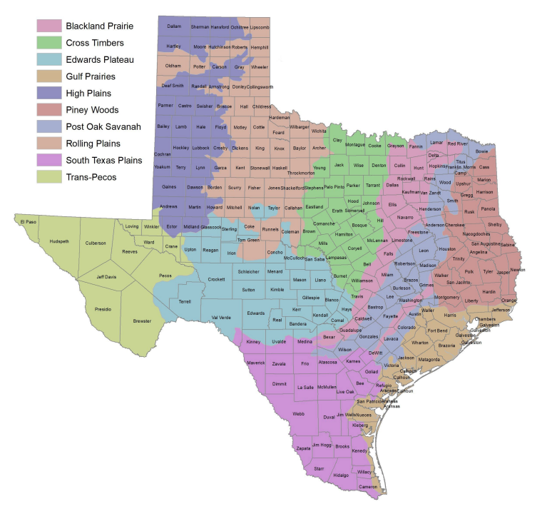
Figure 1-7: Texas Parks and Wildlife Ecoregions
1.4.2 USDA Plant Hardiness
USDA Plant Hardiness Zone Map is the standard by which landscape architects can determine which plants are most likely to thrive at a location (see
).
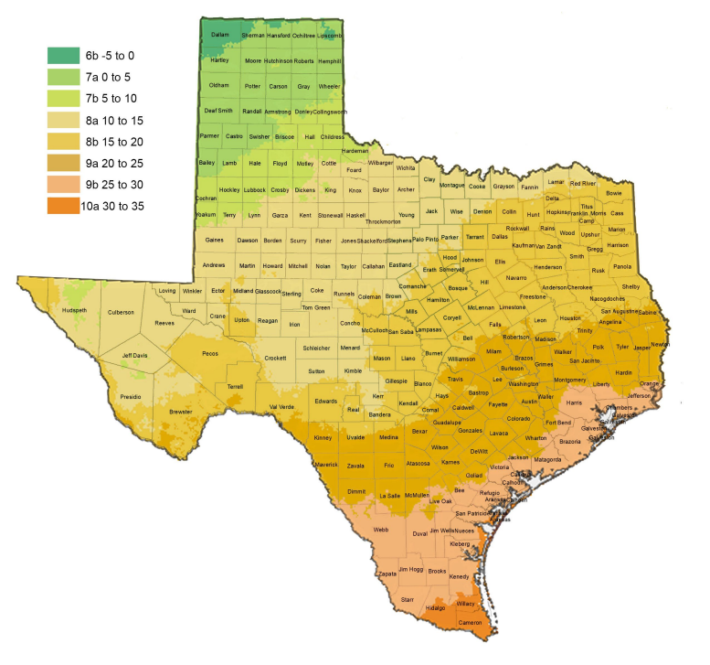
Figure 1-8: USDA Plant Hardiness Zone Map
1.4.3 Texas Rivers, Creeks, and Watersheds
The 13 major river basins of Texas vary greatly in size, shape, and stream patterns as shown in
. Although the river basins share many common features, each is unique. River basins reflect the climate, geology, topography, and vegetation of an area. Annual rainfall rates and watersheds are major factors to be considered in the selection of vegetation types.
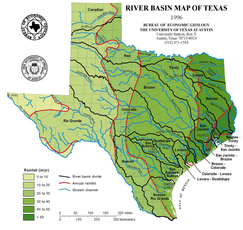
Figure 1-9: Texas River Basins/Rainfall