About this project
Skip to main content

About this project

Project overview

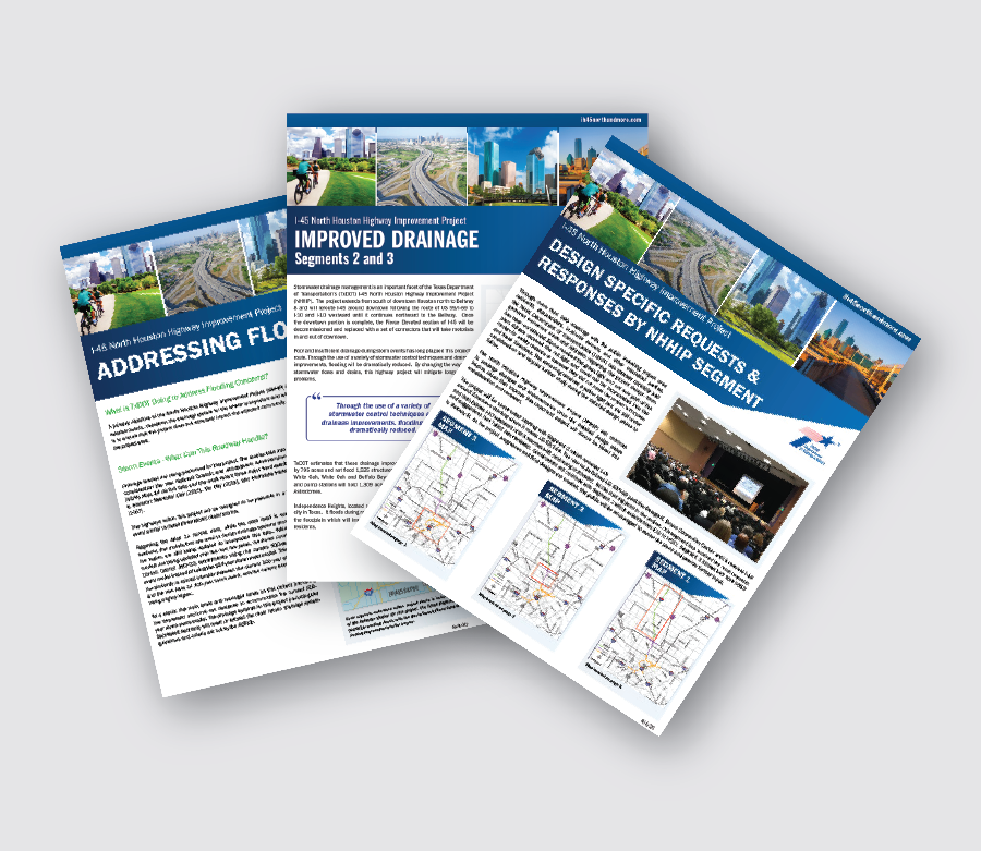
The Preferred Alternative for the North Houston Highway Improvement Project (NHHIP) is designed to enhance safety, create additional roadway capacity to manage congestion, incentivize transit and promote ridesharing, and improve mobility and operational efficiency on I‑45 from U.S. Highway 59/I‑69 to Beltway 8 North, including improvements along US 59/I‑69 between I‑45 and Spur 527 in Harris County, Texas. The project is divided into three segments: Segment 1 is Beltway 8 North to I-610; Segment 2 is I-610 to I-10; and Segment 3 is the Downtown Loop System: I-45, I-10, and US 59/I-69. The NHHIP includes:

  • Addition of four non-tolled managed lanes, two lanes in each direction, 24/7 operations for carpool and transit on I-45 from Beltway 8 North to downtown Houston with improvements continuing south along US 59/I-69 to Spur 527. 
  • Reconstruction of mainlanes and frontage roads.
  • Rerouting of I-45 in the downtown area to be parallel with I-10 on the north side of downtown and parallel with US 59/I-69 on the east side of downtown.
  • Access to the west side of downtown via downtown connectors which would provide access to and from various downtown streets.
  • Both I-10 and US 59/I-69 within the proposed project area would be realigned to eliminate the current roadway curvature.
  • Addition of four I-10 express lanes between I-45 and US 59/I-69.
  • Reconstruction of the interchange at I-45 and I-610N to improve sight distances on direct connectors and replace outdated left lane exits where drivers expect right lane exits.
  • Connection of I-45 and I-610 frontage roads with new intersections in Segment 2 and add one frontage road lane in each direction in Segment 1.
  • Addition of shoulders that are full width. 
  • Addition of bike/pedestrian features along frontage roads and affected cross streets.
  • Addition of trails parallel to bayous within the right of way.
Translation available

This site can be translated to Spanish using the dropdown in the top menu. Other languages are available with your web browser. Translation of specific embedded graphics, images, and PDFs can be obtained by request using the link below.

Request translation

Frequently asked questions

Project information

Since 2011, the Texas Department of Transportation (TxDOT) has been looking at alternatives for providing additional highway capacity in the North-Hardy Corridor. This search built on previous studies that recommended adding four managed lanes to the I-45/Hardy Toll Road corridor from downtown Houston to Beltway 8 North (North-Hardy Planning Studies, Highway Component, 2005). During the project development process for the recommended highway improvements, the team evaluated traffic projections, regional roadway planning, engineering factors, environmental constraints and potential project impacts. In addition, input from the public, agencies and other stakeholders was considered in the development and analysis of alternative solutions.

Mass transit is an important component when examining solutions to traffic congestion.

As a part of the study with the Metropolitan Transit Authority of Harris County (METRO) called the North-Hardy Corridor Planning Study, TxDOT and METRO looked at options addressed by both the transit component as a complement to the highway component, and the highway component as a complement to the transit component. METRO moved upon the transit component agreed to by METRO and its stakeholders to create a transit component, the Red Line, parallel to the highway component. However, it does not address the HOV and bus transit needs that the NHHIP will.

The proposed NHHIP is needed for several reasons. There is inadequate highway capacity for existing and future traffic demands on the highways in the North Houston corridor. Between the years 2015 and 2040, average daily traffic volumes are projected to increase by as much as 40% in the project corridor.

  • Traffic congestion, which is measured by traffic volume and roadway capacity, will increase if no improvements are made.
  • The current high occupancy vehicle (HOV) lane on I-45 serves traffic in only one direction during the peak traffic periods and is unused for large portions of the day. During peak hours, the HOV lane is congested.
  • I-45 is a designated evacuation route for the region. At its present capacity, evacuation effectiveness would be limited in the event of a hurricane or other regional emergency.
  • Portions of I-45 do not meet current roadway design standards, creating a traffic safety concern. Other roadway design deficiencies include inadequate storm water drainage in some locations. Intense rainfall causes high water levels at the I-45/I-10 underpass and on the outside lanes. I-45 would not operate effectively as an evacuation route with high water closures, especially during hurricane evacuations when high rainfall events are likely.
  • Forecasts for commuter traffic indicate that even with parallel high capacity transit in the corridor, two-way managed lanes would be needed to support commuter traffic and express bus service.

Flooding concerns

Yes. Drainage studies performed for the project take into consideration the new National Oceanic and Atmospheric Administration (NOAA) Atlas 14 rainfall data, and the three most recent major flood events in Houston: Memorial Day in 2015, Tax Day in 2016, and Hurricane Harvey in 2017. These major events were considered 500-year storms. The Harris County Flood Control District (HCFCD) recommends using the current 500-year storm event model for systems that are usually designed to the 100-year storm event, such as freeway mainlanes and managed lanes. The mainlanes and managed lanes on this project, including the depressed sections, are designed to accommodate the current 500-year storm event. The highways within this project are being designed to be passable in a rain event similar to these three recent major storms. For more information, please see the NHHIP paper "Addressing flooding"

TxDOT is committed to designing drainage structures that meet or exceed water volumes associated with Houston’s recent flood events. Pump stations will be designed for a 500-year rainfall event. Backup pumps will be included in the system and will operate in case of primary pump failure. Berms/walls will be built around depressed roadway sections to prevent water sheet flow from overtopping into those areas.

Coordination with the Harris County Flood Control District Harris County Flood Control District (HCFCD) and the City of Houston to neutralize any flood elevation rise is ongoing. The crossings over Little White Oak Bayou will be wider to accommodate water flow as well as pedestrians and bicyclists.

Air quality

TxDOT conducted two air quality studies. Air quality was modeled at five locations to establish a baseline for conducting a carbon monoxide (CO) traffic air quality analysis. Modeling to project future CO concentrations through the year 2040 indicated that concentrations are not expected to exceed national standards at any time along any segment of the project. A mobile source air toxics analysis (MSAT) of nine compounds identified by the Environmental Protection Agency (EPA) as cancer risk drivers indicated that a 72% decrease in these compounds can be expected through the year 2040 as compared with 2018.

Air quality will improve with the proposed project in part because of reduced congestion. NHHIP would help reduce congestion on 12 segments of the “Texas 100 Most Congested Roadways” as reported by the Texas A&M Transportation Institute (TTI). These 12 segments annually account for 39 million person-hours of delay, $788 million in congestion costs, and 11.9 million gallons of excess fuel used. The wasted fuel produces an estimated 120,209 tons of excess carbon dioxide. NHHIP provides options to reduce single-occupant vehicle driving through four managed express lanes for use by transit vehicles, buses, carpools, and future autonomous vehicles. Improved pedestrian and bicyclist facilities also contribute to improved air quality. For more information, please see the NHHIP paper "Air quality is improving."

Please visit Texas Commission on Environmental Quality to view the air quality status of the Houston regional area.

Please visit Pollution Control Services Department of Harris County to view the air quality status of Harris County.

TxDOT will place one air monitor in each project segment one year in advance of the start of construction on the corresponding project segment. This website will be updated to post the readings from the air monitors.

Bikes and pedestrians

Yes. Expanding and improving bicycle and pedestrian infrastructure means ensuring that a network of infrastructure is in place to make bicycling or walking viable modes of travel. It also means ensuring that the infrastructure is safe and comfortable to use. This additional capacity promotes health by providing added opportunity for physical activity from transportation.

Through close coordination with local agencies and stakeholders, TxDOT is providing connections between existing and future trails, enhanced bridges across the freeway that support bicycle lanes and a pedestrian realm, and highway caps with potential for private investment. For more information, please see the NHHIP paper "Pedestrian & bicyclist accommodations."

TxDOT is working to improve bike and pedestrian elements through a number of initiatives:

  • TxDOT integrated the City of Houston Bike Plan into NHHIP’s schematic design. TxDOT and the city agreed that all 44 street crossings in Segment 3 would have a pedestrian space. Ranging in size from 12 to 17 feet in width, this feature includes a wide sidewalk, bicycle lane and a buffer zone.
  • To raise the freeway out of the 100-year flood elevations, the proposed I-45 freeway elevations over Little White Oak Bayou will be higher than the existing structure. This allows a future trail connection with a bridge to link Woodland and Moody Parks.
  • Highway caps in three areas provide opportunities to create recreational areas built above roadways. They will be located in the Heights/Near Northside between North Main Street and Patton Street, the Midtown/Museum District and the George R. Brown Convention Center/EaDo area.
  • TxDOT is currently consulting with the TTI about the best facility to replace the proposed 15-foot shared use lanes on Segment 1 frontage roads with a safer facility for bicycles.

In the instance of any modifications to existing or proposed hike and bike facilities, TxDOT will coordinate with the City of Houston and other agencies and organizations to provide the same level connectivity as the existing and future facilities provide. Temporary impacts during construction will be minimized as much as possible.

Please return to the NHHIP homepage and utilize the interactive map located at the bottom of the home page to view the active transportation options in the project corridor. Utilize the “layer” icon in the lower right of the interactive map to view the various active transportation modes.

Displacement concerns

The proposed project would displace the residents of Clayton Homes and from some of the buildings at Kelly Village, which are public housing properties administered by the Houston Housing Authority (HHA). TxDOT is coordinating with the HHA regarding potential impacts to these communities. The HHA plans to build new subsidized housing in the general area of the existing facilities and TxDOT has professional relocators working with residents to ensure a smooth relocation to better housing.

Clayton Homes

The entire Clayton Homes property located at 1919 Runnels Street, Houston, Texas 77003 is needed for the NHHIP. TxDOT and Houston Housing Authority (HHA) have agreed to a two-phase acquisition of the property. Phase I acquisition is complete and Phase II acquisition is anticipated to be completed by the end of 2023.

As of September 2022, all residents of Clayton Homes have been relocated to various residential locations as selected by each residential family. HHA will replace Clayton Homes by constructing two new residential properties within 2 miles the original Clayton Homes location. Please visit HHA for more information about these new residential projects.

TxDOT will remain in contact with the former residents of Clayton Homes to maintain their current contact information so they can claim their opportunity to move into the new residential properties once available for occupancy. The residents can also contact HHA and TxDOT to provide updated contact information. HHA can be contacted at 2640 Fountain View Dr., Houston, TX 77057 or (713) 260-0500.

TxDOT can be contacted at www.hou-piowebmail@txdot.gov or (713) 802-5076.


Kelly Village

A portion of the Kelly Village property located at 3118 Green Street, Houston, Texas 77020 is needed for the NHHIP. TxDOT and Houston Housing Authority (HHA) will negotiate for this partial acquisition. Along with direct communication with the residents to be relocated, this website will be updated to reflect anticipated dates that the residents will move out of the portion of Kelly Village that will be needed for the NHHIP.

It is anticipated that HHA will replace the portion of the Kelly Village units acquired for the NHHIP with the construction of new residential properties within 2 miles of the original Kelly Village location. HHA will update its website to reflect information about new residential projects to replace the portion of Kelly Village units to be acquired for the NHHIP and moving dates specific to relocation from Kelly Village.

For the residents of the portion of the Kelly Village units that will be acquired for the NHHIP, TxDOT will remain in contact with these residents to maintain their current contact information so they can claim their opportunity to move into the new residential properties once available for occupancy. The residents can also contact HHA and TxDOT to provide updated contact information. HHA can be contacted at 2640 Fountain View Dr., Houston, TX 77057 or (713) 260-0500. TxDOT can be contacted at hou-piowebmail@txdot.gov or (713) 802-5076.

Yes. The proposed project would displace places of worship, schools, commercial billboards, homes and medical care facilities.

TxDOT’s Acquisition and Relocation Assistance Program will provide assistance and counseling to residential property owners that would be required to relocate. TxDOT is already working to acquire some properties. TxDOT has implemented a relocation specific program on the project to help property owners as well as tenants with funding and counseling.

It is important to note that residents will not be displaced from homes until adequate replacement housing has been identified. Residents in subsidized or non-subsidized housing will receive assistance in finding comparable housing. Comparable housing is decent, safe, sanitary, functionally equivalent to their present homes, and accessible to employment, public and commercial facilities.

The proposed project would displace some residences and businesses in areas that have low income populations and social service organizations that serve low income populations. TxDOT is coordinating with community facilities/services, housing and businesses to discuss the proposed project, potential impacts, and mitigation.

Collaboration and working with partners

Like with many of our projects, TxDOT works with the City of Houston, Harris County, Harris County Flood Control District and other agencies as projects move through the planning process. With the NHHIP, TxDOT also actively participates on the Houston-Galveston Area Council’s Transportation Policy Council, which provides local input on the project and local match funding. By providing more mobility options such as managed lanes to relieve congestion, TxDOT encourages users to try new modes of transportation other than single vehicle occupancy lanes. These are wiser choices when trying to balance the mobility needs of a growing population, actual user travel mode preferences, the purpose of the roadway, and prevailing policies affecting funding.

Together, we work to find smart ways to manage growing congestion by increasing the efficiency of our existing roadways, looking for multimodal solutions and targeting improvements that hold the greatest potential for long term, system wide impacts. In jointly developing and implementing travel demand management solutions, TxDOT and its local partners can help reduce congestion.

TxDOT works with its community and transportation partners to ensure the voices of community are heard during the planning and execution of improvements on TxDOT roads. Further, through the Local Government Projects Program, TxDOT provides guidance and training for local governments, including municipalities, counties or regional mobility authorities in the development of transportation projects under TxDOT oversight. The program addresses both federal and state requirements.

The design of the NHHIP remains open to future design changes and improvements after environmental clearance is achieved, also referred to as a Record of Decision (ROD). The ROD for this project was granted in February 2021.

The federal process to obtain environmental clearance is based on a schematic level design which accounts for the right of way footprint at a specific snapshot in time needed for completing impact analysis and identifying mitigation for adverse impacts that can’t be avoided per the current level design.

Obtaining environmental clearance is a prerequisite of taking a project into a detailed design phase where additional refinements and design improvements can be made.

The NHHIP represents years of work by TxDOT to define the purpose and need for the project, and to develop and analyze alternatives to meet the project’s goals while proactively seeking meaningful public involvement along the way. More specifically, TxDOT has spent the better course of the last several years evaluating the physical, cultural, and human environments affected by the proposed project, including a thorough examination of strategies to avoid adverse impacts and the identification of mitigation for those impacts that could not be avoided. This effort is reflected in the Final Environmental Impact Statement (Final EIS), which was released in August 2020. The Record of Decision for the NHHIP was received in February 2021.

TxDOT values the collaborative spirit of our partners and the investment the City of Houston has contributed to exploring strategies to help make the NHHIP a positively transformative project for the State of Texas, the City of Houston, and the Houston-Galveston Metropolitan Area. With the receipt of a Record of Decision (ROD) in February 2021, TxDOT can now focus on continuing to work together to make I-45 even better. TxDOT has many options for how to refine the project and is committed to judiciously evaluating the requests made on behalf of the City of Houston and others, and looking for mutually beneficial opportunities to ensure the project reflects our collective best efforts.