Field Entry Data
The strip map should be made complete by entering field data to show road details in every aspect. The headings on the strip map blank indicate much of the required data. Figure 3-5 through Figure 3-8 show examples of how the data should be presented.
If the roadway is not divided, it is not necessary to repeat the right-of-way and roadbed width, surface width and type, grades over three percent, and curves over two degrees for both directions of travel.
In addition to the headings on the strip map blank, the following information should be shown:
Information Item | Notes |
|---|---|
Name and highway number of the route to be zoned |
|
Crossroads and cross streets |
|
Limits of the speed zone | Indicate reference marker and milepoint and control and section numbers. Reference markers are generally in even two-mile increments, for example: 100, 102, 104. Speed zones or distances will be measured plus or minus from the reference marker. EXAMPLE: 102+1.343 |
Adjoining speed zone(s) of connecting map(s) | - |
Limits of any incorporated city or town | Show reference marker and milepoint and control and section numbers for these points. |
Names and approximate limits of the developed area of unincorporated towns | Indicate by “beginning of developed area” and “end of developed area” under the heading, “Development” — not as “city limits.” |
Urban districts |
|
Schools and school crossings |
|
Traffic signals | Show location of existing devices to aid in proper spacing and placement of speed zone signs. |
Important traffic generators | Show all factories, shopping centers/malls, and any other establishments that attract large volumes of traffic. |
Ball bank readings | Show each direction of travel for all curves having a safe speed of 10 miles per hour or more below the statewide maximum speed limit. |
Railroad crossings |
|
Bridges | Indicate if the roadway on the bridge is narrower than the roadway on either side of it. |
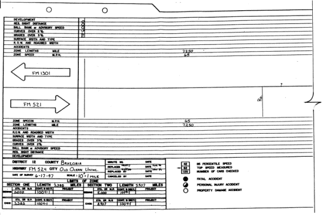
Figure 3-5. Typical speed zone through an unincorporated community (continued in Figure 3.6)
Click
to view or print the above graphic in MS Word.
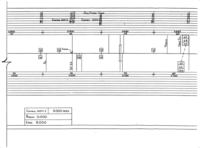
Figure 3-6. (continued from Figure 3-5). Typical speed zone through an unincorporated community
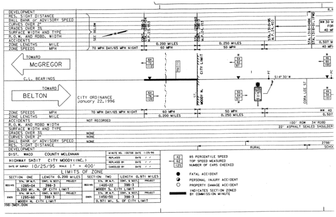
Figure 3-7. Typical speed zone on approaches to and through an incorporated area (continued in Figure 3-8)
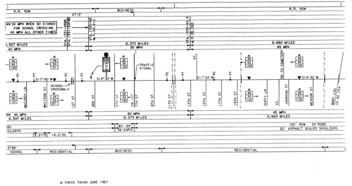
Figure 3-8. (continued from Figure 3-7). Typical speed zone on approaches to and through an incorporated area