Stream Classification
Figure 7‑1 illustrates the three main natural channel patterns: straight, meandering, braided, and their relationships to each other. For a more complete explanation of this classification system, see FHWA/RD-80/160 “Methods for Assessment of Stream Related Hazards to Highways and Bridges”, Shen, et. al, 1981.
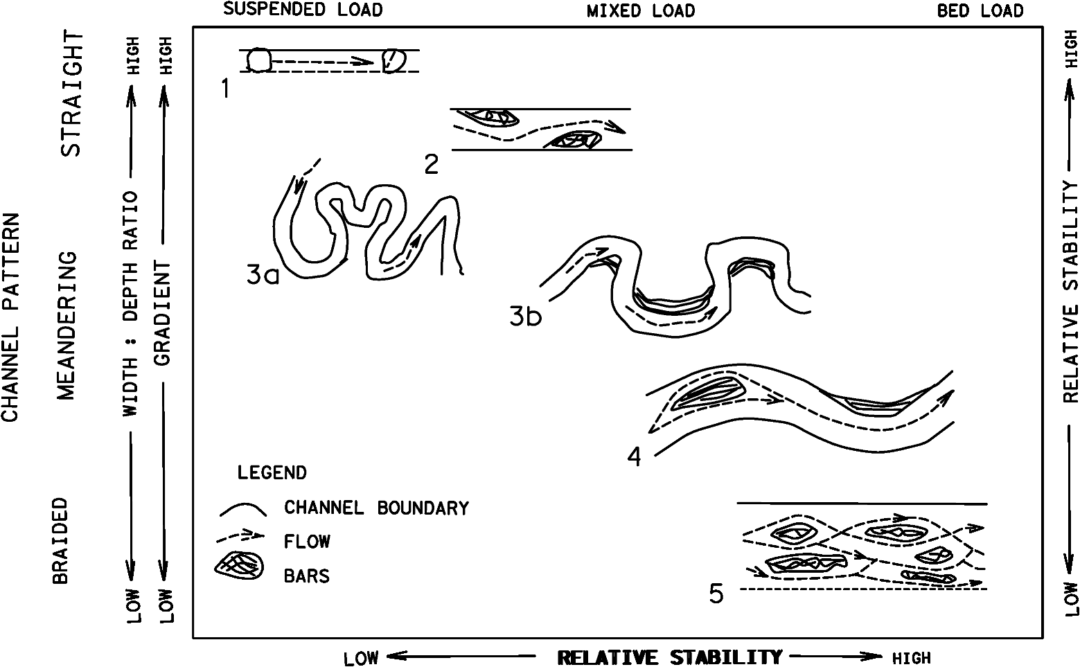
Figure 7-1. Natural Stream Patterns
Straight Streams.
A stream is classified as straight when the ratio of the length of the thalweg (path of deepest flow; see Figure 7‑2) to the length of the valley is less than 1.05. This ratio is known as the sinuosity of the stream. Degrees of sinuosity are illustrated in Figure 7‑3.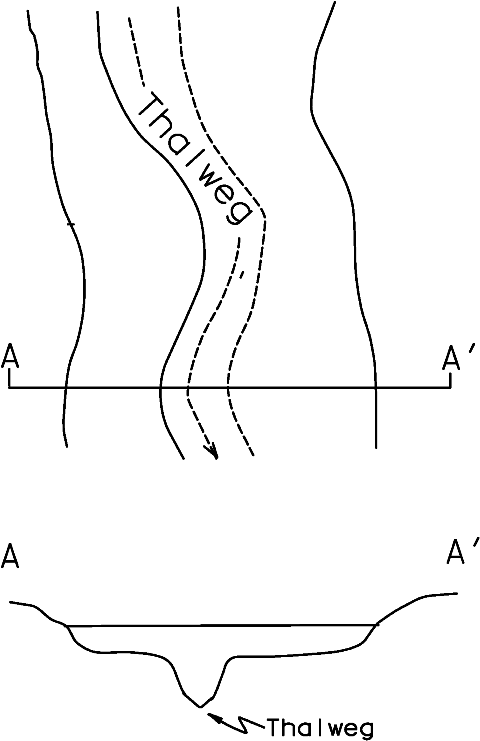
Figure 7-2. Thalweg Location in Plan View and Cross Section
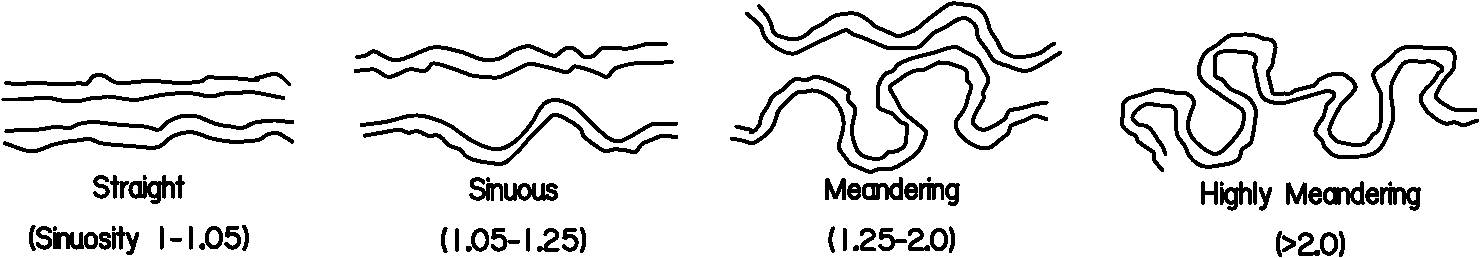
Figure 7-3. Various Degrees of Sinuosity
Straight channels are sinuous to the extent that the thalweg usually oscillates transversely within the low flow channel, and the current is deflected from one side to the other. The current oscillation usually results in the formation of pools on the outside of bends while lateral bars, resulting from deposition, form on the inside of the bends as shown in Figure 7-1, diagrams 2 and 3b.
Straight reaches of alluvial channels may be only a temporary condition. Aerial photography and topographic maps may reveal former locations of the channel and potential directions of further movement.
Braided Streams.
Braiding is caused by bank caving and by large quantities of sediment load that the stream is unable to transport (see Figure 7‑4). Deposition occurs when the supply of sediment exceeds the stream’s transport capacity. As the streambed aggrades from deposition, the downstream channel reach develops a steeper slope, resulting in increased velocities. Multiple channels develop on the milder upstream slope as additional sediment is deposited within the main channel.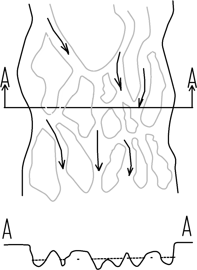
Figure 7-4. Plan View and Cross Section of a Braided Stream
The interlaced channels cause the overall channel system to widen, resulting in additional bank erosion. The eroded material may be deposited within the channel to form bars that may become stabilized islands. At flood stage, the flow may inundate most of the bars and islands, resulting in the complete destruction of some and changing the location of others. A braided stream is generally unpredictable and difficult to stabilize because it changes alignment rapidly, is subject to degradation and aggradation, and is very wide and shallow even at flood stage.
Meandering Streams.
A meandering stream consists of alternating S-shaped bends (see Figure 7‑5). In alluvial streams, the channel is subject to both lateral and longitudinal movement through the formation and destruction of bends.Bends are formed by the process of erosion and sloughing of the banks on the outside of bends and by the corresponding deposition of bed load on the inside of bends to form point bars. The point bar constricts the bend and causes erosion in the bend to continue, accounting for the lateral and longitudinal migration of the meandering stream (Figure 7‑5).
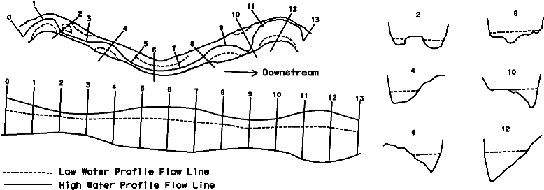
Figure 7-5. Plan View and Cross Section of a Meandering Stream
As a meandering stream moves along the path of least resistance, the bends move at unequal rates because of differences in the erodibilty of the banks and floodplain. Bends are ultimately cut off, resulting in oxbow lakes (see below).
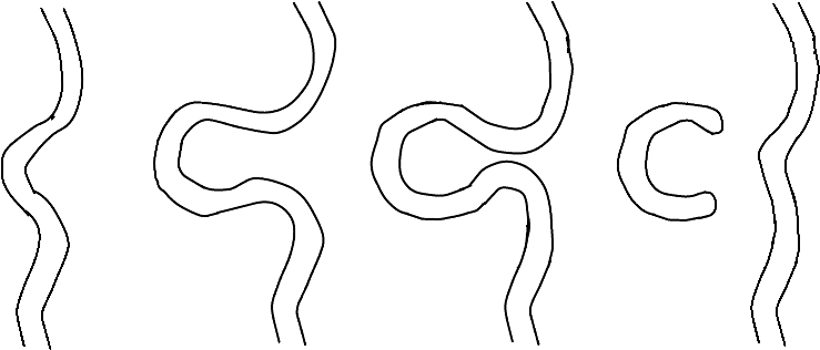
Figure 7-6. Migration Leading to Formation of Oxbow Lake
After a cutoff is formed, the stream gradient is steeper, the stream tends to adjust itself upstream and downstream, and a new bend may develop. Compare aerial photographs taken over a period of years to estimate the rate and direction of the meander movement. Local history may also help to quantify the rate of movement.