Establishing a Design Elevation
For existing infrastructure, begin by reviewing the bridge or roadway elevations from as-built drawings or surveys, as well as maintenance reports that would indicate how nearshore coastal processes have impacted the project area. For new coastal infrastructure projects, the historical coastal hazards at the site can be investigated through references such as site surveys, desktop analysis, historical imagery, interviews with residents and stakeholders, among others and can help inform the design elevation ultimately selected.
Bridges and roadways designed on the coast may be elevated above the design elevation, which includes the cumulative effects of stillwater levels above typical water levels from storm tides and relative sea level rise, as well as increases in elevation from waves and subsequent runup. This design elevation would be dictated by the appropriate return period as established in the previous sections. In many cases, however, it is not practical to elevate a coastal roadway above the design elevation. In these cases, understanding that a coastal roadway may be more readily influenced by tidal ranges and relative sea level rise will help determine likely drainage impacts and general accessibility limitations that should be communicated to appropriate authorities and stakeholders. In general, determining the primary drivers of infrastructure impacts, such as the nearshore coastal processes that are most likely to occur, will enable proper consideration of coastal conditions when elevating a structure or providing freeboard. The design elevation can be computed using the methods previously discussed in Sections 2 and 3.
The site conditions, such as the nearshore processes that appear to impact the site, will dictate the considerations to be made in water level data. Later in this section, three examples, one for each level of analysis, will illustrate how to determine a design elevation. In general, the designer should select a tide station close to the project site, convert the tidal data to the same datum as the project, and account for the stillwater level components that affect the project design, which can include: average tide range, annual high tides, storm tides, and future relative sea level rise projections. Upon determining the appropriate stillwater scenario, a subsequent wave analysis should be completed, resulting in an appropriate design elevation. Potential design elevation components are shown in Figure 15-20.
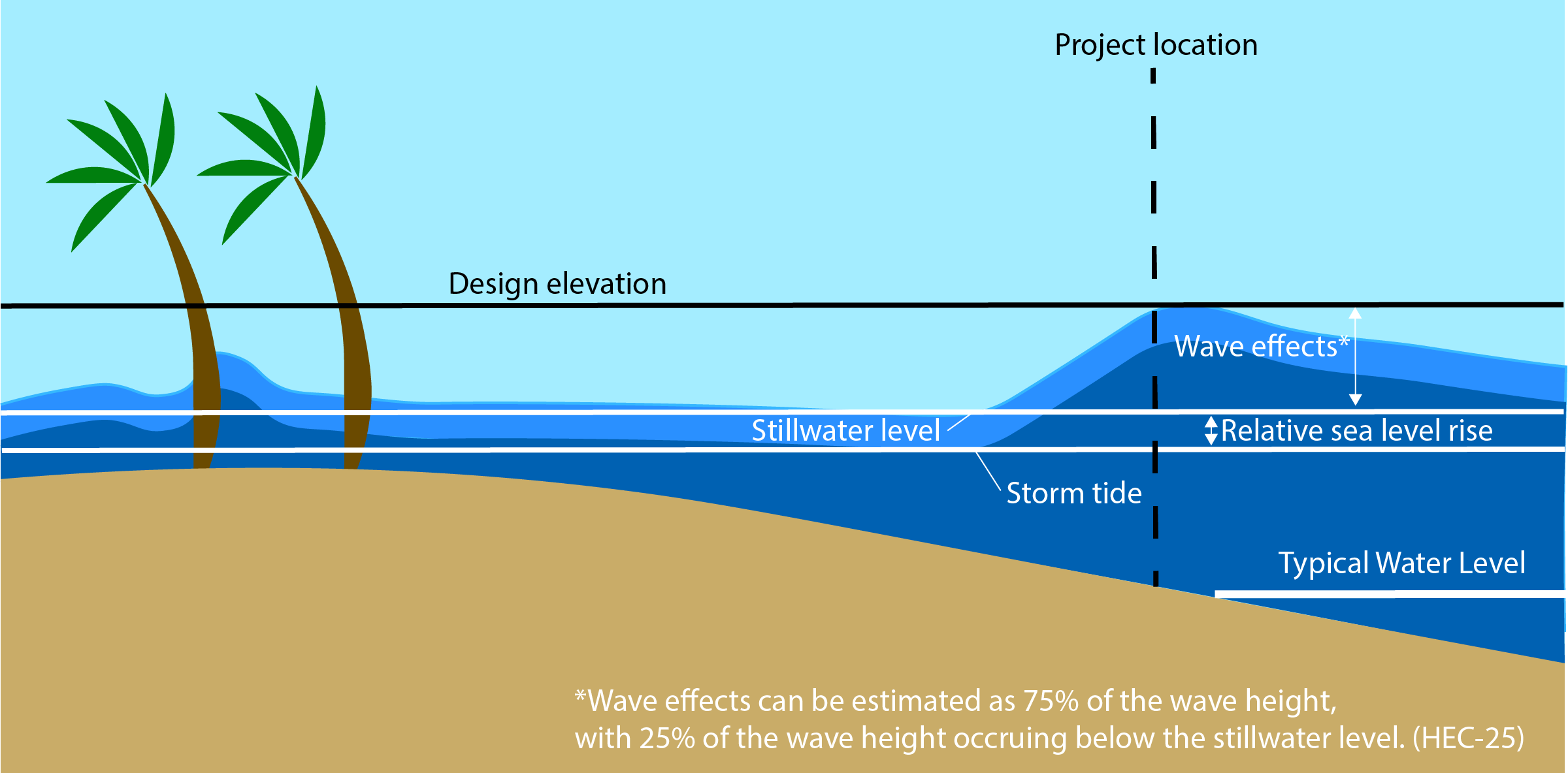
Figure 15-20. Design Elevation Diagram.