Level 1, 2, and 3 Analysis Discussion and Examples
To assist the reader, three categories of projects have been created, labeled as Level 1, Level 2, and Level 3. These represent an increase in complexity, vulnerability, and effort from Level 1 to Level 3. The purpose of these categories is to assist the designer when determining how to apply the elements described within this chapter.
The most common level of analysis for TxDOT projects influenced by coastal processes is Level 1. Level 1 analyses are typically represented as having either a project that includes lower levels of investment by TxDOT or the factor has limited vulnerability to coastal forces. An example of this is a project located landward of the FEMA Limit of Moderate Wave Action line when considering wave analysis as the specific factor of interest. Coastal analysis for a Level 1 project will typically be based on solely evaluating existing coastal data.
Level 2 analyses are less frequent than Level 1, but more common the Level 3. These analyses may represent projects with moderate to high levels of investment by TxDOT and include factors that represent exposure to moderate coastal vulnerabilities. Coastal analysis for a Level 2 project will typically involve leveraging existing data for the more complex factors, such as stillwater level or scour, and in addition commonly require coastal models to develop additional necessary data for design, particularly with regard to wave analysis.
Level 3 analyses are rare within TxDOT. These are typified by high risk projects such as causeways or other significant coastal roadways with high levels of investment, often serving as major evacuation routes, with high vulnerability. Level 3 analyses require extensive data acquisition and modeling effort to develop project specific data for complex designs.
These three representative categories are introduced in Table 15-1 and will be referenced throughout this chapter. These levels are intentionally not prescriptively delineated as it is the responsibility of the District and engineer of record to review and determine the appropriate level of analysis for each project. This decision is similar to riverine modeling decisions when deciding the complexity of modeling that should be performed – approximate, detailed, or complex. Under this concept, one project may have multiple levels of analysis, such as a causeway project (Level 3) that also has several miles of approach road (Level 2). This decision will typically be made during scoping and documented in the DSR.
Level 1 Analysis | Level 2 Analysis | Level 3 Analysis | |
|---|---|---|---|
Approximate Frequency | Most common | Less common | Infrequent |
Road Type | Off-system and minor arterials in less critical areas | Various roadway types up to and including interstates in less/moderately critical areas– | Highly vulnerable routes, freeways/interstates in very critical areas |
Bridge Type | Less critical bridges over a tidal creek in shallow estuary with minimal coastal scour risk | Less/moderately critical bridge that is well-protected with minimal coastal impacts; moderate coastal scour risk | Highly critical or major evacuation route bridges; severe or dynamic coastal scour risk |
Vulnerability | Low to Moderate | Moderate to High | High |
Road Type Example | Local or minor arterial, less critical roadway 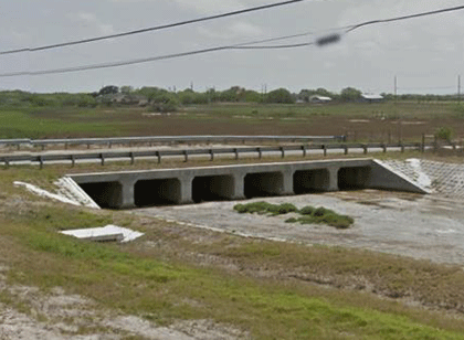 | Principal arterial, but less critical road with armoring needs, located in FEMA Coastal AE/VE Zone 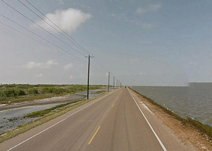 | Interstate with seawall located along major evacuation route 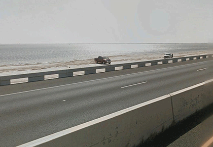 |
Bridge Type Example | Culvert or small bridge in AE Zone, well-protected, local road | Small bridge over protected bay in AE zone, local road 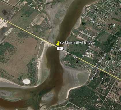 | Causeway connecting mainland and barrier island 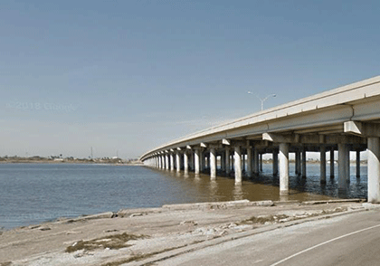 |
Other Considerations | Less complex analysis may require more conservative design assumptions, which can increase overall construction cost. | More complex analysis may be more time intensive and costly during the design phase, but can reduce overall construction cost for level of protection needed. | Complex geometries can cause waves to change direction or height; accounting for these complexities may not be feasible with simple analytical methods. |