Applicable Projects
To determine whether the project needs to consider coastal engineering concepts, this section includes maps representing the five districts within TxDOT that are along the coast (Figure 15-1 through Figure 15-5). Each map shows an area defined as the Coastal Risk Area; the designer should consider the coastal forces and guidance presented in this chapter if a project is within this area. The extents of the Coastal Risk Area were derived using Federal Emergency Management Agency (FEMA) designated coastal VE and AE zones. The shown Coastal Risk Area serves only as initial guidance on applicability, and it is incumbent upon the project team to further assess and define the potential for coastal forces to impact any given project.
Additionally, some projects not included in the Coastal Risk Area still may need to consider this design guidance. Consider using this document if the project is:
- Located along inland lake shorelines where wave action and inland fetch can create wave forces that require consideration during design (further discussed below), or
- Located in a coastal county (Aransas, Brazoria, Calhoun, Cameron, Chambers, Galveston, Harris, Jackson, Jefferson, Kenedy, Kleberg, Matagorda, Nueces, Orange, Refugio, San Patricio, Victoria, and Willacy), or
- Known to have historic evidence of coastal influence (e.g. coastal flooding), including impacts from extreme weather events, such as hurricanes.
The Coastal Risk Area shown in the district maps below will change in extent and risk classification over time, as the coast experiences erosion, subsidence, and sea level changes. The maps include a one to two mile buffer inland of the FEMA designated coastal zones to partially represent these additional considerations. All these processes may expand the area of influence from coastal processes further inland than shown.
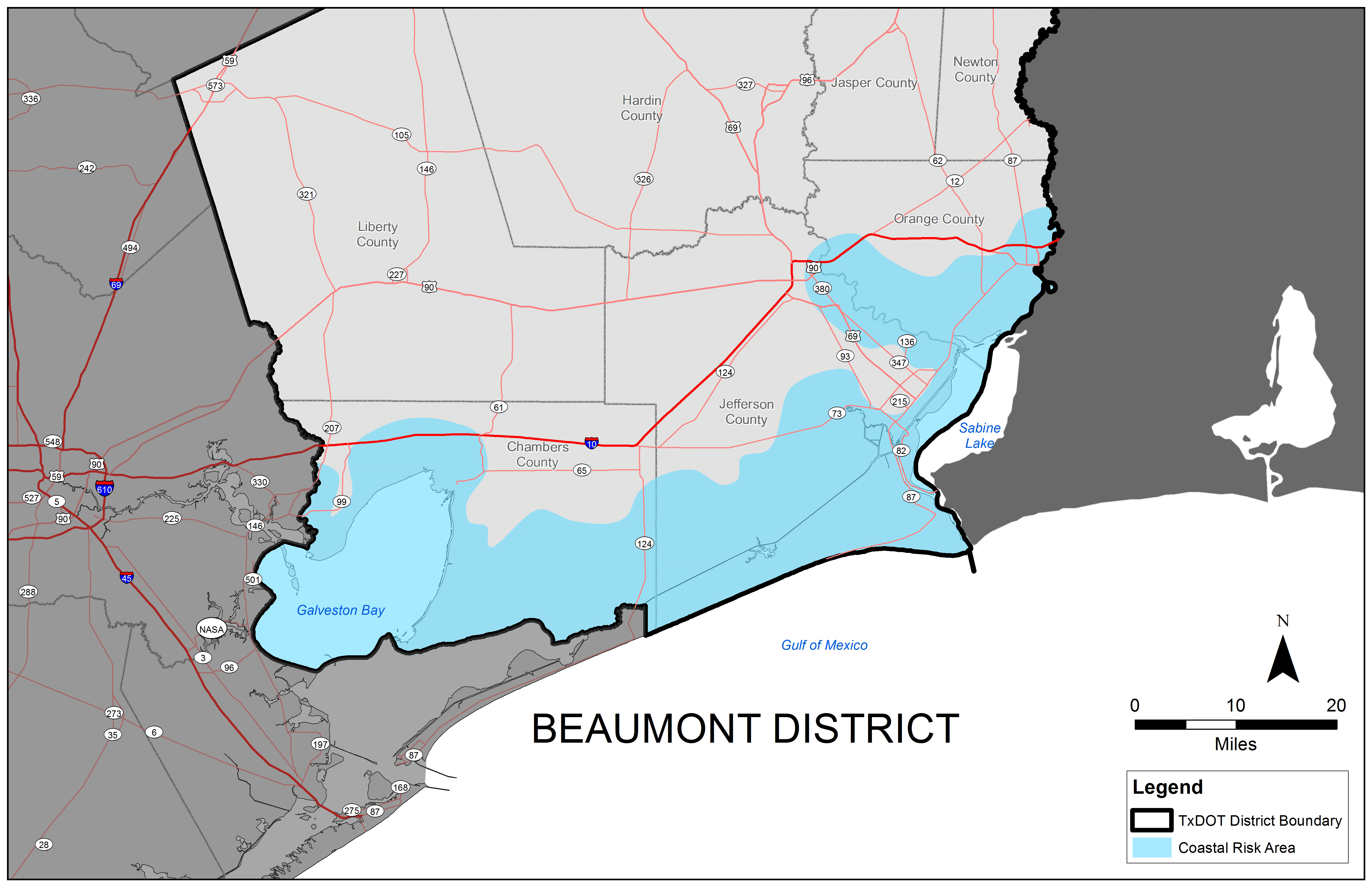
Figure 15-1. TxDOT Beaumont District Coastal Risk Area.
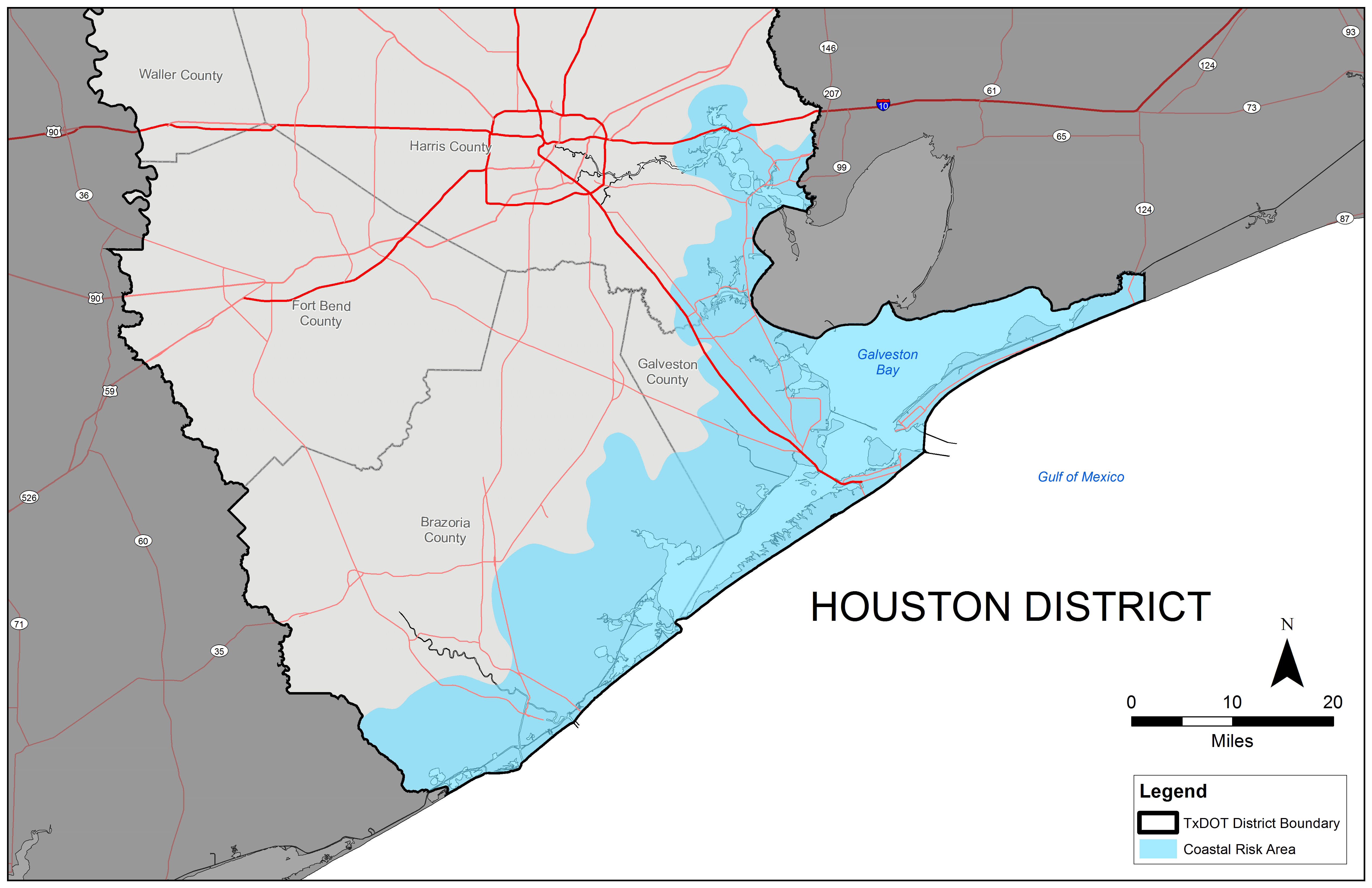
Figure 15-2. TxDOT Houston District Coastal Risk Area.
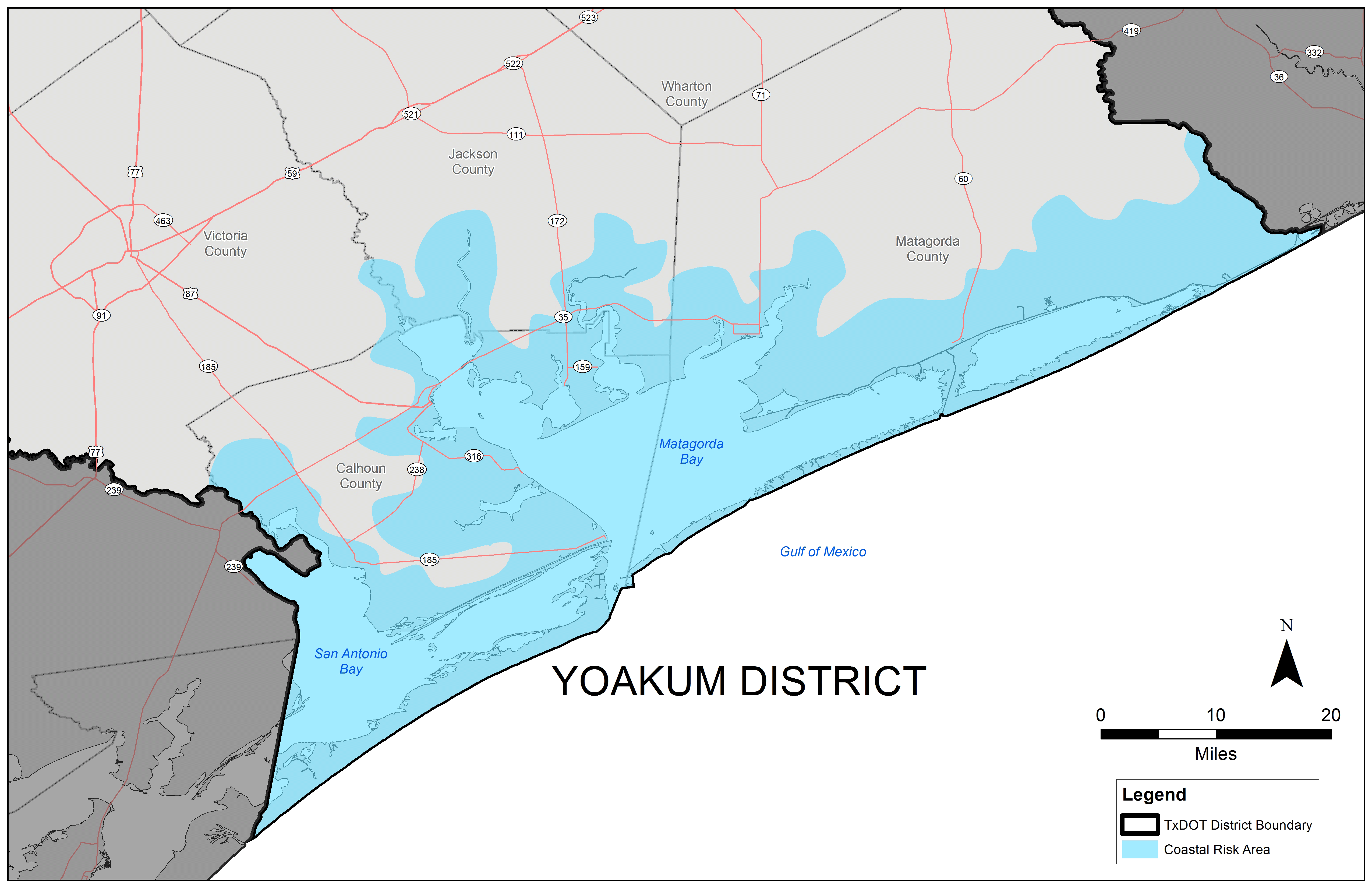
Figure 15-3. TxDOT Yoakum District Coastal Risk Area.
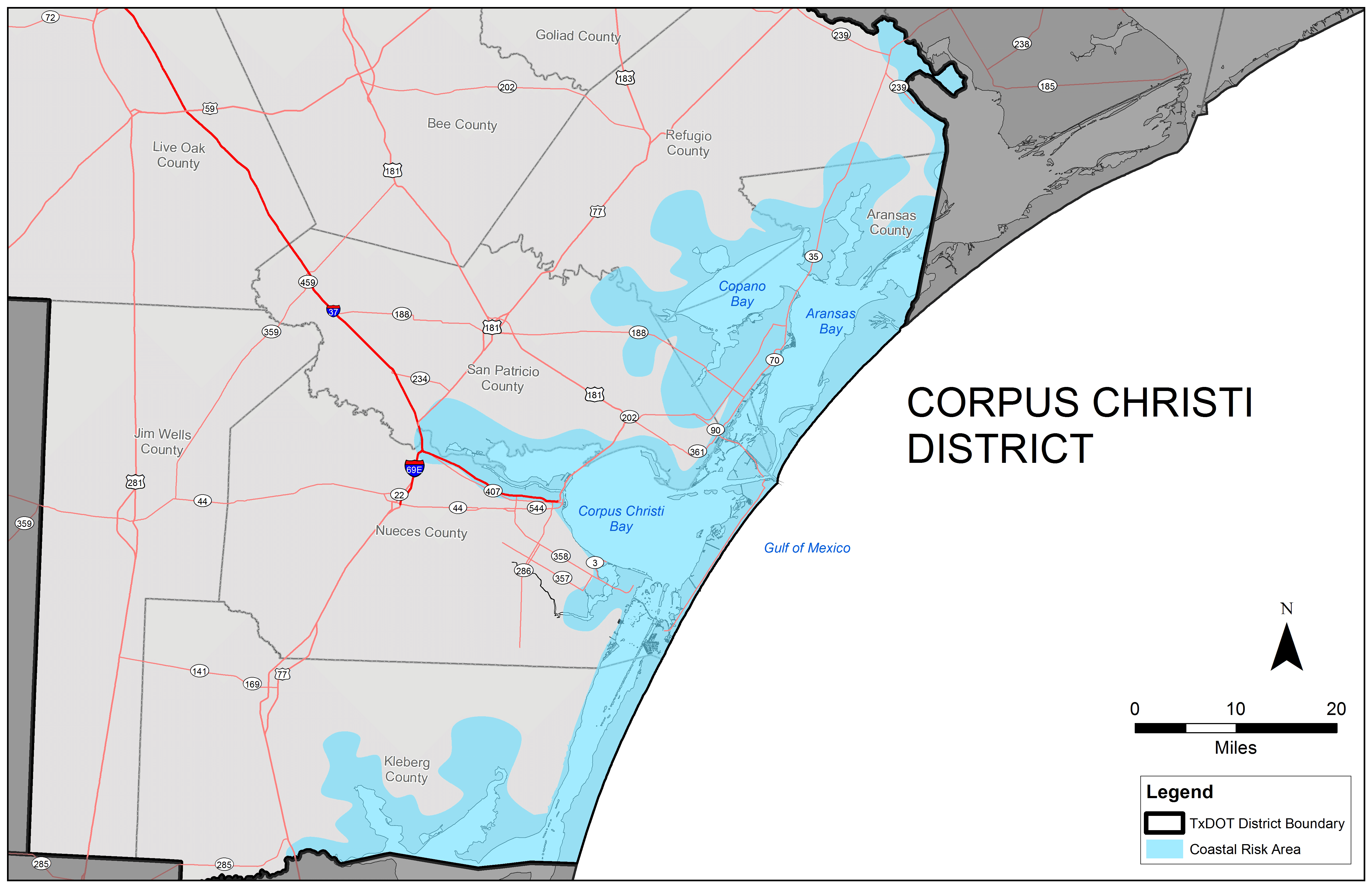
Figure 15-4. TxDOT Corpus Christi District Risk Area.
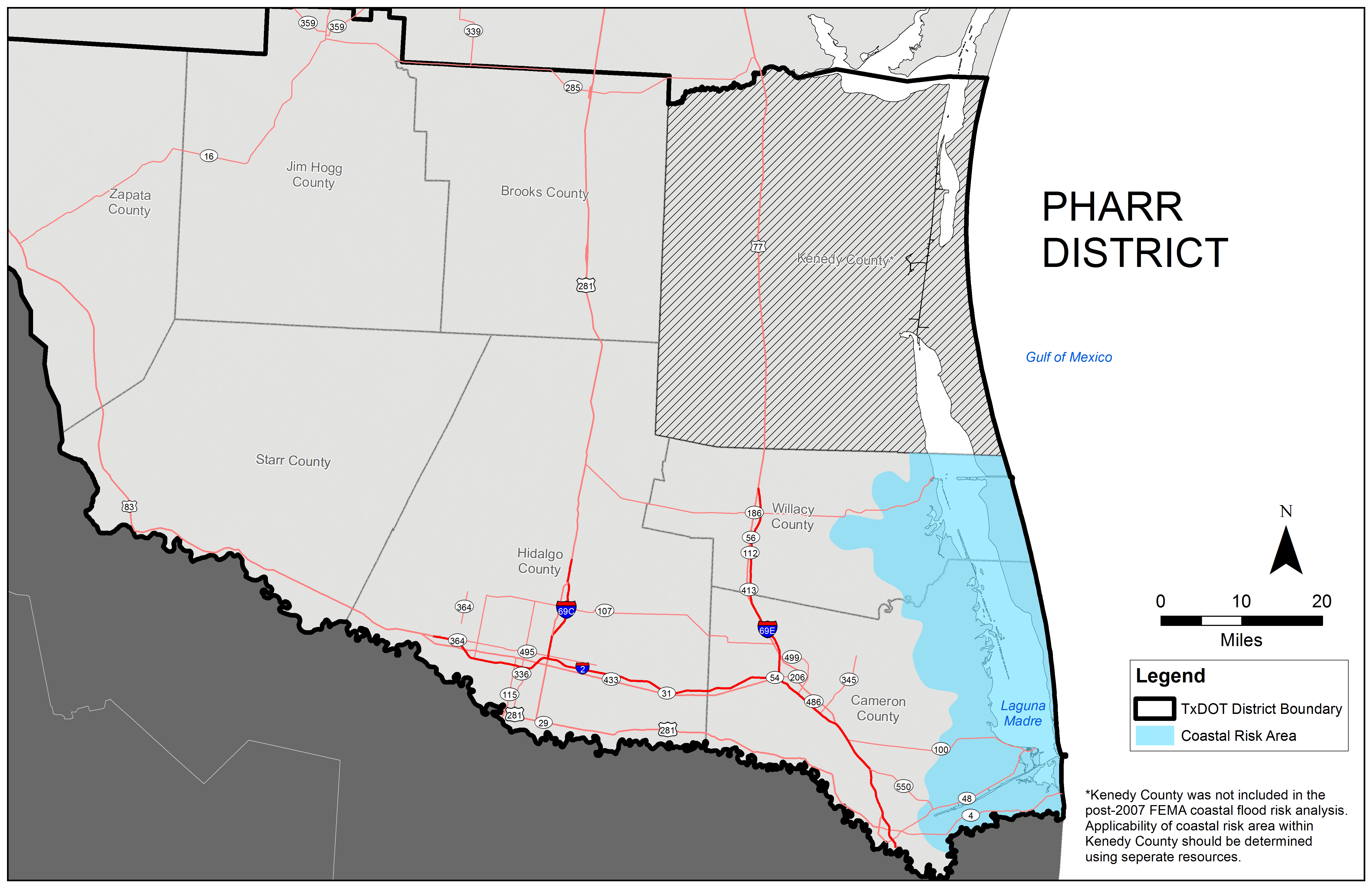
Figure 15-5. TxDOT Pharr District Risk Area.
Design for some projects located near inland water bodies should also consider coastal guidance, especially if surrounding areas may experience or have experienced erosion or other damage caused by wave conditions.